Aquitania, Boyacá
| Aquitania | |||
|---|---|---|---|
| Municipality and town | |||
|
Central square | |||
| |||
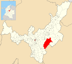 Location of the municipality and town of Aquitania in the Boyacá Department of Colombia | |||
| Country |
| ||
| Department | Boyacá Department | ||
| Province | Sugamuxi Province | ||
| Founded | 1777 | ||
| Government | |||
| • Mayor |
Felipe A. Cardozo (2016-2019) | ||
| Area | |||
| • Municipality and town | 943 km2 (364 sq mi) | ||
| • Urban | 0.52 km2 (0.20 sq mi) | ||
| Elevation | 3,030 m (9,940 ft) | ||
| Population (2015) | |||
| • Municipality and town | 15,241 | ||
| • Density | 16/km2 (42/sq mi) | ||
| • Urban | 6,329 | ||
| Time zone | Colombia Standard Time (UTC-5) | ||
| Website | Official website | ||


.svg.png)
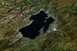
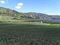
Aquitania is a town and municipality in Boyacá Department, Colombia, part of the Sugamuxi Province, a subregion of Boyaca. Aquitania borders Sogamoso, Cuítiva and Mongua in the north, Zetaquirá, San Eduardo and Páez in the south, Labranzagrande, Pajarito, Recetor and Chámeza in the east and Cuítiva, Tota, Zetaquirá and San Eduardo in the west. The urban centre is situated on the Altiplano Cundiboyacense as one of the highest towns at an altitude of 3,030 metres (9,940 ft). The town of Aquitania borders Lake Tota to the east.[1]
Climate
| | ||||||||||||||||||||||||||||||||||||||||||||||||||||||||||||
|---|---|---|---|---|---|---|---|---|---|---|---|---|---|---|---|---|---|---|---|---|---|---|---|---|---|---|---|---|---|---|---|---|---|---|---|---|---|---|---|---|---|---|---|---|---|---|---|---|---|---|---|---|---|---|---|---|---|---|---|---|
| Climate chart (explanation) | ||||||||||||||||||||||||||||||||||||||||||||||||||||||||||||
| ||||||||||||||||||||||||||||||||||||||||||||||||||||||||||||
| ||||||||||||||||||||||||||||||||||||||||||||||||||||||||||||
History
Aquitania was called Guáquia in the times before the Spanish conquest of the Muisca and inhabited by the Muisca and was ruled by the iraca of Sugamuxi. conquistador Juan de San Martín reached the area in 1540. Modern Aquitania was founded in 1777.[1]
Economy
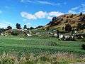
Main economical activity of Aquitania is onion farming. Small carbon mining exists within the municipality.[1]
Born in Aquitania
- Arsenio Chaparro Cardoso, former professional cyclist[2]
- Freddy Montaña, professional cyclist
Gallery
-
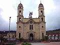
Church of Aquitania
-
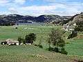
Onion fields in Aquitania
-
Onion fields
-
Onion fields
-

Monument to the onion farmers
References
- 1 2 3 (Spanish) Official website Aquitania
- ↑ "Arsenio Chaparro Cardoso". Cycling Archives. Retrieved 2 April 2015.
Coordinates: 5°35′N 72°50′W / 5.583°N 72.833°W