Sora, Boyacá
| Sora | |||
|---|---|---|---|
| Municipality and town | |||
|
Central square of Sora | |||
| |||
 Location of the municipality and town of Sora in the Boyacá department of Colombia | |||
| Country |
| ||
| Department | Boyacá Department | ||
| Province | Central Boyacá Province | ||
| Founded | 12 August 1556 | ||
| Founded by | Tomás Gualba Castellanos | ||
| Government | |||
| • Mayor |
Mauricio Neisa Alvarado (2016-2019) | ||
| Area | |||
| • Municipality and town | 42 km2 (16 sq mi) | ||
| • Urban | 1.08 km2 (0.42 sq mi) | ||
| Elevation | 2,650 m (8,690 ft) | ||
| Population (2015) | |||
| • Municipality and town | 3,025 | ||
| • Density | 72/km2 (190/sq mi) | ||
| • Urban | 499 | ||
| Time zone | Colombia Standard Time (UTC-5) | ||
| Website | Official website | ||


Sora is a town and municipality in the Central Boyacá Province, part of the Colombian Department of Boyacá. Sora borders Motavita and Chíquiza in the north, Cucaita and Samacá in the south, Motavita and department capital Tunja in the east and Sáchica and Chíquiza in the west.[1]
Etymology
The name Sora comes from Chibcha and means "Devil worshipper".[2]
History
In the times before the Spanish conquest, the area of Sora was inhabited by the Muisca, organised in their loose Muisca Confederation. Sora was under the rule of the zaque from nearby Hunza.
Modern Sora was founded on August 12, 1556 by Tomás Gualba Castellanos.[1]
Born in Sora
- Mauricio Neiza, professional cyclist
Gallery
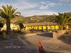
 Central square
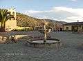
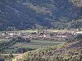 View of Sora
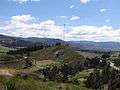 Border of Sora, Cucaita and Samacá
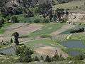 Farm fields in rural Sora
References
- 1 2 (Spanish) Official website Sora
- ↑ (Spanish) Etymology Sora - Excelsio.net
| Wikimedia Commons has media related to Sora, Boyacá. |
Coordinates: 5°34′N 73°26′W / 5.567°N 73.433°W
This article is issued from Wikipedia - version of the 9/29/2016. The text is available under the Creative Commons Attribution/Share Alike but additional terms may apply for the media files.