Batavia, Arkansas
| Batavia, Arkansas | |
|---|---|
| Unincorporated community | |
 Batavia, Arkansas  Batavia, Arkansas | |
| Coordinates: 36°15′18″N 93°13′22″W / 36.25500°N 93.22278°WCoordinates: 36°15′18″N 93°13′22″W / 36.25500°N 93.22278°W | |
| Country | United States |
| State | Arkansas |
| County | Boone |
| Elevation | 1,506 ft (459 m) |
| Time zone | Central (CST) (UTC-6) |
| • Summer (DST) | CDT (UTC-5) |
| Area code(s) | 870 |
| GNIS feature ID | 57339[1] |
Batavia is an unincorporated community in Boone County, Arkansas, United States. Batavia is located on Arkansas Highway 392 5.0 miles (8.0 km) west-northwest of Harrison.[2]
Batavia was a former incorporated town. In 1880, Roswell Underwood established the first post office in the former town. He named it Batavia after his hometown of Batavia, New York. The town was laid out in blocks. The first house on Main Street was built in 1912. Arkansas Highway 206 is where Main Street used to be located. The post office was closed in 1955. During its heyday, businesses included stores, hotels, a canning factory, a train depot, stockyards, mills, a corn gristmill, and a blacksmith shop. There was also a school and churches. By 1926, the passenger railroad stopped going through Batavia. While the community is bigger in terms of population and homes than it was as an incorporated town, the businesses are fewer.[3] Batavia township still exists (see township population history) without any current incorporated towns inside of it.
References
- ↑ "Batavia". Geographic Names Information System. United States Geological Survey.
- ↑ Boone County, Arkansas General Highway Map (PDF) (Map). Arkansas State Highway and Transportation Department. 2002. Retrieved January 6, 2012.
- ↑ Moehr, Dennis; Ramsey, Regina, "Batavia", Reflections of Our Ozarks Past: 6
Municipalities and communities of Boone County, Arkansas, United States | ||
|---|---|---|
| Cities | 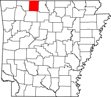 | |
| Towns | ||
| Townships | ||
| Unincorporated communities | ||
| Ghost town | ||
| Footnotes | ‡This populated place also has portions in an adjacent county or counties | |