Everton, Arkansas
| Everton, Arkansas | |
|---|---|
| Town | |
 Location in Boone County and the state of Arkansas | |
| Coordinates: 36°9′14″N 92°54′29″W / 36.15389°N 92.90806°WCoordinates: 36°9′14″N 92°54′29″W / 36.15389°N 92.90806°W | |
| Country | United States |
| State | Arkansas |
| County | Boone |
| Area | |
| • Total | 0.5 sq mi (1.2 km2) |
| • Land | 0.5 sq mi (1.2 km2) |
| • Water | 0 sq mi (0 km2) |
| Elevation | 860 ft (262 m) |
| Population (2010) | |
| • Total | 170 |
| • Density | 340/sq mi (141.7/km2) |
| Time zone | Central (CST) (UTC-6) |
| • Summer (DST) | CDT (UTC-5) |
| ZIP code | 72633 |
| Area code(s) | 870 |
| FIPS code | 05-22450 |
| GNIS feature ID | 0048952 |
Everton is a town in Boone County, Arkansas, United States. The population was 170 at the 2010 census. It is part of the Harrison Micropolitan Statistical Area.
Geography
Everton is located at 36°9′14″N 92°54′29″W / 36.15389°N 92.90806°W (36.154002, -92.908029).[1]
According to the United States Census Bureau, the town has a total area of 1.2 km² (0.5 mi²), all land.
List of highways
Demographics
| Historical population | |||
|---|---|---|---|
| Census | Pop. | %± | |
| 1930 | 180 | — | |
| 1940 | 190 | 5.6% | |
| 1950 | 198 | 4.2% | |
| 1960 | 118 | −40.4% | |
| 1970 | 124 | 5.1% | |
| 1980 | 134 | 8.1% | |
| 1990 | 150 | 11.9% | |
| 2000 | 170 | 13.3% | |
| 2010 | 133 | −21.8% | |
| Est. 2015 | 134 | [2] | 0.8% |
2014 Estimate[4] | |||
As of the census[5] of 2010, there were 170 people, 70 households, and 49 families residing in the town. The population density was 139.7/km² (359.5/mi²). There were 73 housing units at an average density of 60.0/km² (154.4/mi²). The racial makeup of the town was 97.65% White, 0.59% Native American, 0.59% Asian, and 1.18% from two or more races. 3.53% of the population were Hispanic or Latino of any race.
There were 70 households out of which 30.0% had children under the age of 18 living with them, 54.3% were married couples living together, 10.0% had a female householder with no husband present, and 30.0% were non-families. 27.1% of all households were made up of individuals and 12.9% had someone living alone who was 65 years of age or older. The average household size was 2.43 and the average family size was 2.88.
In the town the population was spread out with 25.3% under the age of 18, 8.2% from 18 to 24, 33.5% from 25 to 44, 16.5% from 45 to 64, and 16.5% who were 65 years of age or older. The median age was 36 years. For every 100 females there were 82.8 males. For every 100 females age 18 and over, there were 89.6 males.
The median income for a household in the town was $18,438, and the median income for a family was $27,292. Males had a median income of $25,625 versus $15,313 for females. The per capita income for the town was $14,274. About 16.3% of families and 20.3% of the population were below the poverty line, including 26.1% of those under the age of eighteen and 25.0% of those sixty five or over.
Education
Public education for elementary and secondary school students is provided by Ozark Mountain School District that includes the Everton-based Bruno–Pyatt High School and the Valley Springs School District and the Valley Springs High School.[6]
References
- ↑ "US Gazetteer files: 2010, 2000, and 1990". United States Census Bureau. 2011-02-12. Retrieved 2011-04-23.
- ↑ "Annual Estimates of the Resident Population for Incorporated Places: April 1, 2010 to July 1, 2015". Retrieved July 2, 2016.
- ↑ "Census of Population and Housing". Census.gov. Retrieved June 4, 2015.
- ↑ "Annual Estimates of the Resident Population for Incorporated Places: April 1, 2010 to July 1, 2014". Retrieved June 4, 2015.
- ↑ "American FactFinder". United States Census Bureau. Retrieved 2008-01-31.
- ↑ School District Reference Map (2010 Census): Boone County, AR (PDF) (Map). US Census Bureau. Retrieved 20110628. Check date values in:
|access-date=(help)
External links
- Map of Everton (US Census Bureau)
- Boone County Historical and Railroad Society, Inc.
- Town government information
- Valley Springs School District
- Detailed 2000 US Census statistics
- Boone County School District Reference Map (US Census Bureau, 2010)
Municipalities and communities of Boone County, Arkansas, United States | ||
|---|---|---|
| Cities | 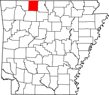 | |
| Towns | ||
| Townships | ||
| Unincorporated communities | ||
| Ghost town | ||
| Footnotes | ‡This populated place also has portions in an adjacent county or counties | |