Beaumont, California
| City of Beaumont | |
|---|---|
| City | |
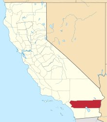
 Location in Riverside County and the state of California | |
 City of Beaumont Location in the United States | |
| Coordinates: 33°55′46″N 116°58′38″W / 33.92944°N 116.97722°WCoordinates: 33°55′46″N 116°58′38″W / 33.92944°N 116.97722°W[1] | |
| Country |
|
| State |
|
| County | Riverside |
| Incorporated | November 18, 1912[2] |
| Area[3] | |
| • Total | 30.926 sq mi (80.098 km2) |
| • Land | 30.912 sq mi (80.062 km2) |
| • Water | 0.014 sq mi (0.036 km2) 0.04% |
| Elevation[1] | 2,612 ft (796 m) |
| Population (April 1, 2010)[4] | |
| • Total | 36,877 |
| • Estimate (2013)[4] | 40,481 |
| • Density | 1,200/sq mi (460/km2) |
| Time zone | PST (UTC-8) |
| • Summer (DST) | PDT (UTC-7) |
| ZIP code | 92223 |
| Area code | 951 |
| FIPS code | 06-04758 |
| GNIS feature IDs | 1660318, 2409805 |
| Website |
ci |
Beaumont is a city in Riverside County, California, United States located at a half mile elevation in the pass area south of Southern California's highest peak, Mt. San Gorgonio, and north of Mt. San Jacinto.
Beaumont is bordered on the east by the city of Banning, on the south by the city of San Jacinto, on the west by the city of Calimesa, and on the north by the unincorporated community of Cherry Valley.
History
During the early 1850s, many surveying parties passed through the vicinity of present-day Beaumont in search of a pass that would connect the east to the Pacific Ocean. The San Gorgonio Pass was discovered in 1853 by a surveying expedition under Lieutenant R.S. Williamson, who was sent by the United States government. Its discovery enthralled many who now saw that connecting to the ocean was a feasible measure and led to plans for connecting a railway from the Missouri River to the Pacific. By the early 1860s, the Southern Pacific Railroad had laid tracks through the modern-day location of Beaumont. At the summit of the pass, a site was founded and named Edgar Station after a physician from one of the original expedition parties. Edgar Station served as a rest stop for railway travelers from the Mojave Desert on their way to the Los Angeles vicinity. Soon Edgar Station changed its name to San Gorgonio, named by a real estate development company, and it gradually attracted permanent residents.
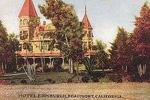
The sleepy town of San Gorgonio became an incorporated Californian city on November 18, 1912, and adopted its current name of Beaumont (French for "beautiful mountain"). As of 1927, the town boasted a small population of 857 with five churches, a public library, a bank, a high school, two local newspapers, several lumber yards, commercial packing houses, and a dehydrating plant. The city, one of Riverside County's largest apple growers, was dubbed "the land of the big red apple" by local residents in its early years. Apple orchards in and around the town expanded to a $200,000 industry by 1930. Beaumont saw a rise in visitors and residents as the little-known nearby city of Palm Springs to the east grew to become a highly popular resort spot in the 1930s and after; Beaumont followed suit and attempted to capitalize on the tourism by establishing guest ranches. According to an early 1930s/1940s postcard, the Highland Springs Guest Ranch of Beaumont offered its patrons horseback riding, tennis, archery, horseshoes, swimming, shuffle-board, ping pong, baseball, ballroom dancing, massage, basketball, as well as a place to spend the night.
During the Cold War, a Lockheed rocket test site operated by Simi Valley-based Rocketdyne was established south of the town in Potrero Canyon. In late 2003, the majority of the Potrero Canyon site was sold to the state of California. Toxic chemicals used in rocket fuel and site test activities have been found in the soil and groundwater at the site, and planning is underway to begin cleanup sometime in the next few years. Plans are being developed by the California Department of Fish and Game to allow public access. With the housing boom in the early decade, the urban sprawl reached the last remaining valleys of the Inland Empire.
Since 2000, with Beaumont's close proximity to Los Angeles, various Southern California residents flocked to the San Gorgonio Pass region for its low housing cost, causing a 20% jump in the city's population, making it the fastest growing city in the state.[5] This has concerned many local residents, who cite increasing student population in schools, rising demand on the water supply, and increasing traffic in and out of the city on Interstate 10 in both directions. A 2008 study by the Public Policy Institute of California noted that Beaumont and its surrounding communities in the San Jacinto Valley have registered the highest population growth throughout the sprawling Riverside County and the region is projected to increase by 4.5% a year to 310,000 by 2015.[6]
Beaumont is host to many new master-planned communities. The following communities are currently under construction or have been built: Oak Valley Greens, Three Rings Ranch, Solera by Del Webb later sold to Pulte Homes Inc., Sundance and Tournament Hills by Pardee Homes, and Fairway Canyon. Excepting Oak Valley Greens, these communities operate under HOAs and are similar to developments in Redlands, Rancho Cucamonga, and even Orange County suburbs. New big box stores have recently opened up in town, including a Wal-Mart Supercenter, a Home Depot Home Improvement Center, and Kohl's Department Store in the 2nd Street Marketplace.[7] Other new businesses in the 2nd Street Marketplace area include Best Buy, Bed, Bath, and Beyond, Petco, Ross Dress for Less, Dollar Tree, Bank of America, Chase, Wells Fargo, Chili's, McDonald's, Starbuck's, and Taco Bell. Beaumont also boasts a new Walgreens, Rite-Aid, and a Stater Bros. grocery store.
The nearby Highland Springs Resort, established in 1884, hosts Southern California's largest certified organic lavender farm at 123 Farm, the Annual Lavender Festival in June, the Annual Sausage and Beer Festival in August, and the Annual Olive & Wine Faire in October. For 90 years, Beaumont has hosted the Annual Cherry Festival. The next Cherry Festival takes place from June 4 through 7, 2015, featuring the Cherry Festival Parade on June 6, 2015.
Local recreational possibilities include two golf courses including the Tukwet Canyon and Oak Valley Golf Clubs.
Future
The city of Beaumont will expand its city boundary and population with additional 25,000 new residential units being planned and built for the next 10–25 years.[8] The Preserve, an approved, upcoming 3,412 homes community, will be the largest, although Sundance, an in-progress 4,716 homes community by Pardee Homes, will be the city's largest. Over to the right from Sundance is Butterfield, an upcoming 5,400 homes community in the city of Banning, which will be California's largest residential community ever. Right now in the western part of Beaumont, several new, major roads are being built, including Potrero Blvd. to improve traffic congestion. Construction on the new Potrero Blvd. is in work right now. New, improved freeway intersections are on the way for expansion. With these many new homes being developed in the near future, Beaumont is easily predicted to be California's next fastest growing city with population in excess of 125,000 total, making it the largest master-planned community in the Greater Los Angeles area after Valencia, CA in the Santa Clarita Valley north of Los Angeles...
Geography
Beaumont's neighboring city to the east is Banning and Calimesa to the west.
With an elevation of 2,500-3,000 feet above sea level, Beaumont is at the peak on the San Gorgonio Pass between San Bernardino, CA and Palm Springs, CA neighboring the California Interstate 10 and California State Route 60 freeways. If driving east to Banning or west to Calimesa, drivers can feel a gradual downward slope.
According to the United States Census Bureau, the city has a total area of 30.9 square miles (80 km2), of which, 99.96% of it is land and 0.04% is water.
Climate
Beaumont reaches an average of up to 95 degrees high Fahrenheit during the summer and 52 degrees low Fahrenheit during the winter. Due to its higher elevation, it is usually 5-10 Fahrenheit degrees cooler than its neighboring lower-elevation cities, such as Riverside, Hemet/Perris/San Jacinto, and the Palm Springs desert area. Snow is rare. According to the Köppen Climate Classification system, Beaumont has a warm-summer Mediterranean climate, abbreviated "Csa" on climate maps.[9]
Beaumont's slightly cooler temperatures and less smoggy air, compared to its neighboring lower-elevation cities, makes it an attractive, desirable area for development in the Inland Empire (California) region. However, it is one of the windiest cities in Southern California, along with San Bernardino, Fontana and Victorville.
Annual precipitation is approximately 17"[10]
| Climate data for Beaumont, California. (station elevation 2,591ft) | |||||||||||||
|---|---|---|---|---|---|---|---|---|---|---|---|---|---|
| Month | Jan | Feb | Mar | Apr | May | Jun | Jul | Aug | Sep | Oct | Nov | Dec | Year |
| Record high °F (°C) | 83 (28) |
88 (31) |
95 (35) |
100 (38) |
111 (44) |
109 (43) |
114 (46) |
113 (45) |
112 (44) |
106 (41) |
92 (33) |
86 (30) |
114 (46) |
| Average high °F (°C) | 60.3 (15.7) |
63.1 (17.3) |
65.8 (18.8) |
71.9 (22.2) |
78.6 (25.9) |
87.5 (30.8) |
95.5 (35.3) |
95.0 (35) |
90.1 (32.3) |
80.1 (26.7) |
69.0 (20.6) |
61.7 (16.5) |
76.6 (24.8) |
| Average low °F (°C) | 38.4 (3.6) |
38.8 (3.8) |
39.9 (4.4) |
42.7 (5.9) |
47.5 (8.6) |
52.2 (11.2) |
58.2 (14.6) |
58.8 (14.9) |
55.5 (13.1) |
49.1 (9.5) |
42.9 (6.1) |
39.2 (4) |
46.9 (8.3) |
| Record low °F (°C) | 11 (−12) |
19 (−7) |
21 (−6) |
25 (−4) |
31 (−1) |
35 (2) |
42 (6) |
38 (3) |
24 (−4) |
29 (−2) |
20 (−7) |
20 (−7) |
11 (−12) |
| Average precipitation inches (mm) | 3.52 (89.4) |
3.40 (86.4) |
3.12 (79.2) |
1.44 (36.6) |
0.55 (14) |
0.14 (3.6) |
0.23 (5.8) |
0.27 (6.9) |
0.51 (13) |
0.65 (16.5) |
1.72 (43.7) |
2.26 (57.4) |
17.81 (452.4) |
| Average snowfall inches (cm) | 1.0 (2.5) |
0.4 (1) |
0.2 (0.5) |
0.0 (0) |
0.0 (0) |
0.0 (0) |
0.0 (0) |
0.0 (0) |
0.0 (0) |
0.0 (0) |
0.1 (0.3) |
0.2 (0.5) |
1.8 (4.6) |
| Source: The Western Regional Climate Center[11] | |||||||||||||
Demographics
| Historical population | |||
|---|---|---|---|
| Census | Pop. | %± | |
| 1920 | 857 | — | |
| 1930 | 1,332 | 55.4% | |
| 1940 | 2,208 | 65.8% | |
| 1950 | 3,152 | 42.8% | |
| 1960 | 4,288 | 36.0% | |
| 1970 | 5,484 | 27.9% | |
| 1980 | 6,818 | 24.3% | |
| 1990 | 9,685 | 42.1% | |
| 2000 | 11,384 | 17.5% | |
| 2010 | 36,877 | 223.9% | |
| Est. 2015 | 43,811 | [12] | 18.8% |
2010
The 2010 United States Census[14] reported that Beaumont had a population of 36,877. The population density was 1,192.4 people per square mile (460.4/km²). The racial makeup of Beaumont was 23,163 (62.8%) White (42.9% Non-Hispanic White),[15] 2,276 (6.2%) African American, 544 (1.5%) Native American, 2,845 (7.7%) Asian, 83 (0.2%) Pacific Islander, 6,058 (16.4%) from other races, and 1,908 (5.2%) from two or more races. Hispanic or Latino of any race were 14,864 persons (40.3%).
The Census reported that 36,403 people (98.7% of the population) lived in households, 263 (0.7%) lived in non-institutionalized group quarters, and 211 (0.6%) were institutionalized.
There were 11,801 households, out of which 5,341 (45.3%) had children under the age of 18 living in them, 7,152 (60.6%) were opposite-sex married couples living together, 1,452 (12.3%) had a female householder with no husband present, 708 (6.0%) had a male householder with no wife present. There were 767 (6.5%) unmarried opposite-sex partnerships, and 106 (0.9%) same-sex married couples or partnerships. 1,906 households (16.2%) were made up of individuals and 695 (5.9%) had someone living alone who was 65 years of age or older. The average household size was 3.08. There were 9,312 families (78.9% of all households); the average family size was 3.44.
The population was spread out with 11,121 people (30.2%) under the age of 18, 2,904 people (7.9%) aged 18 to 24, 11,058 people (30.0%) aged 25 to 44, 7,905 people (21.4%) aged 45 to 64, and 3,889 people (10.5%) who were 65 years of age or older. The median age was 32.5 years. For every 100 females there were 95.2 males. For every 100 females age 18 and over, there were 91.1 males.
There were 12,908 housing units at an average density of 417.4 per square mile (161.2/km²), of which 8,846 (75.0%) were owner-occupied, and 2,955 (25.0%) were occupied by renters. The homeowner vacancy rate was 4.3%; the rental vacancy rate was 5.9%. 26,871 people (72.9% of the population) lived in owner-occupied housing units and 9,532 people (25.8%) lived in rental housing units.
According to the 2010 United States Census, Beaumont had a median household income of $67,758, with 11.2% of the population living below the federal poverty line.[16]
2000
As of the census[17] of 2000, there were 11,384 people, 3,881 households, and 2,782 families residing in the city. The population density was 418.9 people per square mile (161.8/km²). There were 4,258 housing units at an average density of 156.7 per square mile (60.5/km²). The racial makeup of the city was 68.1% White, 2.9% Black or African American, 2.3% Native American, 1.7% Asian, 0.1% Pacific Islander, 20.3% from other races, and 4.6% from two or more races. Hispanic or Latino of any race were 36.2% of the population.
There were 3,881 households, 42.6% of them with children under the age of 18; 47.3% were married couples living together, 17.8% had a female householder with no husband present, and 28.3% were non-families. Single individuals made up 22.3% of all households, and 9.2% had someone living alone who was 65 years of age or older. The average household size was 2.9 persons and the average family size was 3.4.
In the city the population was spread out with 33.0% under the age of 18, 9.9% from 18 to 24, 29.1% from 25 to 44, 17.3% from 45 to 64, and 10.7% who were 65 years of age or older. The median age was 30 years. For every 100 females there were 91.6 males. For every 100 females age 18 and over, there were 88.1 males.
The median income for a household in the city was $40,295 in 2007. Males had a median income of $30,829 versus $20,613 for females. The per capita income for the city was $14,141. About 17.8% of families and 20.2% of the population were below the poverty line, including 28.9% of those under age 18 and 10.3% of those age 65 or over.
Politics
In the California State Legislature, Beaumont is in the 23rd Senate District, represented by Republican Mike Morrell, and in the 42nd Assembly District, represented by Republican Chad Mayes.[18]
In the United States House of Representatives, Beaumont is in California's 36th congressional district, as a result of redistricting in 2012. The district is represented by Democrat Raul Ruiz, who defeated Mary Bono in 2012, after redistricting reassigned her seat from the District 44 to District 36. In 2014, Democrat Raul Ruiz defeated Republican Brian Nestande 54.2 percent to 45.8 percent.[19] Prior to the 2012 General Election, Beaumont was in District 41, represented by Republican Jerry Lewis. Lewis announced his retirement before the election, which was contested by Republican John Tavaglione and Democrat Mark Takano who won the new (redistricted) seat.
Public services
Public safety
The California Highway Patrol has a regional office on the Beaumont side of Highland Springs Avenue (its jurisdiction goes from Calimesa to the west to Desert Hot Springs to the east, as well as Hemet and San Jacinto to the south).
Law enforcement is provided by the Beaumont police department.
The city of Beaumont contracts for fire and paramedic services with the Riverside County Fire Department through a cooperative agreement with Cal-Fire. Station 66 of the City of Beaumont Fire Services maintains: Two type 1 engines and One rescue squad
Education
The Beaumont Unified School District has schools in its city and in Cherry Valley.
- High schools: Beaumont, Glen View (continuation).
- Middle schools: Mountain View, San Gorgonio, Highland Academy Charter School.
- Elementary schools: Anna Hause, Brookside, Highland Springs, Palm Avenue, Sundance, Three Rings Ranch and Tournament Hills.
Public Library
The Beaumont Library District, a California special district, independent of both city and county government, provides library services to Beaumont and Cherry Valley.
Cemeteries
Mountain View Cemetery[20] (also known as the Beaumont Cemetery) was established as the Beaumont Public Cemetery District in 1927.[21] It began as a family cemetery for the Osburn family in 1843 and is now operated by the Summit Cemetery District.[22] The district also operates the Stewart Sunnyslope Cemetery[23][24] which was developed from land donated to the city in 1888.[25]
Public corruption scandal
In May 2016 prosecutors announced that they were charging almost all of Beaumont’s former government leadership with corruption they said had been going on for three decades. Seven former officials were arrested and charged with stealing nearly $43 million from city coffers.[26][27][28] Former City Manager Alan Kapanicas, former Economic Development Director David William Dillon, former Public Works Director Deepak Moorjani, former Planning Director Ernest Alois Egger, former Finance Director William Kevin Aylward, former City Atty. Joseph Sandy Aklufi and former Police Chief Francis Dennis Coe Jr. were accused of using their public offices to enrich themselves personally and secure interest-free loans for friends and colleagues with taxpayer money. Bail for Kapanicas, Aylward, Aklufi, Dillon, Moorjani and Egger was set at $5 million each, while Coe’s bail was set at $100,000. The criminal probe began in April 2015 when investigators with the Riverside County district attorney’s office and the FBI raided City Hall and seized records, computers and other items.[29][30]
Miscellaneous
The 1995 movie How to Make an American Quilt filmed many of its driving scenes through Beaumont. Local wildlife in the surrounding vicinity include quail, coyotes, and foxes. Today the town is home to many antique store establishments dating back several decades, including the Nettie and Alice Museum of Hobbies and the modern-day Beaumont Antique Mall.
Although raised in Pomona and Arcadia, California, current NASA Astronaut and STS-118 crew member Tracy E. Caldwell graduated from Beaumont High School in 1987.[31] Former actor Brion James also used to reside in Beaumont.
Professional Wrestler George Wagner, known as "Gorgeous George" had a 195-acre (0.79 km2) turkey ranch in Beaumont, CA in the late 1950s to early 1960s.[32]
A few episodes of the TV show "My Name is Earl" were filmed in Beaumont, as well as many of the show's opening scenes; the liquor store where he buys the winning lotto ticket, the car wash, and the scene where Earl gets hit by a car were all filmed near the intersection of 6th Street and Pennsylvania Avenue.[33]
Scott Haskin, retired American professional basketball player who was selected by the Indiana Pacers in the 1st round (14th overall) of the 1993 NBA Draft, graduated from Beaumont High School in 1988. Haskin played one season in the NBA for the Pacers, appearing in 27 games and averaging 2.0 ppg. He played collegiately at Oregon State University.[34] Haskin led the Cougar basketball team to the CIF Southern Section 1-A championship in 1988.[35]
Jim Goodman, Founder and President of the UGH Club and former Record-Gazette reporter, graduated from Beaumont High School in 1977. Goodman was elected ASB President and helped lead the Cougar basketball team to a perfect 0-21 record in the CIF Southern Section 2-A Division[36] before attending Claremont Men's College on scholarship[37] and then earning his Juris Doctorate at UOP McGeorge School of Law.[38]
References
- 1 2 "Beaumont". Geographic Names Information System. United States Geological Survey. Retrieved November 11, 2014.
- ↑ "California Cities by Incorporation Date". California Association of Local Agency Formation Commissions. Archived from the original (Word) on November 3, 2014. Retrieved August 25, 2014.
- ↑ "2010 Census U.S. Gazetteer Files – Places – California". United States Census Bureau.
- 1 2 "Beaumont (city) QuickFacts". United States Census Bureau. Retrieved March 20, 2015.
- ↑ Woolseey, Matt (2007-07-16). "America's Fastest-Growing Suburbs". Forbes.com. Retrieved 2008-04-10.
- ↑ Kelly, David (April 10, 2008). "Inland Empire's growth to continue". Los Angeles Times. Archived from the original on April 11, 2008. Retrieved 2008-04-10.
- ↑ http://www.ci.beaumont.ca.us/DocumentCenter/Home/View/118
- ↑ Hoffman Land | http://www.hoffmanland.com/land_docs/116.pdf | page 11 |
- ↑ Climate Summary for Beaumont, California
- ↑
- ↑ "Seasonal Temperature and Precipitation Information". Western Regional Climate Center. Retrieved December 3, 2014.
- ↑ "Annual Estimates of the Resident Population for Incorporated Places: April 1, 2010 to July 1, 2015". Retrieved July 2, 2016.
- ↑ "Census of Population and Housing". Census.gov. Archived from the original on May 11, 2015. Retrieved June 4, 2015.
- ↑ "2010 Census Interactive Population Search: CA - Beaumont city". U.S. Census Bureau. Retrieved July 12, 2014.
- ↑ http://quickfacts.census.gov/qfd/states/06/0604758.html
- ↑ http://quickfacts.census.gov/qfd/states/06/0604758.html. Missing or empty
|title=(help) - ↑ "American FactFinder". United States Census Bureau. Archived from the original on September 11, 2013. Retrieved 2008-01-31.
- ↑ "Statewide Database". UC Regents. Retrieved December 3, 2014.
- ↑ http://vote.sos.ca.gov/returns/us-rep/district/36/
- ↑ 33°56′37″N 116°58′51″W / 33.9436270°N 116.9808594°W USGS Geographic Names Information System (GNIS)
- ↑ Mountain View Cemetery (aka Beaumont Cemetery) Find A Grave
- ↑ Summit Cemetery District
- ↑ 33°56′46″N 116°52′43″W / 33.9461263°N 116.8786326°W USGS Geographic Names Information System (GNIS) [duplicate GNIS listings] 33°55′10″N 116°57′54″W / 33.9194608°N 116.9650252°W USGS Geographic Names Information System (GNIS)
- ↑ Beaumont, California at Find a Grave
- ↑ Summit Cemetery District -- Stewart Sunnyslope Cemetery
- ↑ Spillman, Eric (May 17, 2016). "Ex-Police Chief, City Manager Among 7 Former Top Officials of Beaumont Charged With Corruption". KTLA. Retrieved 2016-07-08.
- ↑ Esquivel, Paloma (July 8, 2016). "Beaumont, stunned by years of alleged corruption, has been 'turned upside down'". Los Angeles Times. Retrieved 2016-07-08.
- ↑ Kelman, Brett (May 18, 2016). "DA: Former Beaumont officials siphoned $43 million". The Desert Sun. Retrieved 2016-07-08.
- ↑ Rocha, Veronica (May 17, 2016). "7 former top officials of Beaumont charged with corruption". Los Angeles Times. Retrieved 2016-07-08.
- ↑ Muckenfuss, Mark (May 17, 2016). "Seven former city employees charged with corruption". Press-Enterprise. Retrieved 2016-07-08.
- ↑ DeCarlo, Paul (2006-08-10). "Beaumont High graduate gears up for shuttle flight". The Press-Enterprise. Retrieved 2008-04-10.
- ↑ url=http://www.trivia-library.com/b/biography-of-famous-wrestler-gorgeous-george-part-2.htm
- ↑ url=http://www.boxxet.com/My_Name_Is_Earl/news:beaumont-s-everywhereness-lures-hit-tv-show/
- ↑ url=http://www.basketballreference.com/players/playerpage.htm?ilkid=HASKISC01/
- ↑ url=http://articles.latimes.com/1988-03-09/sports/sp-583_1_mitchell-butler/
- ↑ url=http://trees.ancestry.com/tree/30045565/person/12237202081/photo/1?pgnum=1&pg=32916&pgpl=pid%7cpgNum/
- ↑ url=http://www.e-yearbook.com/yearbooks/Claremont_McKenna_College_Ayer_Yearbook/1980/Page_88.html/
- ↑ url=http://trees.ancestry.com/tree/30045565/person/12237202081/media/3?pgnum=1&pg=0&pgpl=pid%7cpgNum/
Further reading
- Holtzclaw, Kenneth H.; Fox, Jeff (Mayor) (2007). Beaumont. Images of America. Arcadia Publishing. ISBN 978-0738547138.
External links
| Wikivoyage has a travel guide for Beaumont. |