Chino Hills, California
| Chino Hills, California | ||
|---|---|---|
| City | ||
| City of Chino Hills | ||
|
Chino Hills, with the San Gabriel Mountains in background | ||
| ||
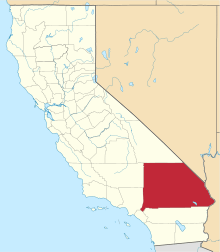
 Location of Chino Hills within Southwestern San Bernardino County, California. | ||
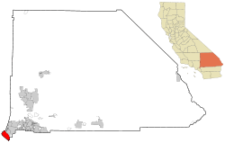
 Chino Hills, California Location in the United States | ||
| Coordinates: 33°59′38″N 117°45′32″W / 33.99389°N 117.75889°WCoordinates: 33°59′38″N 117°45′32″W / 33.99389°N 117.75889°W[1] | ||
| Country |
| |
| State |
| |
| County | San Bernardino | |
| Incorporated (city) | December 1, 1991[2] | |
| Government | ||
| • Type | Council-Manager | |
| • Mayor | Art Bennett [3] | |
| • City manager | Konradt Bartlam[4] | |
| Area[5] | ||
| • Total | 44.749 sq mi (115.899 km2) | |
| • Land | 44.681 sq mi (115.723 km2) | |
| • Water | 0.068 sq mi (0.175 km2) 0.15% | |
| Elevation[1] | 860 ft (262 m) | |
| Population (April 1, 2010)[6] | ||
| • Total | 74,799 | |
| • Estimate (2013)[6] | 76,572 | |
| • Density | 1,700/sq mi (650/km2) | |
| Time zone | Pacific (UTC-8) | |
| • Summer (DST) | PDT (UTC-7) | |
| ZIP code | 91709 | |
| Area code(s) | 909 | |
| FIPS code | 06-13214 | |
| GNIS feature IDs | 1668255, 2409454 | |
| Website |
www | |

Chino Hills is an affluent city located in the southwestern corner of San Bernardino County, California, United States. The city borders Los Angeles County on its northwest side, Orange County to its south, and Riverside County to its southeast. The city had a population of 74,799 at the 2010 census.
History
Pre-development
After the Spanish founded Mission San Gabriel in 1771, the Chino Hills were used extensively for grazing by mission cattle. During the Mexican Republic era, the hills were used as spillover grazing from such surrounding Mexican ranchos as Santa Ana del Chino and Rancho La Sierra (Yorba). After Mexico ceded California to the United States it was, and still is, a swamp and subject to flooding annually. Most historical dwellings were demolished in the rush to build. A local state monument is present in the grass lawn area of the local fire department, if one looks closely. Casa Colina, a well-known rehabilitation center now situated in Pomona California, began as a tubercular clinic in the Los Serranos sector. Similarly, the well known hospital, Loma Linda Hospital, also had its beginnings as a tubercular clinic. Sadly, most patients admitted for tuberculosis, succumbed to the illness because of the ineffectiveness of pre-antibotic treatments.
This land was sold to Richard Gird, the founder of nearby Chino subdivision and from which the town of Chino sprung in 1910.[7] With the building of the Carbon Canyon Mineral Springs in the modern-day Sleepy Hollow region of the city and the new Los Serranos Country Club in Los Serranos, Chino Hills, California, the area became a destination for both Los Angeles tourists and bootleggers during the prohibition because of its isolation. For the same reason, Sleepy Hollow became a destination for hippies and artists during the 1960s.[8] During the late 1980s, an incorporation effort began and in 1991, the city was incorporated with a population of 42,000.[9]
Development
Due to its topography of rolling hills, Chino Hills was primarily rural prior to the mid-1970s; most land was utilized for equestrian purposes and for dairies, except for the multi-use purposes of the State of California, promoting jobs for your community through day labor from the Chino Institute for Men on Central Avenue. Rapid and extensive housing developments followed throughout the 1980s and early 1990s, only slowing down in recent years. Most neighborhoods are arranged in a village-type format with strategically placed shopping centers and parks designed to be within walking distance of nearby homes.
Chino Hills is home to the Vellano Country Club, a private golf course and housing development designed by golf champion Greg Norman, his first project in the Greater Los Angeles area. With home prices expected to exceed $2 million, Vellano was touted (as of 2005) as the most expensive housing development in the Inland Empire.[10]
Chino Hills also includes the developed golf course development neighborhood of Los Serranos. Other large master-planned subdivisions without amenities include Woodview/Village Crossing, Gordon Ranch, LaBand Village, Butterfield Ranch,[11] Rolling Ridge, Fairfield Ranch, and Payne Ranch.[12]
Chino Hills is also the location of The Shoppes at Chino Hills. The mall features over 65 upscale stores and restaurants. The Shoppes is designed to be "Main Street Chino Hills" featuring the Chino Hills Government Center and Library in addition to retail outlets.
Chino Hills earthquake
On July 29, 2008, a 5.4 magnitude earthquake occurred at approximately 11:42:15 am PDT (18:42:15 UTC). It was the largest earthquake to affect the urbanized portion of Southern California since the 2004 Parkfield-San Bernardino earthquake. Some incidents of damage were reported, but no fatalities or severe injuries occurred as a result. The earthquake was felt as far south as San Diego and as far north as Las Vegas. The quake was reported to have interrupted a taping of the show Judge Judy, as well as a first day taping of the new show Judge Penny. The epicenter was located at the southeast portion of the Yorba Linda Fault.
Recent
Chino Hills was ranked 34th in Money magazine's "Best places to live 2012."[13] It is also the 6th highest income place in the United States (with population 65,000 to 250,000)[14] and was ranked as the 13th safest city in the United States in 2008 by the FBI.[15] Chino Hills is a part of the Chino Valley.
Chino Hills’ reputation is known in the national arena as well, as it was featured on the list of 87 of America's hottest towns in the January 2004 issue of Money magazine.[16] Chino Hills was ranked 8th on the list of “best places in the west with a population under 100,000.” The magazine reviewed a decade of data for communities with above average population growth, income, and home prices “to see where people were most willing to devote a high multiple of their annual income to live happily ever after.”
Government
Local
Chino Hills follows the Council-Manager model of government.[17] The city is governed by a city council which establishes all city ordinances, approves plans, adopts budgets, etc. The council appoints the city manager who enforces laws and, in essence, runs the city's day-to-day operations.[18]
City council
The city council is elected by city residents and, within the council, rotates the position of mayor. Once elected, the city council members serve a four-year term. The five city council members meet on the second and fourth Tuesday of each month,[17] with opportunity for residents to voice their opinion during the open forum. The meetings are broadcast via the city's television station and streaming via the city's website.
Police and fire
Law enforcement services in Chino Hills are provided by the San Bernardino County Sheriff's department. As of January 2016, the current "police chief" is Captain Robert Guillen. Chino Hills has contracted with the San Bernardino County Sheriff's department for Law Enforcement services since it was incorporated in 1991.[19]
The city contracts with the Chino Valley Independent Fire District (CVIFD) for fire protection services. The CVIFD serves the Chino Valley, serving Chino Hills and the city of Chino. The CVIFD is a separate political entity from either Chino Hills or Chino and is managed by its own elected board. The department has three stations located throughout Chino Hills.[20]
State and Federal
In the state legislature, Chino Hills is located in the 29th Senate District, represented by Republican Bob Huff, and in the 55th Assembly District, represented by Republican Ling Ling Chang
In the United States House of Representatives, Chino Hills is located in California's 39th congressional district, which has a Cook PVI of R +5[21] and is represented by Republican Ed Royce.[22]
Geography
| Chino Hills, California | ||||||||||||||||||||||||||||||||||||||||||||||||||||||||||||
|---|---|---|---|---|---|---|---|---|---|---|---|---|---|---|---|---|---|---|---|---|---|---|---|---|---|---|---|---|---|---|---|---|---|---|---|---|---|---|---|---|---|---|---|---|---|---|---|---|---|---|---|---|---|---|---|---|---|---|---|---|
| Climate chart (explanation) | ||||||||||||||||||||||||||||||||||||||||||||||||||||||||||||
| ||||||||||||||||||||||||||||||||||||||||||||||||||||||||||||
| ||||||||||||||||||||||||||||||||||||||||||||||||||||||||||||
Physical geography
Chino Hills is located at 33°58′31″N 117°43′23″W / 33.975267°N 117.723054°W.[23]
According to the United States Census Bureau, the city has a total area of 44.8 square miles (116 km2), much of which is undeveloped rolling hills, including the Chino Hills State Park. 44.7 square miles (116 km2) of it is land and 0.1 square miles (0.26 km2) of it (0.15%) is water.
City layout
The city of Chino Hills is bounded by the Los Angeles County cities of Pomona and Diamond Bar to the north and to the northwest, the San Bernardino County city of Chino to the east, unincorporated Riverside County near Corona to the southeast, and the Orange County cities of Brea and Yorba Linda to the west and southwest, respectively, as well as an unincorporated area of Orange County between Brea and Yorba Linda and a small unincorporated area between Yorba Linda and Anaheim commonly mistaken as part of the city of Anaheim, to the southwest and south, respectively.
The eastern border of Chino Hills roughly follows the Chino Valley Freeway (SR 71), which offers access to the Pomona Freeway (SR 60) to the north and the Riverside Freeway (SR 91) to the south. Undeveloped hills form the western border, which also serves as the San Bernardino – Orange County line. Because this area is mostly undeveloped, there is only one road directly connecting Chino Hills and Orange County, Carbon Canyon Road (SR 142), which is long, winding, and prone to landslides.[24][25]
 |
Diamond Bar | Pomona | Chino | |
| Diamond Bar Brea |
|
Chino Eastvale | ||
| ||||
| | ||||
| Brea Yorba Linda |
Yorba Linda Anaheim |
Corona |
Demographics
| Historical population | |||
|---|---|---|---|
| Census | Pop. | %± | |
| 1990 | 27,608 | — | |
| 2000 | 66,787 | 141.9% | |
| 2010 | 74,799 | 12.0% | |
| Est. 2015 | 78,309 | [26] | 4.7% |
2010
The 2010 United States Census[28] reported that Chino Hills had a population of 74,799. The population density was 1,671.5 people per square mile (645.4/km²). The racial makeup of Chino Hills was 38,035 (50.8%) White (33.4% Non-Hispanic White),[29] 3,415 (4.6%) African American, 379 (0.5%) Native American, 22,676 (30.3%) Asian, 115 (0.2%) Pacific Islander, 6,520 (8.7%) from other races, and 3,659 (4.9%) from two or more races. Hispanic or Latino of any race were 21,802 persons (29.1%).
The Census reported that 74,644 people (99.8% of the population) lived in households, 8 (0%) lived in non-institutionalized group quarters, and 147 (0.2%) were institutionalized.
There were 22,941 households, out of which 11,026 (48.1%) had children under the age of 18 living in them, 15,840 (69.0%) were opposite-sex married couples living together, 2,381 (10.4%) had a female householder with no husband present, 1,101 (4.8%) had a male householder with no wife present. There were 834 (3.6%) unmarried opposite-sex partnerships, and 142 (0.6%) same-sex married couples or partnerships. 2,713 households (11.8%) were made up of individuals and 717 (3.1%) had someone living alone who was 65 years of age or older. The average household size was 3.25. There were 19,322 families (84.2% of all households); the average family size was 3.54.
The population was spread out with 20,291 people (27.1%) under the age of 18, 7,147 people (9.6%) aged 18 to 24, 20,207 people (27.0%) aged 25 to 44, 21,889 people (29.3%) aged 45 to 64, and 5,265 people (7.0%) who were 65 years of age or older. The median age was 36.6 years. For every 100 females there were 97.7 males. For every 100 females age 18 and over, there were 94.7 males.
There were 23,617 housing units at an average density of 527.8 per square mile (203.8/km²), of which 18,421 (80.3%) were owner-occupied, and 4,520 (19.7%) were occupied by renters. The homeowner vacancy rate was 1.0%; the rental vacancy rate was 5.4%. 61,152 people (81.8% of the population) lived in owner-occupied housing units and 13,492 people (18.0%) lived in rental housing units.The median household income was $100,099 and the mean household income was $116,788. For families, the median income was $103,106 and the mean was $121,755.[28]
2000
As of the census[30] of 2000, there are 66,787 people, 20,039 households, and 17,073 families residing in the city. The population density is 575.5/km² (1,490.6/mi²). There are 20,414 housing units at an average density of 175.9/km² (455.6/mi²). The racial makeup of the city is 56.4% White, 5.5% African American, 0.6% Native American, 22.1% Asian, 0.1% Pacific Islander, 10.6% from other races, and 4.7% from two or more races. 25.7% of the population are Hispanic or Latino of any race. The average house cost is $654,250.
There are 20,039 households out of which 53.8% have children under the age of 18 living with them, 72.6% are married couples living together, 8.5% have a female householder with no husband present, and 14.8% are non-families. 10.8% of all households are made up of individuals and 1.6% have someone living alone who is 65 years of age or older. The average household size is 3.33 and the average family size is 3.61. The average home price (excluding the unincorporated area of Los Serranos) is approximately $716,900, and the median home price is $659,900.
In the city the population is spread out with 32.9% under the age of 18, 7.4% from 18 to 24, 35.6% from 25 to 44, 19.9% from 45 to 64, and 4.2% who are 65 years of age or older. The median age is 32 years. For every 100 females there are 98.9 males. For every 100 females age 18 and over, there are 95.1 males.
The median income for a household in the city is $83,550, and the median income for a family is $81,794. Males have a median income of $55,272 versus $38,620 for females. The per capita income for the city is $26,182. The average income for the city is $95,990. 5.1% of the population and 3.7% of families are below the poverty line. Out of the total population, 5.7% of those under the age of 18 and 4.9% of those 65 and older are living below the poverty line.
Economy
Top employers
According to the City's 2009 Comprehensive Annual Financial Report,[31] the top employers in the city are:
| # | Employer | # of Employees |
|---|---|---|
| 1 | Chino Valley Unified School District | 1,350 |
| 2 | City of Chino Hills | 286 |
| 3 | Costco | 270 |
| 4 | Lowe's | 218 |
| 5 | Boys Republic | 191 |
| 6 | Albertson's | 185 |
| 7 | Harkins Theatres | 146 |
| 8 | Chino Valley Independent Fire District | 125 |
| 9 | Lucille's Smokehouse BBQ | 119 |
| 10 | 99 Ranch Market | 105 |
Education
Chino Hills is served by the Chino Valley Unified School District
Elementary schools
- Hidden Trails - a California Distinguished School
- Country Springs - a California Distinguished School and a National Blue Ribbon School
- Eagle Canyon - a California Distinguished School
- Oak Ridge- a California Distinguished School
- Butterfield Ranch- a California Distinguished School
- Michael G. Wickman - California Distinguished School
- Chaparral - California Distinguished School
- Gerald Litel - California Distinguished School
- Glenmeade
- Rolling Ridge-California Distinguished School
Junior high schools
- Canyon Hills Junior High - a California Distinguished School
- Townsend Junior High - a California Distinguished School
High schools
- Ruben S. Ayala High School - a California Distinguished School[32]
- Chino Hills High School
- Boys Republic High School - a treatment center for troubled boys ages from 12 - 18.[33]
Independent schools
- Loving Savior of the Hills
- Chino Hills Christian School
- Chino Hills Montessori School
Charter schools
- Oxford Preparatory Academy (located in Chino but Chino Hills residents may attend)
- Mirus Secondary School (grades 7th - 12th)
Colleges and universities
- Biola University (Satellite Campus)
- California State Polytechnic University, Pomona (Cal Poly Pomona) - Closest 4-year public university.
Places of worship
Nondenominational Christianity
- Calvary Chapel Chino Hills
Evangelical
- Chino Valley Community Church
Roman Catholicism
- Saint Paul the Apostle Roman Catholic Church - The largest church in the Roman Catholic Diocese of San Bernardino
The Church of Jesus Christ of Latter-day Saints
- The Church of Jesus Christ of Latter-day Saints at 3332 and 3354 Eucalyptus Avenue in Chino Hills.
Buddhism
- Buddhist Temple of Chino Hills
Hinduism
- B.A.P.S Shri Swaminarayan Mandir & Cultural Center - As of November 2009, the Temple complex was open for use with primary worship facilities. The Reception Building includes intricate hand-carved wood interior and exterior elements based on traditional Indian religious symbols and architecture. The complex also includes a main Hall for religious assembly, Sunday school, and monastery. The temple was controversially completed in 2012 due to issue with the height of the structure.[34] It features intricate hand-carved stone exterior, and traditional Indian religious architecture.
Lutheranism
- Loving Savior of the Hills Lutheran Church
Notable natives and residents
- Of Mice & Men (band), musical group
- A Static Lullaby, musical group
- A Thorn for Every Heart, musical group
- Michael Aranda- vlogger, musician, and professional online video producer.
- Leah O'Brien-Amico, U.S. Olympic softball group gold medalist
- Cameron Dallas, vine sensation, actor, musician
- Mike Harkey, former Major League pitcher and pitching coach, 1987 first-round draft pick Chicago Cubs
- Cory Harkey, Los Angeles Rams tight end
- Danny Lopez, Hall of Fame boxer
- Ricky Minor, American Idol music director
- Matt Frazier – Drummer for the Local Natives
- Mat Mladin, AMA Superbike champion
- Mike Randolph, Los Angeles Galaxy soccer player
- Ron Roenicke, MLB player and manager
- Tony Pedregon, current NHRA Funny Car champion
- Del Worsham, NHRA Top Fuel dragster driver
- Jaclyn Swedberg, Playboy Playmate of the Month for April 2011
- Teebs, electronic musician
- Tyler Wilson, soccer player
- Kwame Watson-Siriboe, Real Salt Lake City soccer player
- Steve McQueen (1930–80), American Actor who spent some of his teen years at Boys Republic High School
- Randy Lew, Evasive Motorsports
Transportation
Highways in or near Chino Hills
Public transportation
Chino Hills is served by Omnitrans' OmniLink demand-response service open to the general public. For $2.50 one way, one can travel throughout the city and transfer for free to the Omnitrans public bus at the Chino Hills Marketplace and the Chino Hills Civic Center. The dial-a-ride service operates five days a week, mostly during daytime hours.[35]
References
- 1 2 "Chino Hills". Geographic Names Information System. United States Geological Survey. Retrieved November 18, 2014.
- ↑ "California Cities by Incorporation Date". California Association of Local Agency Formation Commissions. Archived from the original (Word) on November 3, 2014. Retrieved August 25, 2014.
- ↑ "City Council". Chino Hills, CA. Retrieved February 8, 2015.
- ↑ "City Manager". Chino Hills, CA. Retrieved February 8, 2015.
- ↑ "2010 Census U.S. Gazetteer Files – Places – California". United States Census Bureau.
- 1 2 "Chino Hills (city) QuickFacts". United States Census Bureau. Retrieved February 26, 2015.
- ↑ "Los Serranos Country Club History". Los Serranos Golf and Country Club. Archived from the original on 2006-09-08. Retrieved 2006-10-18.
- ↑ Sullivan, Susan (2004-02-08). "Room to Roam, Family Style". Los Angeles Times. Retrieved 2007-01-18.
- ↑ "Chino Hills - Demographics". City of Chino Hills. Retrieved 2006-10-18.
- ↑ Rappaport, Michael. "Buyers Lining Up To Live in Vellano". Inland Valley Daily Bulletin. Archived from the original on 2006-10-17. Retrieved 2007-01-18.
- ↑ http://sbsentinel.com/2014/03/chino-hills-allows-high-density-units-at-butterfield/
- ↑ https://books.google.com/books?id=jAdYj0MqNNIC&pg=PA210&lpg=PA210&dq=history+of+Butterfield+ranch&source=bl&ots=Zt3JGIY_LR&sig=FyD8AiV9Pc65BM4H2MJRaSnX790&hl=en&sa=X&ei=vQ3HU7O9Iar07Aau3oGYDg&ved=0CDcQ6AEwAzgK#v=onepage&q=history%20of%20Butterfield%20ranch&f=false
- ↑ "MONEY Magazine: Best places to live 2005 Top 100 (3)". CNN. Retrieved 2007-01-16.
- ↑ "Chino Hills Official Web-Site". Retrieved 2007-10-29.
- ↑ "2007 FBI Crime Statistics". Retrieved 2009-101-26. Check date values in:
|access-date=(help) - ↑ .Money
- 1 2 "Chino Hills - City Council". City of Chino Hills. Retrieved 2007-01-18.
- ↑ Fahim, Mayraj (2005-12-18). "Council managers are running more and more American cities". City Mayors. Retrieved 2007-01-18.
- ↑ "Chino Hills Sheriff Station". San Bernardino County Sheriff. Retrieved 2011-05-08.
- ↑ "CVIFD: Locations" (PDF). Chino Valley Independent Fire District. Archived (PDF) from the original on 2007-09-28. Retrieved 2007-01-18.
- ↑ http://cookpolitical.com/file/2013-04-47.pdf
- ↑ "California's 39th Congressional District - Representatives & District Map". Civic Impulse, LLC.
- ↑ "US Gazetteer files: 2010, 2000, and 1990". United States Census Bureau. 2011-02-12. Retrieved 2011-04-23.
- ↑ "1998 Landslide Inventory". Department of Conservation. Retrieved 2007-01-18.
- ↑ "Southern California Landslide Localities". California Geological Survey. 2006-10-30. Archived from the original on 2006-09-24. Retrieved 2007-01-18.
- ↑ "Annual Estimates of the Resident Population for Incorporated Places: April 1, 2010 to July 1, 2015". Retrieved July 2, 2016.
- ↑ "Census of Population and Housing". Census.gov. Archived from the original on May 11, 2015. Retrieved June 4, 2015.
- 1 2 "2010 Census Interactive Population Search: CA - Chino Hills city". U.S. Census Bureau. Retrieved July 12, 2014.
- ↑ http://quickfacts.census.gov/qfd/states/06/0613214.html. Missing or empty
|title=(help) - ↑ "American FactFinder". United States Census Bureau. Archived from the original on 2013-09-11. Retrieved 2008-01-31.
- ↑ City of Chino Hills CAFR
- ↑ "2011 Distinguished Middle and High Schools - California Distinguished Schools Program (CA Department of Education)". California Department of Education.
- ↑ "Boys Republic: Who We Are". Boys Republic. Retrieved 2007-01-19.
- ↑ http://m.championnewspapers.com/articles/2011/07/24/news/doc4e29cdb39ed1c315148202.txt[]
- ↑ "Omnitrans: Omnilink". Omnitrans. Retrieved 2007-01-18.
External links
| Wikimedia Commons has media related to Chino Hills, California. |
-
 Chino Hills travel guide from Wikivoyage
 - Official website
- Chino Valley Chamber of Commerce