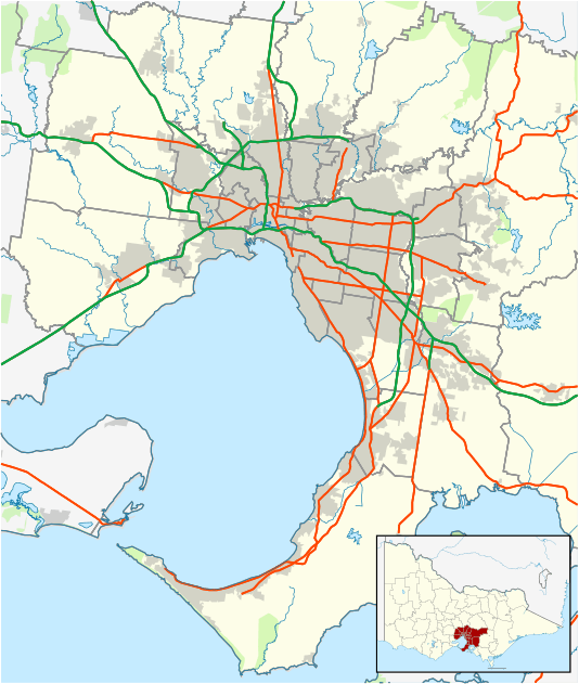
Bentleigh, Victoria
| Bentleigh Melbourne, Victoria | |||||||||||||
|---|---|---|---|---|---|---|---|---|---|---|---|---|---|
 Bentleigh | |||||||||||||
| Coordinates | 37°55′19″S 145°02′10″E / 37.922°S 145.036°ECoordinates: 37°55′19″S 145°02′10″E / 37.922°S 145.036°E | ||||||||||||
| Population | 14,920 (2011)[1] | ||||||||||||
| • Density | 3,170/km2 (8,220/sq mi) | ||||||||||||
| Postcode(s) | 3204 | ||||||||||||
| Area | 4.7 km2 (1.8 sq mi) | ||||||||||||
| Location | 13 km (8 mi) from Melbourne | ||||||||||||
| LGA(s) | City of Glen Eira | ||||||||||||
| State electorate(s) | Bentleigh | ||||||||||||
| Federal Division(s) | Goldstein | ||||||||||||
| |||||||||||||
Bentleigh is a suburb in Melbourne, Victoria, Australia, 13 km south-east of Melbourne's central business district.[2] Its local government area is the City of Glen Eira. At the 2011 Census, Bentleigh had a population of 14,920.
History
Bentleigh was named after the infamous Victorian politician, Thomas Bent.
The first Post Office in the area opened on 1 July 1865 as Jasper Road. After the railway arrived it moved to near the station in 1882 and was named Brighton East.[3]
In 1908 it was renamed Bentleigh in line with the station name.
A Patterson Post Office opened in 1948. In 1961 it was renamed Patterson West when a new Patterson office opened near the railway station.[4]
Today
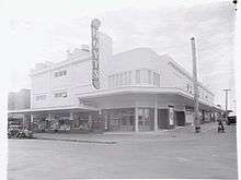
Bentleigh is home to Alnutt Park, Victory Park, Halley Park, and Bentleigh Memorial Gardens. The strip shopping centre along Centre Road is the biggest in the area, of over 250 retail businesses,[5] and convenient car parking. The shopping centre has a focus on fresh food, continental delis and cake shops, restaurants and cafes. It has bank branches, fashion and shoe shops, doctors surgeries, dentists and other medical services, an independent bookshop, a newsagent, a toy shop and three supermarkets. It has other services like hairdressers, picture framers, op shops for second-hand retail, and an interior decorator. There is a weekly market next to the train station.
There is also Patterson road shopping centre that has a cafe, two coffee shops, a Chinese restaurant, an Indian restaurant, a newsagent, a supermarket, a bakery, an organic green grocer, a fishmonger, a travel agent, a pizza shop, a nail technician, a violin maker, a remedial massage centre and three hairdressers. Its schools are Our Lady of the Sacred Heart College, Bentleigh West Primary School, and St. Paul's Primary School.
Public transport
Bentleigh has two railway stations, Bentleigh and Patterson; the former is the end of zone 1 on the Frankston train line.[6]
The level crossing at Bentleigh railway station was upgraded in 2006 at a cost of A$1.2 million and included sirens as well as bells, red man lights, 'Another Train is Coming' lights and latches on the emergency exit.[7] This was after several fatal accidents at the crossing involving pedestrians.
Bentleigh is also serviced by two bus services. The 703 is a SmartBus service which runs from Middle Brighton to Blackburn through Bentleigh's main shopping strip Centre Road. The 701 service starts from Bentleigh railway station and terminates at Oakleigh railway station. As part of the State Government's $10.5 billion transport plan the 701 service has been upgraded and the operating hours expanded to run seven-days-a-week for the first time.
Education
St. Paul's Primary School
St. Paul's Primary School[8] is a Catholic coeducational primary school located in Bentleigh on Jasper Road. The current principal is Mrs Tammisald who replaced Ann Cooper. The current Parish priest is Father Michael Sierakowski .[9] Established in 1928, it was managed by the Daughters of Our Lady of the Sacred Heart until 1993. In 2009 the school started building a new hall and renovating the main building both which were completed in 2010. The renovation improved the school substantially. The computer lab used to be in the library but it is now in a separate room. This means that the library is now bigger and to create even more space a mezzanine has been built. Another renovation is currently underway. This was halted in 2013 and then started in early 2014. It involves the renovation of the senior part of the school, the senior toilets and the storage area. The renovation will move the senior school classrooms so they are all in the same place as the year six classrooms were separated beforehand. The renovation is scheduled to finish mid next year.
Our Lady of Sacred Heart College
Our Lady of Sacred Heart College (OLSH) is a Catholic girls only secondary school located on the corner of Jasper Road and Patterson Road.The principal is Anne O'Laughlan. During Term 1 of 2014, the central courtyard was renovated. The courtyard was officially opened by the principal on the first day of Term 2.
Bentleigh West Primary School
Bentleigh West Primary School is a government primary school located in the suburbs of Glen Eira, about 15 km out of Melbourne, Australia. The current principal is Craig Johnson, who succeeded Jennifer Small, who succeeded Euan Wells. The enrolment is around 550 students from prep to grade 6. There are 46 non-teaching and teaching staff. The school led the way in using environmental sustainability programs to engage students in the learning experience
Artwork
The most known piece of artwork in Bentleigh is the wall of mosaics outside Patterson Station called 'Stationary Faces'. Before the artwork was put up the wall was just bare blue concrete and very depressing but now it is covered with mosaics of faces made by people from the surrounding area, including Bentleigh West Kindergarten and overseas.
See also
References
- ↑ Australian Bureau of Statistics (31 October 2012). "Bentleigh (State Suburb)". 2011 Census QuickStats. Retrieved 11 February 2013.
- ↑ http://www.postcodes-australia.com/areas/vic/dandenong/bentleigh
- ↑ "Archived copy". Archived from the original on 28 December 2008. Retrieved 2009-01-16. A History Of Bentleigh And The Centre Rd Shops
- ↑ Premier Postal History. "Post Office List". Retrieved 11 April 2008.
- ↑ Bentleigh list of shops A-Z Archived 18 July 2008 at the Wayback Machine.. Retrieved 11 July 2008
- ↑ Frankston line map Archived 29 July 2008 at the Wayback Machine.
- ↑ Bentleigh pedestrian crossing trial site fully operational (Victorian Government media release). Retrieved 11 July 2008
- ↑ "School Profile". St. Paul's Primary School. Archived from the original on 31 December 2009. Retrieved 26 December 2009.
- ↑ Cooper, Ann. "St. Paul's Primary School". St. Paul's Primary School. Archived from the original on 31 December 2009. Retrieved 26 December 2009.