Caulfield East, Victoria
| Caulfield East Melbourne, Victoria | |||||||||||||
|---|---|---|---|---|---|---|---|---|---|---|---|---|---|
 | |||||||||||||
 Caulfield East | |||||||||||||
| Coordinates | 37°52′34″S 145°02′38″E / 37.876°S 145.044°ECoordinates: 37°52′34″S 145°02′38″E / 37.876°S 145.044°E | ||||||||||||
| Population | 1,237 (2011 census)[1] | ||||||||||||
| • Density | 950/km2 (2,460/sq mi) | ||||||||||||
| Postcode(s) | 3145 | ||||||||||||
| Area | 1.3 km2 (0.5 sq mi) | ||||||||||||
| Location | 14 km (9 mi) from Melbourne | ||||||||||||
| LGA(s) | City of Glen Eira | ||||||||||||
| State electorate(s) | |||||||||||||
| Federal Division(s) | Melbourne Ports | ||||||||||||
| |||||||||||||
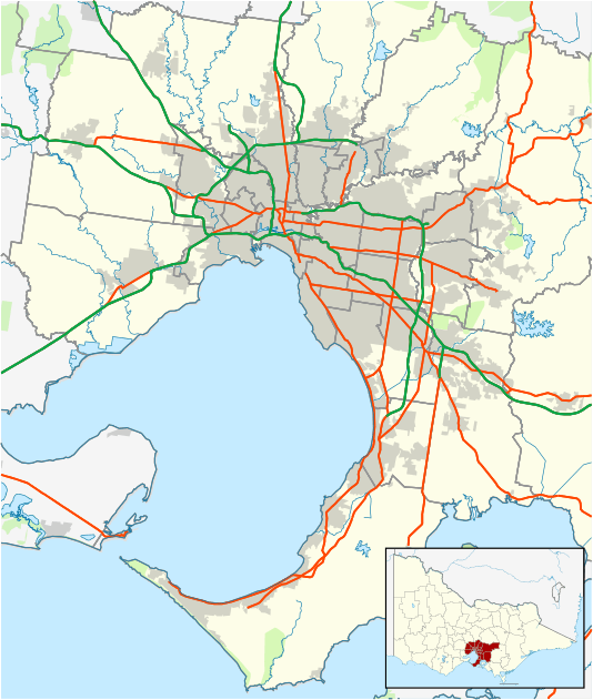
Caulfield East is a suburb in Melbourne, Victoria, Australia, 10 km south-east from Melbourne's central business district. Its local government area is the City of Glen Eira. As of the 2011 Census, Caulfield East had a population of 1,237.
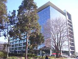
The suburb contains landmarks such as the Caulfield Racecourse, Caulfield railway station, the Caulfield Campus of Monash University and Glen Eira College. The suburb is bounded by Booran Road and Kambrook Road to the west, Dandenong Road to the north, Grange Road to the east and Neerim Road to the south.
History
Caulfield East Post Office opened on 6 December 1888, and was known briefly in 1928 and 1929 as Malvern East.[2]
See also
- City of Caulfield - the former local government area of which Caulfield East was a part.
References
- ↑ Australian Bureau of Statistics (31 October 2012). "Caulfield East (State Suburb)". 2011 Census QuickStats. Retrieved 11 February 2013.
- ↑ Premier Postal History, Post Office List, retrieved 11 April 2008
This article is issued from Wikipedia - version of the 8/23/2016. The text is available under the Creative Commons Attribution/Share Alike but additional terms may apply for the media files.