Bois, Charente-Maritime
| Bois | |
|---|---|
 | |
 Bois | |
|
Location within Nouvelle-Aquitaine region  Bois | |
| Coordinates: 45°29′17″N 0°35′55″W / 45.4881°N 0.5986°WCoordinates: 45°29′17″N 0°35′55″W / 45.4881°N 0.5986°W | |
| Country | France |
| Region | Nouvelle-Aquitaine |
| Department | Charente-Maritime |
| Arrondissement | Jonzac |
| Canton | Saint-Genis-de-Saintonge |
| Government | |
| • Mayor (2001–2008) | Annie Métoyer |
| Area1 | 21.12 km2 (8.15 sq mi) |
| Population (2008)2 | 496 |
| • Density | 23/km2 (61/sq mi) |
| Time zone | CET (UTC+1) |
| • Summer (DST) | CEST (UTC+2) |
| INSEE/Postal code | 17050 / 17240 |
| Elevation | 29–59 m (95–194 ft) |
|
1 French Land Register data, which excludes lakes, ponds, glaciers > 1 km² (0.386 sq mi or 247 acres) and river estuaries. 2 Population without double counting: residents of multiple communes (e.g., students and military personnel) only counted once. | |
Bois is a commune in the Charente-Maritime department in southwestern France.
Population
| Historical population | ||
|---|---|---|
| Year | Pop. | ±% |
| 1793 | 902 | — |
| 1800 | 865 | −4.1% |
| 1806 | 878 | +1.5% |
| 1821 | 845 | −3.8% |
| 1831 | 954 | +12.9% |
| 1836 | 895 | −6.2% |
| 1841 | 890 | −0.6% |
| 1846 | 894 | +0.4% |
| 1851 | 890 | −0.4% |
| 1856 | 906 | +1.8% |
| 1861 | 918 | +1.3% |
| 1866 | 879 | −4.2% |
| 1872 | 825 | −6.1% |
| 1876 | 852 | +3.3% |
| 1881 | 800 | −6.1% |
| 1886 | 764 | −4.5% |
| 1891 | 726 | −5.0% |
| 1896 | 680 | −6.3% |
| 1901 | 645 | −5.1% |
| 1906 | 622 | −3.6% |
| 1911 | 622 | +0.0% |
| 1921 | 579 | −6.9% |
| 1926 | 536 | −7.4% |
| 1931 | 545 | +1.7% |
| 1936 | 590 | +8.3% |
| 1946 | 588 | −0.3% |
| 1954 | 578 | −1.7% |
| 1962 | 472 | −18.3% |
| 1968 | 473 | +0.2% |
| 1975 | 459 | −3.0% |
| 1982 | 456 | −0.7% |
| 1990 | 427 | −6.4% |
| 1999 | 430 | +0.7% |
| 2008 | 496 | +15.3% |
International relations
Bois is twinned with:
-
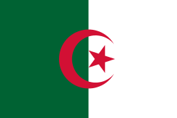 Treat, Algeria
 -
 Tát, Hungary
 -
 Domino, California
See also
References
| Wikimedia Commons has media related to Bois (Charente-Maritime). |
This article is issued from Wikipedia - version of the 8/11/2013. The text is available under the Creative Commons Attribution/Share Alike but additional terms may apply for the media files.