Soubise, Charente-Maritime
| Soubise | ||
|---|---|---|
|
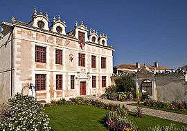
Town hall | ||
| ||
 Soubise | ||
|
Location within Nouvelle-Aquitaine region  Soubise | ||
| Coordinates: 45°55′34″N 1°00′28″W / 45.9261°N 1.0078°WCoordinates: 45°55′34″N 1°00′28″W / 45.9261°N 1.0078°W | ||
| Country | France | |
| Region | Nouvelle-Aquitaine | |
| Department | Charente-Maritime | |
| Arrondissement | Rochefort | |
| Canton | Saint-Agnant | |
| Intercommunality | Sud-Charente | |
| Government | ||
| • Mayor (2008–2014) | Robert Chatelier | |
| Area1 | 10.93 km2 (4.22 sq mi) | |
| Population (2008)2 | 3,032 | |
| • Density | 280/km2 (720/sq mi) | |
| Time zone | CET (UTC+1) | |
| • Summer (DST) | CEST (UTC+2) | |
| INSEE/Postal code | 17429 / 17780 | |
| Elevation | 0–22 m (0–72 ft) | |
|
1 French Land Register data, which excludes lakes, ponds, glaciers > 1 km² (0.386 sq mi or 247 acres) and river estuaries. 2 Population without double counting: residents of multiple communes (e.g., students and military personnel) only counted once. | ||

Soubise is a commune in the Charente-Maritime department in southwestern France.
It is situated on the left bank of the Charente River opposite Rochefort and is a former shipbuilding centre.
Population
| Historical population | ||
|---|---|---|
| Year | Pop. | ±% |
| 1962 | 706 | — |
| 1968 | 730 | +3.4% |
| 1975 | 842 | +15.3% |
| 1982 | 1,422 | +68.9% |
| 1990 | 1,220 | −14.2% |
| 1999 | 1,243 | +1.9% |
| 2008 | 3,032 | +143.9% |
See also
References
| Wikimedia Commons has media related to Soubise. |
This article is issued from Wikipedia - version of the 3/15/2016. The text is available under the Creative Commons Attribution/Share Alike but additional terms may apply for the media files.