Border Village
| Border Village South Australia | |
|---|---|
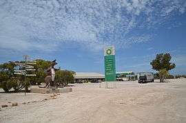 The Border Village roadhouse, 2012. | |
 Border Village | |
| Coordinates | 31°38′17.19″S 129°0′12.7″E / 31.6381083°S 129.003528°ECoordinates: 31°38′17.19″S 129°0′12.7″E / 31.6381083°S 129.003528°E |
| Postcode(s) | 5690 |
| Time zone | CWST (UTC+8:45) |
| Location | |
| LGA(s) | Outback Communities Authority[1] |
| State electorate(s) | Flinders[2] |
| Federal Division(s) | Grey[3] |
| Footnotes |
Coordinates[4] Location[5] |
Border Village is a settlement located in South Australia within the locality of Nullarbor on the Eyre Highway at the border with Western Australia.[4][5]
The settlement, which is 12 km east of Eucla, was named in 1993 by the South Australian Geographical Names Advisory Committee following a suggestion provided by the Royal Automobile Club of Western Australia.[4] The settlement is located at the western end of the cliffs separating the Nullarbor Plain from the Great Australian Bight.[5]
As of 2004, the settlement offered services to travellers and visitors to Nullarbor including:[5]
Motel, cabin and caravan accommodation, a restaurant which opens from 6.00 a.m. - 10.00 p.m., a takeaway service which is open from 6.00 a.m. - 11.00 p.m., full garage service and a desalination plant which provides fresh water.
There is a Western Australian agricultural checkpoint at Border Village, and also "Hole 6: Border Kangaroo" of the Nullarbor Links golf course.[6]
The settlement is one of five that uses the Central Western Standard Time (UTC+08:45). It is also the only place in South Australia where Daylight Saving Time is not in use.
See also
Notes
- ↑ Page 1 0 OUTBACK COMMUNITIESAUTHORITYAnnual Report2011 - 12 HOUSE OF ASSEMBLYLAID ON THE TABLE 27 November 2013 Page 2 1 OUTBACK COMMUNITIESAUTHORITY Annual Report 2011 - 12 (PDF). Government of South Australia. 2013. p. 53. Retrieved 11 October 2014.
- ↑ "District of Flinders Background Profile". Electoral Commission SA. Retrieved 9 September 2015.
- ↑ "Federal electoral division of Grey, boundary gazetted 16 December 2011" (PDF). Australian Electoral Commission. Retrieved 20 August 2015.
- 1 2 3 "Search result for " Nullarbor (LOCU)" (Record no SA0008549)". Department of Planning Transport and Infrastructure. Retrieved 22 September 2015.
- 1 2 3 4 "Border Village". Sydney Morning Herald. 2004-02-08. Retrieved 2 January 2013.
- ↑ "Hole 6: Border Kangaroo". Nullarbor Links. Eyre Highway Operators Association. Retrieved 2 January 2013.