Brackaghlislea
| Brackaghlislea | |
|---|---|
| Irish transcription(s) | |
| • Derivation: | An Bhreacach |
| • Meaning: | "The speckled place" |
| Irish transcription(s) | |
| • Derivation: | Lios Liath |
| • Meaning: | "Grey fort" |
 | |
 Brackaghlislea Brackaghlislea shown within Northern Ireland | |
| Coordinates: 54°46′16″N 6°44′49″W / 54.771°N 6.747°WCoordinates: 54°46′16″N 6°44′49″W / 54.771°N 6.747°W | |
| Country | Northern Ireland |
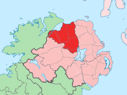
| County | County Londonderry |
| Barony | Loughinsholin |
| Civil parish | Kilcronaghan |
| Plantation grant | Drapers Company and freeholds |
| First recorded | 1609 |
| Government | |
| • Council | Magherafelt District Council |
| • Ward | Tobermore |
| Area[1] | |
| • Total | 509.09 ha (1,258.01 acres) |
| Irish grid ref | H8092 |
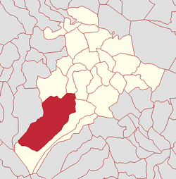
Brackaghlislea (locally [ˌbraklïsˈleː], [ˌbrakrïsˈleː], and [ˌbrakïsˈleː]; from Irish: An Bhreacach, meaning "the speckled place", and Lios Liath, meaning "grey fort"[2]) is a townland lying within the civil parish of Kilcronaghan, County Londonderry, Northern Ireland. It lies to the south-west of the parish and is bounded to the south and west by the civil parish of Ballinascreen. It is bounded by the following townlands: Drumard, Gortahurk, Mormeal, Tamnyaskey and Tullyroan. It was apportioned to the Drapers company and freeholds.[3]
The townland currently lies within Tobermore electoral ward of Magherafelt District Council, however in 1901 and 1926 it was part of Iniscarn District Electoral Division as part of the Draperstown dispensery (registrar's) district of Magherafelt Rural District.[4][5] It was also part of the historic barony of Loughinsholin.[3]
History
The modern townland of Brackaghlislea appears to be the amalgamation of two 17th century townlands: Ballynebracky (from Irish: Baile na Breacai, meaning "townland of the speckled place"); and Lislea (from Irish: Lios Liath, meaning "grey fort").[2] They are listed separately in several early sources and appear side by side in a map of the Escheated Counties from 1609.[2]
|
|
| ||||||||||||||||||||||||||||||||||||||||||||||||||||||||
See also
References
- ↑ Northern Ireland Environment Agency. "NIEA Map Viewer". Retrieved 27 January 2012.
- 1 2 3 4 Toner, Gregory: Place-Names of NortHern Ireland, page 114-115. Queen's University of Belfast, 1996, ISBN 0-85389-613-5
- 1 2 Notes on the Place Names of the Parishes and Townlands of the County of Londonderry, 1925, Alfred Moore Munn, Clerk of the Crown and Peace of the City and County of Londonderry
- 1 2 3 4 5 HistPop; Area, houses, and population, Vol. III [Part 2], Ireland, 1901 Page 34
- 1 2 3 4 HistPop; County and County Borough of Londonderry, 1926, page 24
- 1 2 3 4 5 6 HistPop; Area, population and number of houses, Vol. III, Ireland, 1881, page 698
- ↑ HistPop; County of Londonderry, 1851, page 241
- ↑ Place Names NI - Brackaghlislea Archived July 17, 2011, at the Wayback Machine.