CFB Currie, Calgary
| CFB Currie | |
|---|---|
| Neighbourhood | |
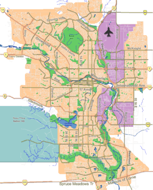 CFB Currie Location of CFB Currie in Calgary | |
| Coordinates: 51°01′05″N 114°07′29″W / 51.018155°N 114.124739°WCoordinates: 51°01′05″N 114°07′29″W / 51.018155°N 114.124739°W | |
| Country |
|
| Province |
|
| City |
|
| Quadrant | SW |
| Ward | 11 |
| Government[1] | |
| • Mayor | Naheed Nenshi |
| • Administrative body | Calgary City Council |
| • Councillor | Brian Pincott |
| Population (2012)[2] | |
| • Total | 172 |
| Time zone | Mountain (UTC-7) |
| Area code(s) | 403 587 |
CFB Currie is a residential neighbourhood in the southwest quadrant of Calgary, Alberta, Canada. It is located on former Canadian Forces Base (CFB) Calgary, bounded by the Lincoln Park community to the southwest, Sarcee Road S.W. to the west, 33 Avenue S.W. to the north, and Crowchild Trail to the east.[3] Being part of former CFB Calgary, the neighbourhood is planned for redevelopment under the CFB West Master Plan.[4]
CFB Currie is located within Calgary City Council's Ward 11.[2]
Demographics
In the City of Calgary's 2012 municipal census, CFB Currie had a population of 172 living in 76 dwellings, a 616.7% increase from its 2011 population of 24.[2] With a land area of 1.1 km2 (0.42 sq mi), it had a population density of 156/km2 (405/sq mi) in 2012.[5][2]
See also
References
- ↑ "Calgary Elections". City of Calgary. October 21, 2013. Retrieved October 22, 2013.
- 1 2 3 4 "2012 Civic Census Results" (PDF). City of Calgary. 2012. Retrieved February 4, 2013.
- ↑ "City of Calgary Communities and Industrial Area Locations" (PDF). City of Calgary. September 2011. Retrieved 2012-05-07.
- ↑ "CFB West Master Plan" (PDF). City of Calgary. December 2000. Retrieved 2012-05-07.
- ↑ "Community Boundaries" (Esri shapefile). City of Calgary. Retrieved February 5, 2013.
 |
Rutland Park | Richmond | Richmond | |
| Rutland Park | |
Altadore | ||
| ||||
| | ||||
| Lincoln Park | Lincoln Park | North Glenmore Park |