Chinook Park, Calgary
| Chinook Park | |
|---|---|
| Neighbourhood | |
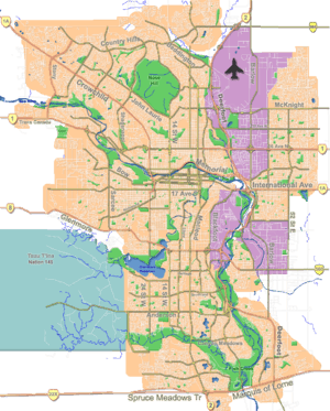 Chinook Park Location of Chinook Park in Calgary | |
| Coordinates: 50°58′58″N 114°05′19″W / 50.98278°N 114.08861°WCoordinates: 50°58′58″N 114°05′19″W / 50.98278°N 114.08861°W | |
| Country |
|
| Province |
|
| City |
|
| Quadrant | SW |
| Ward | 11 |
| Established | 1959 |
| Government[1] | |
| • Mayor | Naheed Nenshi |
| • Administrative body | Calgary City Council |
| • Councillor | Brian Pincott |
| Area | |
| • Total | 0.6 km2 (0.2 sq mi) |
| Elevation | 1,070 m (3,510 ft) |
| Population (2006)[2] | |
| • Total | 1,717 |
| • Average Income | $88,357 |
| Website | Chinook Park Community Association |
Chinook Park is a residential neighbourhood in the south-west quadrant of Calgary, Alberta. It is bounded by Glenmore Trail to the north, Elbow Drive to the east, 14 Street W to the west and Heritage Drive to the south.
Chinook Park was established in 1959. It is represented in the Calgary City Council by the Ward 11 councillor.[1]
Demographics
In the City of Calgary's 2012 municipal census, Chinook Park had a population of 1,707 living in 589 dwellings, a 0.2% increase from its 2011 population of 1,703.[3] With a land area of 0.6 km2 (0.23 sq mi), it had a population density of 2,850/km2 (7,400/sq mi) in 2012.[4][3]
Residents in this community had a median household income of $88,357 in 2000, and there were 9.7% low income residents living in the neighbourhood.[5] As of 2000, 19.8% of the residents were immigrants. A proportion of 18.3% of the buildings were condominiums or apartments, and 17.5% of the housing was used for renting.[2]
Education
The community is served by Chinook Park Bilingual Elementary and Henry Wise Wood Senior High public schools.
See also
References
- 1 2 "Calgary Elections". City of Calgary. October 21, 2013. Retrieved October 22, 2013.
- 1 2 City of Calgary (2006). "Chinook Park Community Statistics" (PDF). Retrieved 2007-05-10.
- 1 2 "2012 Civic Census Results" (PDF). City of Calgary. 2012. Retrieved February 4, 2013.
- ↑ "Community Boundaries" (Esri shapefile). City of Calgary. Retrieved February 5, 2013.
- ↑ City of Calgary (2004). "Ward 11 Profile" (PDF). Retrieved 2007-05-10.
External links
 |
Glenmore Reservoir | Kelvin Grove | Kingsland | |
| Eagle Ridge | |
Kingsland | ||
| ||||
| | ||||
| Bayview | Haysboro | Haysboro |