Skyview Ranch, Calgary
| Skyview Ranch | |
|---|---|
| Neighbourhood | |
 Skyview Ranch Location of Skyview Ranch in Calgary | |
| Coordinates: 51°09′35″N 113°57′34″W / 51.1597°N 113.959479°WCoordinates: 51°09′35″N 113°57′34″W / 51.1597°N 113.959479°W | |
| Country |
|
| Province |
|
| City |
|
| Quadrant | NE |
| Government[1] | |
| • Mayor | Naheed Nenshi |
| • Administrative body | Calgary City Council |
| • Councillor | Jim Stevenson |
| Population (2012)[2] | |
| • Total | 2,990 |
| Time zone | Mountain (UTC-7) |
| Area code(s) | 403 587 |
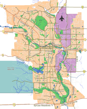
Skyview Ranch is a residential neighbourhood in the northeast quadrant of Calgary, Alberta, Canada. Located near the north edge of the city, it is bounded by Métis Trail N.E. to the west, the Redstone community to the north, 60 Street N.E. to the east, and the Cityscape community to the south.[3][4] It is bisected by Country Hills Boulevard, which becomes Highway 564 to the east.
Skyview Ranch is located within Calgary City Council's Ward 3.[1]
Demographics
In the City of Calgary's 2012 municipal census, Skyview Ranch had a population of 2,990 living in 1,306 dwellings, a 65.7% increase from its 2011 population of 1,805.[2] With a land area of 4.6 km2 (1.8 sq mi), it had a population density of 650/km2 (1,683/sq mi) in 2012.[5][2]
See also
References
- 1 2 "Calgary Elections". City of Calgary. October 21, 2013. Retrieved October 22, 2013.
- 1 2 3 "2012 Civic Census Results" (PDF). City of Calgary. 2012. Retrieved February 4, 2013.
- ↑ "Report to the Calgary Planning Commission (CPC2013-025)" (PDF). City of Calgary. January 17, 2013. Retrieved February 22, 2013.
- ↑ "City of Calgary Communities and Industrial Area Locations" (PDF). City of Calgary. September 2011. Retrieved 2012-05-02.
- ↑ "Community Boundaries" (Esri shapefile). City of Calgary. Retrieved February 5, 2013.
 |
Stonegate Landing | Redstone | Rocky View County | |
| Stonegate Landing | |
Rocky View County | ||
| ||||
| | ||||
| Stoney 3 Industrial | Cityscape | Saddle Ridge |