Charlotte Township, Bates County, Missouri
| Charlotte Township | |
|---|---|
| Township | |
 Location in Bates County | |
| Coordinates: 38°15′54″N 94°27′29″W / 38.26500°N 94.45806°WCoordinates: 38°15′54″N 94°27′29″W / 38.26500°N 94.45806°W | |
| Country |
|
| State |
|
| County | Bates |
| Area | |
| • Total | 35.97 sq mi (93.15 km2) |
| • Land | 35.87 sq mi (92.91 km2) |
| • Water | 0.09 sq mi (0.24 km2) 0.26% |
| Elevation | 869 ft (265 m) |
| Population (2000) | |
| • Total | 367 |
| • Density | 10.2/sq mi (4/km2) |
| Time zone | CST (UTC-6) |
| • Summer (DST) | CDT (UTC-5) |
| ZIP codes | 64722, 64730 |
| GNIS feature ID | 0766289 |
Charlotte Township is one of twenty-four townships in Bates County, Missouri, USA. As of the 2000 census, its population was 367.[1]
Geography
According to the United States Census Bureau, Charlotte Township covers an area of 35.97 square miles (93.15 square kilometers); of this, 35.87 square miles (92.91 square kilometers, 99.74 percent) is land and 0.09 square miles (0.24 square kilometers, 0.26 percent) is water.
Unincorporated towns
(This list is based on USGS data and may include former settlements.)
Adjacent townships
- Elkhart Township (north)
- Mound Township (northeast)
- Mount Pleasant Township (east)
- New Home Township (south)
- Walnut Township (southwest)
- Homer Township (west)
- West Point Township (northwest)
Cemeteries
The township contains these two cemeteries: Park and Virginia.
Major highways
Lakes
- Butler Lake
Landmarks
- Park Cemetery
- Virginia Cemetery
School districts
- Butler R-V School District
- Miami R-I
Political districts
- Missouri's 4th congressional district
- State House District 125
- State Senate District 31
References
- United States Census Bureau 2008 TIGER/Line Shapefiles
- United States Board on Geographic Names (GNIS)
- United States National Atlas
External links
 |
West Point Township | Elkhart Township | Mound Township | |
| Homer Township | |
Mount Pleasant Township | ||
| ||||
| | ||||
| Walnut Township | New Home Township |
Municipalities and communities of Bates County, Missouri, United States | ||
|---|---|---|
| Cities | 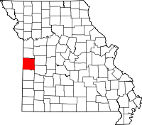 | |
| Villages | ||
| Townships | ||
| Unincorporated communities | ||
| Ghost towns | ||
| Footnotes | ‡This populated place also has portions in an adjacent county or counties | |
This article is issued from Wikipedia - version of the 11/20/2016. The text is available under the Creative Commons Attribution/Share Alike but additional terms may apply for the media files.