Elkhart Township, Bates County, Missouri
| Elkhart Township | |
|---|---|
| Township | |
 Location in Bates County | |
| Coordinates: 38°20′24″N 94°26′46″W / 38.34000°N 94.44611°WCoordinates: 38°20′24″N 94°26′46″W / 38.34000°N 94.44611°W | |
| Country |
|
| State |
|
| County | Bates |
| Area | |
| • Total | 35.54 sq mi (92.05 km2) |
| • Land | 35.45 sq mi (91.83 km2) |
| • Water | 0.09 sq mi (0.22 km2) 0.24% |
| Elevation | 853 ft (260 m) |
| Population (2000) | |
| • Total | 304 |
| • Density | 8.6/sq mi (3.3/km2) |
| Time zone | CST (UTC-6) |
| • Summer (DST) | CDT (UTC-5) |
| ZIP codes | 64720, 64722, 64723, 64730 |
| GNIS feature ID | 0766293 |
Elkhart Township is one of twenty-four townships in Bates County, Missouri, USA. As of the 2000 census, its population was 304.[1]
History
Elkhart Township was established in the 1860s.[2] The name is a transfer from Elkhart, Indiana.[3]
Geography
According to the United States Census Bureau, Elkhart Township covers an area of 35.54 square miles (92.05 square kilometers); of this, 35.45 square miles (91.83 square kilometers, 99.76 percent) is land and 0.09 square miles (0.22 square kilometers, 0.24 percent) is water.
Adjacent townships
- East Boone Township (north)
- Deer Creek Township (northeast)
- Mound Township (east)
- Mount Pleasant Township (southeast)
- Charlotte Township (south)
- Homer Township (southwest)
- West Point Township (west)
- West Boone Township (northwest)
Cemeteries
The township contains these two cemeteries: Howell and Scott.
School districts
- Adrian County R-III
- Butler R-V School District
- Miami R-I
Political districts
- Missouri's 4th congressional district
- State House District 125
- State Senate District 31
References
- United States Census Bureau 2008 TIGER/Line Shapefiles
- United States Board on Geographic Names (GNIS)
- United States National Atlas
- ↑ United States Census Bureau American FactFinder
- ↑ "Bates County Place Names, 1928-1945 (archived)". The State Historical Society of Missouri. Retrieved 1 September 2016.
- ↑ Eaton, David Wolfe (1916). How Missouri Counties, Towns and Streams Were Named. The State Historical Society of Missouri. p. 285.
External links
 |
West Boone Township | East Boone Township | Deer Creek Township | |
| West Point Township | |
Mound Township | ||
| ||||
| | ||||
| Homer Township | Charlotte Township | Mount Pleasant Township |
Municipalities and communities of Bates County, Missouri, United States | ||
|---|---|---|
| Cities | 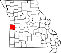 | |
| Villages | ||
| Townships | ||
| Unincorporated communities | ||
| Ghost towns | ||
| Footnotes | ‡This populated place also has portions in an adjacent county or counties | |
This article is issued from Wikipedia - version of the 10/24/2016. The text is available under the Creative Commons Attribution/Share Alike but additional terms may apply for the media files.