Cide
| Cide | |
|---|---|
| District | |
|
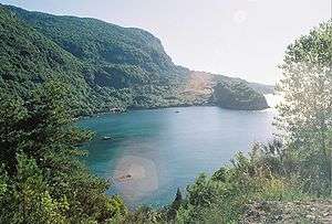
Gideros bay, Cide | |
 Location of pop within Turkey. | |
 Cide Location of Cide | |
| Coordinates: 41°53′N 33°02′E / 41.883°N 33.033°E | |
| Country |
|
| Region | Black Sea |
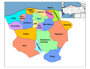
| Province | Kastamonu |
| Government | |
| • Mayor | Nejdet Demir (AKP) |
| Area[1] | |
| • District | 664.10 km2 (256.41 sq mi) |
| Elevation | 403 m (1,322 ft) |
| Population (2012)[2] | |
| • Urban | 6,111 |
| • District | 20,077 |
| • District density | 30/km2 (78/sq mi) |
| Time zone | EET (UTC+2) |
| • Summer (DST) | EEST (UTC+3) |
| Postal code | 37xxx |
| Area code(s) | 366 |
| Licence plate | 37 |
| Climate | Cfb |
| Website | www.cide.bel.tr |
Cide, also Karaağaç, is a town and district of the Kastamonu Province in the Black Sea region of Turkey. According to the 2000 census, population of the district is 23,161 of which 5,834 live in the town of Cide.[3][4] The district covers an area of 664 km2 (256 sq mi),[5] and the town lies at an elevation of 403 m (1,322 ft).
History
In the late 19th and early 20th century, Cide was part of the Kastamonu Vilayet of the Ottoman Empire.
Image gallery
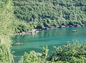 Gideros bay, Cide
 A panorama of Cide by night
 Old Cide houses
Notes
- ↑ "Area of regions (including lakes), km²". Regional Statistics Database. Turkish Statistical Institute. 2002. Retrieved 2013-03-05.
- ↑ "Population of province/district centers and towns/villages by districts - 2012". Address Based Population Registration System (ABPRS) Database. Turkish Statistical Institute. Retrieved 2013-02-27.
- ↑ Turkish Statistical Institute. "Census 2000, Key statistics for urban areas of Turkey" (in Turkish). Archived from the original (XLS) on 2007-07-22. Retrieved 2008-11-09.
- ↑ GeoHive. "Statistical information on Turkey's administrative units". Retrieved 2008-11-24.
- ↑ Statoids. "Statistical information on districts of Turkey". Retrieved 2008-11-24.
References
- Falling Rain Genomics, Inc. "Geographical information on Cide, Turkey". Retrieved 2008-11-09.
External links
![]() Media related to Cide at Wikimedia Commons
Media related to Cide at Wikimedia Commons
- District governor's official website (Turkish)
Coordinates: 41°53′28″N 33°02′20″E / 41.89111°N 33.03889°E
This article is issued from Wikipedia - version of the 11/24/2016. The text is available under the Creative Commons Attribution/Share Alike but additional terms may apply for the media files.