Dolenje Ponikve
| Dolenje Ponikve | |
|---|---|
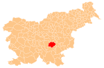
 Dolenje Ponikve Location in Slovenia | |
| Coordinates: 45°53′38.05″N 15°2′41.4″E / 45.8939028°N 15.044833°ECoordinates: 45°53′38.05″N 15°2′41.4″E / 45.8939028°N 15.044833°E | |
| Country |
|
| Traditional region | Lower Carniola |
| Statistical region | Southeast Slovenia |
| Municipality | Trebnje |
| Area | |
| • Total | 1.87 km2 (0.72 sq mi) |
| Elevation | 266.8 m (875.3 ft) |
| Population (2002) | |
| • Total | 161 |
| [1] | |
Dolenje Ponikve (pronounced [dɔˈleːnjɛ pɔˈniːkʋɛ]) is a settlement in the Municipality of Trebnje in eastern Slovenia. It lies on the road leading south from Dolenja Nemška Vas towards Mirna Peč and Novo Mesto. The area is part of the historical region of Lower Carniola. The municipality is now included in the Southeast Slovenia Statistical Region.[2]
References
External links
 Media related to Dolenje Ponikve at Wikimedia Commons
- Dolenje Ponikve at Geopedia
This article is issued from Wikipedia - version of the 1/3/2016. The text is available under the Creative Commons Attribution/Share Alike but additional terms may apply for the media files.