Kamni Potok
| Kamni Potok | |
|---|---|
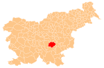
 Kamni Potok Location in Slovenia | |
| Coordinates: 45°55′6.51″N 14°58′37.36″E / 45.9184750°N 14.9770444°ECoordinates: 45°55′6.51″N 14°58′37.36″E / 45.9184750°N 14.9770444°E | |
| Country |
|
| Traditional region | Lower Carniola |
| Statistical region | Southeast Slovenia |
| Municipality | Trebnje |
| Area | |
| • Total | 0.72 km2 (0.28 sq mi) |
| Elevation | 280.2 m (919.3 ft) |
| Population (2002) | |
| • Total | 75 |
| [1] | |
Kamni Potok (pronounced [ˈkaːmni ˈpɔːtɔk]) is a settlement on the Temenica River in the Municipality of Trebnje in eastern Slovenia. The area is part of the historical region of Lower Carniola. The municipality is now included in the Southeast Slovenia Statistical Region.[2]
Remains of a Roman-period burial ground, Roman road and water supply have been found at a site near the settlement.[3]
References
- ↑ Statistical Office of the Republic of Slovenia
- ↑ Trebnje municipal site
- ↑ "EŠD 26499". Registry of Immovable Cultural Heritage (in Slovenian). Ministry of Culture of the Republic of Slovenia. Retrieved 24 February 2011.
External links
This article is issued from Wikipedia - version of the 12/16/2014. The text is available under the Creative Commons Attribution/Share Alike but additional terms may apply for the media files.