Bič, Trebnje
| Bič | |
|---|---|
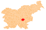
 Bič Location in Slovenia | |
| Coordinates: 45°55′32.57″N 14°53′21.72″E / 45.9257139°N 14.8893667°ECoordinates: 45°55′32.57″N 14°53′21.72″E / 45.9257139°N 14.8893667°E | |
| Country |
|
| Traditional region | Lower Carniola |
| Statistical region | Southeast Slovenia |
| Municipality | Trebnje |
| Area | |
| • Total | 1.79 km2 (0.69 sq mi) |
| Elevation | 306.1 m (1,004.3 ft) |
| Population (2002) | |
| • Total | 56 |
| [1] | |
Bič (pronounced [ˈbitʃ]; German: Fitsch[2]) is a village in the Municipality of Trebnje in eastern Slovenia. It lies just north of the Slovenian A2 motorway east of Ivančna Gorica. The area is part of the historical Lower Carniola region. The Municipality of Trebnje is now included in the Southeast Slovenia Statistical Region.[3]
Name
The settlement was first attested in 1223 as Fütsch. Based on medieval transcriptions of the name, it may have developed from *bъčь 'stone- or wood-lined depression with a spring, well' (cf. Slovene beč 'barrel'), thus referring to a local geographical feature.[4] In the past the German name was Fitsch.[2]
Church
The local church is dedicated to Saint Martin and belongs to the Parish of Veliki Gaber. It has a Romanesque nave with 17th-century additions.[5]
References
- ↑ Statistical Office of the Republic of Slovenia
- 1 2 Leksikon občin kraljestev in dežel zastopanih v državnem zboru, vol. 6: Kranjsko. 1906. Vienna: C. Kr. Dvorna in Državna Tiskarna, p. 104.
- ↑ Trebnje municipal site
- ↑ Snoj, Marko. 2009. Etimološki slovar slovenskih zemljepisnih imen. Ljubljana: Modrijan and Založba ZRC, pp. 54, 59.
- ↑ Slovenian Ministry of Culture register of national heritage reference number ešd 2651