Podlisec
| Podlisec | |
|---|---|
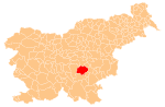
 Podlisec Location in Slovenia | |
| Coordinates: 45°52′41.38″N 14°58′12.37″E / 45.8781611°N 14.9701028°ECoordinates: 45°52′41.38″N 14°58′12.37″E / 45.8781611°N 14.9701028°E | |
| Country |
|
| Traditional region | Lower Carniola |
| Statistical region | Southeast Slovenia |
| Municipality | Trebnje |
| Area | |
| • Total | 2.65 km2 (1.02 sq mi) |
| Elevation | 245.7 m (806.1 ft) |
| Population (2002) | |
| • Total | 24 |
| [1] | |
Podlisec (pronounced [pɔˈdliːsəts]) is a small settlement just west of Dobrnič in the Municipality of Trebnje in eastern Slovenia. It lies on the northeastern slope of Lisec Hill on the regional road to Trebnje. The area is part of the historical region of Lower Carniola. The municipality is now included in the Southeast Slovenia Statistical Region.[2]
The local church built on Lisec Hill south of the settlement, is dedicated to the Holy Cross and belongs to the Parish of Dobrnič. It was first mentioned in written documents dating to 1526, but contains fragments of frescos dated to the early 15th century. The sanctuary and belfry date to the 17th century and in the 19th century a porch was added.[3]
References
- ↑ Statistical Office of the Republic of Slovenia
- ↑ Trebnje municipal site
- ↑ "EŠD 1770". Registry of Immovable Cultural Heritage (in Slovenian). Ministry of Culture of the Republic of Slovenia. Retrieved 15 February 2011.
External links
This article is issued from Wikipedia - version of the 12/22/2014. The text is available under the Creative Commons Attribution/Share Alike but additional terms may apply for the media files.