Edmeston, New York
| Edmeston, New York | |
|---|---|
| Town | |
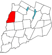 Edmeston, Otsego County | |
| Coordinates: 42°43′N 75°15′W / 42.717°N 75.250°WCoordinates: 42°43′N 75°15′W / 42.717°N 75.250°W | |
| Country | United States |
| State | New York |
| County | Otsego |
| Area | |
| • Total | 44.6 sq mi (115.5 km2) |
| • Land | 44.6 sq mi (115.4 km2) |
| • Water | 0.0 sq mi (0.1 km2) |
| Elevation | 1,430 ft (436 m) |
| Population (2010) | |
| • Total | 1,826 |
| Time zone | Eastern (EST) (UTC-5) |
| • Summer (DST) | EDT (UTC-4) |
| ZIP code | 13335 |
| Area code(s) | 607 |
| FIPS code | 36-23613 |
| GNIS feature ID | 0978926 |
Edmeston is a town located in Otsego County, New York, United States. As of the 2010 census, the town had a total population of 1,826.
The Town of Edmeston is at the western county line. Edmeston is also the name of the largest hamlet in the town. The town is south of Utica.
Geography
According to the United States Census Bureau, the town has a total area of 44.6 square miles (116 km2), of which, 44.5 square miles (115 km2) of it is land and 0.1 square miles (0.26 km2) of it is water. The total area is 0.11% water. The major water features are:
- The Unadilla River, which forms the entire western border of the town,
- Wharton Creek, which meanders to the south and west through the southeastern corner of the town,
- Mill Creek, which flows from north to south from the northern border of Edmeston to the Wharton Creek at the Edmeston hamlet.
- Summit Lake in the northeastern corner of the town.
The elevation of the town varies by about 800 feet (240 m): from just under 1,100 feet (340 m) above sea level at the Unadilla River in the southwest corner of the town, to just over 1,900 feet (580 m) at peaks near Taylor Hill and Summit Lake in the northeast corner.
New York State Route 80 Passes through the southeast part of the town.
History
- For a documented history of the Town of Edmeston, see the Wikisource article: History of Edmeston, New York
The town of Edmeston, in Otsego County, extends to the west as far as the Unadilla River, a line that was established by the 1768 Treaty of Fort Stanwix between the British and the Iroquois, negotiated by Sir William Johnson. The town's name came from the brothers, Robert and William Edmeston, who had been granted 10,000 acres (40 km2) of land in what is now the northwest corner of the town. The hamlets of West Edmeston and South Edmeston are situated in the Unadilla Valley, while the hamlet of Edmeston lies in the Wharton Valley. Earlier settlers came from New England; for most of the settlers, it was planned as a stopover on their way west. A strong Baptist influence came with the settlers. Universalists, Methodists and Roman Catholics soon arrived.
The town was established from the Town of Burlington in 1808.
Dairy farming has historically been the main business of the area. Cheese factories, creameries, livery stables, blacksmith shops, and tanneries were created to support the dairy industry. One room schoolhouses were scattered throughout the town. By damming the creeks, power was created for foundries and mills. Hop growing and maple syrup production were seasonal occupations. Each of the town's communities developed business districts and became self-sufficient. The last spike of the Edmeston branch of the Ontario & Western RR from New Berlin, was driven at Edmeston in January, 1889, but a rumoured extension to Richfield Springs was never built. Then cars, buses and trucks arrived on the scene. Dams were washed out and electricity became available. The hamlets evolved into bedroom communities. The one room schoolhouses closed and the Central School was developed in the hamlet of Edmeston.
Today residents go in all four directions for employment. NYCM Insurance Company not only provides positions for many of the locals but also for hundreds that commute into the community each day. On the Eastern side of the town is the Pathfinder Village (home for Down Syndrome residents) that provides more employment.
The population of the town has not increased much through the years. It still remains largely rural. Organizations like the local Rotary Club, American Legion and Fire and Emergency Squads have active volunteers that provide community needs in lieu of governments in the hamlets. Edmeston Central School is the center of activities.
Demographics
| Historical population | |||
|---|---|---|---|
| Census | Pop. | %± | |
| 1820 | 1,841 | — | |
| 1830 | 2,087 | 13.4% | |
| 1840 | 1,907 | −8.6% | |
| 1850 | 1,885 | −1.2% | |
| 1860 | 1,804 | −4.3% | |
| 1870 | 1,744 | −3.3% | |
| 1880 | 1,794 | 2.9% | |
| 1890 | 1,703 | −5.1% | |
| 1900 | 1,767 | 3.8% | |
| 1910 | 1,567 | −11.3% | |
| 1920 | 1,553 | −0.9% | |
| 1930 | 1,556 | 0.2% | |
| 1940 | 1,580 | 1.5% | |
| 1950 | 1,563 | −1.1% | |
| 1960 | 1,721 | 10.1% | |
| 1970 | 1,709 | −0.7% | |
| 1980 | 1,732 | 1.3% | |
| 1990 | 1,717 | −0.9% | |
| 2000 | 1,824 | 6.2% | |
| 2010 | 1,826 | 0.1% | |
| Est. 2014 | 1,785 | [1] | −2.2% |
As of the census[3] of 2000, the town of Edmeston contained:
- 1824 people,
- 658 households, and
- 480 families.
The population density was 40.9 people per square mile (15.8/km²).
There were 821 housing units at an average density of 18.4 per square mile (7.1/km²).
The racial makeup of the town was:
- 98.14% White,
- 0.44% African American,
- 0.27% Native American,
- 0.05% Asian,
- 0.00% Pacific Islander,
- 0.44% of races other than the above,
- 0.66% of two or more races,
- 0.99% Hispanic or Latino of any race.
There were 658 households out of which:
- 34.2% have children under the age of 18 living with them,
- 62.2% are married couples living together,
- 8.1% have a female householder with no husband present, and
- 26.9% are non-families.
- 22.5% of all households are made up of individuals and
- 12.2% have someone living alone who is 65 years of age or older.
- The average household size is 2.65 and
- the average family size is 3.06.
The population spread of the town of Edmeston was:
- 27.1% under the age of 18,
- 6.3% from 18 to 24,
- 28.6% from 25 to 44,
- 23.5% from 45 to 64, and
- 14.5% who are 65 years of age or older.
Edmeston population distribution (2000 Census)
| Age | Total | % * | Male | % ** | Female | %** |
|---|---|---|---|---|---|---|
| All | 1824 | 100.0 | 912 | 50.0 | 912 | 50.0 |
| 18+ | 1330 | 72.9 | 657 | 36.0 | 673 | 36.9 |
| 21+ | 1282 | 70.3 | - | - | - | - |
| 60+ | 352 | 19.3 | 166 | 47.2 | 186 | 52.8 |
| 62+ | 324 | 17.8 | - | - | - | - |
| 65+ | 265 | 14.5 | 126 | 47.5 | 139 | 52.5 |
| 75+ | 118 | 6.5 | 49 | 41.5 | 69 | 58.5 |
| 85+ | 25 | 1.4 | 9 | 36.0 | 16 | 64.0 |
- (*) percent of total population (all ages)
- (**) percent of population in age bracket
The median age was 37 years.
For every 100 females there were 100.0 males.
For every 100 females age 18 and over, there were 97.6 males.
In the town of Edmeston, median income:
- per household was $36,800,
- per family was $41,510,
- per male was $27,546,
- per female was $21,089.
The per capita income for the town is $17,507.
13.6% of the population and 8.3% of families are below the poverty line.
Out of the total people living in poverty,
- 18.3% of those under the age of 18 and
- 7.5% of those 65 and older are living below the poverty line.
Communities and locations in Edmeston
- Amblers Crossing – A hamlet south of Edmeston village.
- Edmeston – The hamlet of Edmeston is in the south part of the town on NY-80.
- Manchester Crossing – A hamlet east of South Edmeston.
- South Edmeston – A hamlet at the west town line near the Unadilla River at the junction of County Roads 18 and 20.
- Summit Lake – A small lake in the northeast part of the town.
- West Edmeston – A hamlet near the west town line, located next to the Unadilla River.
References
- ↑ "Annual Estimates of the Resident Population for Incorporated Places: April 1, 2010 to July 1, 2014". Retrieved June 4, 2015.
- ↑ "Census of Population and Housing". Census.gov. Retrieved June 4, 2015.
- ↑ "American FactFinder". United States Census Bureau. Retrieved 2008-01-31.
External links
| Wikimedia Commons has media related to Edmeston, New York. |
| Wikisource has original text related to this article: |
Municipalities and communities of Otsego County, New York, United States | ||
|---|---|---|
| City | 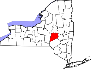 | |
| Towns | ||
| Villages | ||
| CDPs | ||
| Other hamlets | ||
| Footnotes | ‡This populated place also has portions in an adjacent county or counties | |