Ellis Township, Ellis County, Kansas
| Ellis Township | |
|---|---|
| Township | |
 Location in Ellis County | |
| Coordinates: 39°01′30″N 099°29′46″W / 39.02500°N 99.49611°WCoordinates: 39°01′30″N 099°29′46″W / 39.02500°N 99.49611°W | |
| Country | United States |
| State | Kansas |
| County | Ellis |
| Area | |
| • Total | 176.48 sq mi (457.08 km2) |
| • Land | 176.45 sq mi (457 km2) |
| • Water | 0.03 sq mi (0.09 km2) 0.02% |
| Elevation | 2,110 ft (643 m) |
| Population (2000) | |
| • Total | 418 |
| • Density | 2.4/sq mi (0.9/km2) |
| GNIS feature ID | 0485300 |
Ellis Township is a township in Ellis County, Kansas, USA. At the 2010 census, its population was 418.
Geography
Ellis Township covers an area of 176.48 square miles (457.1 km2) and contains one incorporated settlement, Ellis. According to the USGS, it contains two cemeteries: Mount Hope and Saint Marys.
The streams of East Spring Creek, Tomcat Creek and Wild Horse Creek run through this township.
Transportation
Ellis Township contains one airport or landing strip, Ellis Landing Field.
References
External links
Municipalities and communities of Ellis County, Kansas, United States | ||
|---|---|---|
| Cities | 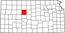 | |
| CDPs | ||
| Unincorporated communities | ||
| Ghost towns | ||
| Townships | ||
This article is issued from Wikipedia - version of the 11/17/2016. The text is available under the Creative Commons Attribution/Share Alike but additional terms may apply for the media files.