Elmwood, Nebraska
| Elmwood, Nebraska | |
|---|---|
| Village | |
|
Downtown Elmwood: 4th Street | |
| Motto: "Growing Together" | |
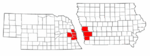
 Location of Elmwood, Nebraska | |
| Coordinates: 40°50′32″N 96°17′40″W / 40.84222°N 96.29444°WCoordinates: 40°50′32″N 96°17′40″W / 40.84222°N 96.29444°W | |
| Country | United States |
| State | Nebraska |
| County | Cass |
| Area[1] | |
| • Total | 0.38 sq mi (0.98 km2) |
| • Land | 0.38 sq mi (0.98 km2) |
| • Water | 0 sq mi (0 km2) |
| Elevation | 1,289 ft (393 m) |
| Population (2010)[2] | |
| • Total | 634 |
| • Estimate (2012[3]) | 628 |
| • Density | 1,668.4/sq mi (644.2/km2) |
| Time zone | Central (CST) (UTC-6) |
| • Summer (DST) | CDT (UTC-5) |
| ZIP code | 68349 |
| Area code(s) | 402 |
| FIPS code | 31-15430[4] |
| GNIS feature ID | 0829094[5] |

Elmwood is a village in Cass County, Nebraska, United States. The population was 634 at the 2010 census.
History
Elmwood was founded in 1868.[6] It was named for the old elm trees at the town site.[7]
Geography
Elmwood is located at 40°50′32″N 96°17′40″W / 40.84222°N 96.29444°W (40.842197, -96.294539).[8]
According to the United States Census Bureau, the village has a total area of 0.38 square miles (0.98 km2), all of it land.[1]
Demographics
| Historical population | |||
|---|---|---|---|
| Census | Pop. | %± | |
| 1880 | 38 | — | |
| 1890 | 303 | 697.4% | |
| 1900 | 544 | 79.5% | |
| 1910 | 635 | 16.7% | |
| 1920 | 558 | −12.1% | |
| 1930 | 515 | −7.7% | |
| 1940 | 456 | −11.5% | |
| 1950 | 445 | −2.4% | |
| 1960 | 481 | 8.1% | |
| 1970 | 548 | 13.9% | |
| 1980 | 598 | 9.1% | |
| 1990 | 584 | −2.3% | |
| 2000 | 668 | 14.4% | |
| 2010 | 634 | −5.1% | |
| Est. 2015 | 639 | [9] | 0.8% |
2010 census
As of the census[2] of 2010, there were 634 people, 243 households, and 168 families residing in the village. The population density was 1,668.4 inhabitants per square mile (644.2/km2). There were 265 housing units at an average density of 697.4 per square mile (269.3/km2). The racial makeup of the village was 97.8% White, 0.2% African American, 0.5% Native American, 0.2% from other races, and 1.4% from two or more races. Hispanic or Latino of any race were 3.6% of the population.
There were 243 households of which 39.1% had children under the age of 18 living with them, 54.3% were married couples living together, 9.5% had a female householder with no husband present, 5.3% had a male householder with no wife present, and 30.9% were non-families. 25.5% of all households were made up of individuals and 13.2% had someone living alone who was 65 years of age or older. The average household size was 2.61 and the average family size was 3.17.
The median age in the village was 36.7 years. 30.9% of residents were under the age of 18; 5.4% were between the ages of 18 and 24; 25% were from 25 to 44; 24% were from 45 to 64; and 14.7% were 65 years of age or older. The gender makeup of the village was 49.4% male and 50.6% female.
2000 census
As of the census[4] of 2000, there were 668 people, 254 households, and 182 families residing in the village. The population density was 1,763.7 people per square mile (678.7/km²). There were 269 housing units at an average density of 710.2 per square mile (273.3/km²). The racial makeup of the village was 99.10% White, 0.15% African American, 0.30% Asian, and 0.45% from two or more races. Hispanic or Latino of any race were 0.30% of the population.
There were 254 households out of which 33.9% had children under the age of 18 living with them, 62.2% were married couples living together, 7.1% had a female householder with no husband present, and 28.3% were non-families. 25.6% of all households were made up of individuals and 16.9% had someone living alone who was 65 years of age or older. The average household size was 2.63 and the average family size was 3.20.
In the village the population was spread out with 29.9% under the age of 18, 6.9% from 18 to 24, 27.1% from 25 to 44, 18.9% from 45 to 64, and 17.2% who were 65 years of age or older. The median age was 36 years. For every 100 females there were 94.8 males. For every 100 females age 18 and over, there were 88.0 males.
As of 2000 the median income for a household in the village was $37,132, and the median income for a family was $46,875. Males had a median income of $35,250 versus $28,750 for females. The per capita income for the village was $17,662. About 3.9% of families and 6.3% of the population were below the poverty line, including 9.0% of those under age 18 and 7.3% of those age 65 or over.
Notable persons
For many years Bess Streeter Aldrich, American author and member of the Nebraska Hall of Fame, lived in Elmwood. The Bess Streeter Aldrich House at 204 East F Street in Elmwood is preserved as a museum.
References
- 1 2 "US Gazetteer files 2010". United States Census Bureau. Retrieved 2012-06-24.
- 1 2 "American FactFinder". United States Census Bureau. Retrieved 2012-06-24.
- ↑ "Population Estimates". United States Census Bureau. Retrieved 2013-05-29.
- 1 2 "American FactFinder". United States Census Bureau. Retrieved 2008-01-31.
- ↑ "US Board on Geographic Names". United States Geological Survey. 2007-10-25. Retrieved 2008-01-31.
- ↑ "Elmwood, Cass County". Center for Advanced Land Management Information Technologies. University of Nebraska. Retrieved 1 August 2014.
- ↑ Fitzpatrick, Lillian L. (1960). Nebraska Place-Names. University of Nebraska Press. p. 31.
- ↑ "US Gazetteer files: 2010, 2000, and 1990". United States Census Bureau. 2011-02-12. Retrieved 2011-04-23.
- ↑ "Annual Estimates of the Resident Population for Incorporated Places: April 1, 2010 to July 1, 2015". Retrieved July 2, 2016.
- ↑ "Census of Population and Housing". Census.gov. Retrieved June 4, 2015.
External links
Municipalities and communities of Cass County, Nebraska, United States | ||
|---|---|---|
| Cities | ||
| Villages | ||
| Unincorporated communities | ||
| Ghost towns | ||
Metropolitan area of Omaha–Council Bluffs | ||||||||
|---|---|---|---|---|---|---|---|---|
| Primary Cities |
|  | ||||||
| Cities over 10,000 (per 2010 Census) |
| |||||||
| Cities of 5,000 to 10,000 (per 2010 Census) |
| |||||||
| Cities of 1,000 to 5,000 (per 2010 Census) |
| |||||||
| Census-designated places |
| |||||||
| Cities and villages of fewer than 1,000 (per 2010 Census) |
| |||||||
| Counties |
| |||||||