Emerson, Iowa
| Emerson, Iowa | |
|---|---|
| City | |
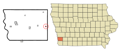 Location of Emerson, Iowa | |
| Coordinates: 41°1′7″N 95°24′7″W / 41.01861°N 95.40194°WCoordinates: 41°1′7″N 95°24′7″W / 41.01861°N 95.40194°W | |
| Country |
|
| State |
|
| County | Mills |
| Area[1] | |
| • Total | 0.26 sq mi (0.67 km2) |
| • Land | 0.26 sq mi (0.67 km2) |
| • Water | 0 sq mi (0 km2) |
| Elevation | 1,056 ft (322 m) |
| Population (2010)[2] | |
| • Total | 438 |
| • Estimate (2012[3]) | 430 |
| • Density | 1,684.6/sq mi (650.4/km2) |
| Time zone | Central (CST) (UTC-6) |
| • Summer (DST) | CDT (UTC-5) |
| ZIP code | 51533 |
| Area code(s) | 712 |
| FIPS code | 19-25500 |
| GNIS feature ID | 0456360 |
Emerson is a city in Mills County, Iowa, United States. The population was 438 at the 2010 census.
History
Emerson was a shipping point on the Chicago, Burlington and Quincy Railroad.[4]
Geography
Emerson is located at 41°1′7″N 95°24′7″W / 41.01861°N 95.40194°W (41.018506, -95.401975).[5]
According to the United States Census Bureau, the city has a total area of 0.26 square miles (0.67 km2), all of it land.[1]
Demographics
| Historical populations | ||
|---|---|---|
| Year | Pop. | ±% |
| 1880 | 456 | — |
| 1890 | 404 | −11.4% |
| 1900 | 502 | +24.3% |
| 1910 | 478 | −4.8% |
| 1920 | 475 | −0.6% |
| 1930 | 512 | +7.8% |
| 1940 | 498 | −2.7% |
| 1950 | 556 | +11.6% |
| 1960 | 521 | −6.3% |
| 1970 | 484 | −7.1% |
| 1980 | 502 | +3.7% |
| 1990 | 476 | −5.2% |
| 2000 | 480 | +0.8% |
| 2010 | 438 | −8.8% |
| 2014 | 426 | −2.7% |
| 2015 | 425 | −0.2% |
| Source:"American FactFinder". United States Census Bureau. and Iowa Data Center Source: | ||
2010 census
As of the census[2] of 2010, there were 438 people, 186 households, and 123 families residing in the city. The population density was 1,684.6 inhabitants per square mile (650.4/km2). There were 203 housing units at an average density of 780.8 per square mile (301.5/km2). The racial makeup of the city was 1.1% White and 98.9% from two or more races. Hispanic or Latino of any race were 0.5% of the population.
There were 186 households of which 26.9% had children under the age of 18 living with them, 55.4% were married couples living together, 8.1% had a female householder with no husband present, 2.7% had a male householder with no wife present, and 33.9% were non-families. 30.1% of all households were made up of individuals and 18.8% had someone living alone who was 65 years of age or older. The average household size was 2.35 and the average family size was 2.87.
The median age in the city was 45.8 years. 21.9% of residents were under the age of 18; 5.6% were between the ages of 18 and 24; 21.8% were from 25 to 44; 31.5% were from 45 to 64; and 19.2% were 65 years of age or older. The gender makeup of the city was 48.6% male and 51.4% female.
2000 census
As of the census[7] of 2000, there were 480 people, 195 households, and 133 families residing in the city. The population density was 1,914.2 people per square mile (741.3/km²). There were 208 housing units at an average density of 829.5 per square mile (321.2/km²). The racial makeup of the city was 98.96% White, 0.21% African American, 0.21% from other races, and 0.62% from two or more races. Hispanic or Latino of any race were 0.62% of the population.
There were 195 households out of which 31.3% had children under the age of 18 living with them, 59.5% were married couples living together, 7.7% had a female householder with no husband present, and 31.3% were non-families. 29.2% of all households were made up of individuals and 16.9% had someone living alone who was 65 years of age or older. The average household size was 2.46 and the average family size was 3.03.
In the city the population was spread out with 26.0% under the age of 18, 4.6% from 18 to 24, 27.7% from 25 to 44, 25.8% from 45 to 64, and 15.8% who were 65 years of age or older. The median age was 38 years. For every 100 females there were 88.2 males. For every 100 females age 18 and over, there were 86.8 males.
The median income for a household in the city was $31,583, and the median income for a family was $36,406. Males had a median income of $29,167 versus $21,250 for females. The per capita income for the city was $15,807. About 7.3% of families and 11.2% of the population were below the poverty line, including 21.2% of those under age 18 and none of those age 65 or over.
References
- 1 2 "US Gazetteer files 2010". United States Census Bureau. Retrieved 2012-05-11.
- 1 2 "American FactFinder". United States Census Bureau. Retrieved 2012-05-11.
- ↑ "Population Estimates". United States Census Bureau. Retrieved 2013-05-23.
- ↑ History of Mills County, Iowa: Containing a History of the County, Its Cities, Towns, Etc. State Historical Company. 1881. p. 585.
- ↑ "US Gazetteer files: 2010, 2000, and 1990". United States Census Bureau. 2011-02-12. Retrieved 2011-04-23.
- ↑ "Census of Population and Housing". Census.gov. Retrieved June 4, 2015.
- ↑ "American FactFinder". United States Census Bureau. Retrieved 2008-01-31.
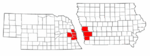
Metropolitan area of Omaha–Council Bluffs | ||||||||
|---|---|---|---|---|---|---|---|---|
| Primary Cities |
|  | ||||||
| Cities over 10,000 (per 2010 Census) |
| |||||||
| Cities of 5,000 to 10,000 (per 2010 Census) |
| |||||||
| Cities of 1,000 to 5,000 (per 2010 Census) |
| |||||||
| Census-designated places |
| |||||||
| Cities and villages of fewer than 1,000 (per 2010 Census) |
| |||||||
| Counties |
| |||||||
Municipalities and communities of Mills County, Iowa, United States | ||
|---|---|---|
| Cities | ||
| CDP | ||
| Footnotes | ‡This populated place also has portions in an adjacent county or counties | |