Fayette County, Iowa
| Fayette County, Iowa | |
|---|---|
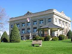 Fayette County Courthouse | |
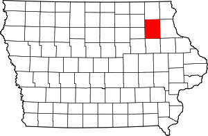 Location in the U.S. state of Iowa | |
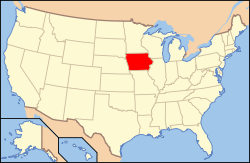 Iowa's location in the U.S. | |
| Founded | 1837 |
| Named for | Marquis de Lafayette |
| Seat | West Union |
| Largest city | Oelwein |
| Area | |
| • Total | 731 sq mi (1,893 km2) |
| • Land | 731 sq mi (1,893 km2) |
| • Water | 0.5 sq mi (1 km2), 0.07% |
| Population | |
| • (2010) | 20,880 |
| • Density | 29/sq mi (11/km²) |
| Congressional district | 1st |
| Time zone | Central: UTC-6/-5 |
| Website |
fayettecountyiowa |
Fayette County is a county located in the U.S. state of Iowa. As of the 2010 census, the population was 20,880.[1] The county seat is West Union.[2]
History
Fayette County was founded on December 21, 1837 as a part of Wisconsin Territory. It was named after Gilbert du Motier, marquis de La Fayette,[3] a French general and politician, who came to America in 1777 in order to fight in the Revolutionary War, and who was named Major General of the Continental Army. The county was formed as part of a large reorganization of Dubuque County, which at that time comprised most of the northern half of Iowa, Minnesota, and parts of the Dakotas. Fayette County was granted the Minnesota and Dakotas territory on that date. It became part of Iowa Territory when it was formed on July 4, 1838.[4] Fayette County's size was drastically reduced into land that was part of the modern state of Iowa in 1843, then further split in 1847 after Iowa had achieved statehood. The county was organized in 1850.[5]
Geography
According to the U.S. Census Bureau, the county has a total area of 731 square miles (1,890 km2), of which 731 square miles (1,890 km2) is land and 0.5 square miles (1.3 km2) (0.07%) is water.[6]
Major highways
 U.S. Highway 18
 Iowa Highway 3
 Iowa Highway 56
 Iowa Highway 93
 Iowa Highway 150
 Iowa Highway 187
 Iowa Highway 281
Adjacent counties
- Allamakee County (northeast)
- Black Hawk County (southwest)
- Buchanan County (south)
- Bremer County (west)
- Chickasaw County (northwest)
- Clayton County (east)
- Delaware County (southeast)
- Winneshiek County (north)
Demographics
| Historical population | |||
|---|---|---|---|
| Census | Pop. | %± | |
| 1850 | 825 | — | |
| 1860 | 12,073 | 1,363.4% | |
| 1870 | 16,973 | 40.6% | |
| 1880 | 22,258 | 31.1% | |
| 1890 | 23,141 | 4.0% | |
| 1900 | 29,845 | 29.0% | |
| 1910 | 27,919 | −6.5% | |
| 1920 | 29,251 | 4.8% | |
| 1930 | 29,145 | −0.4% | |
| 1940 | 29,151 | 0.0% | |
| 1950 | 28,294 | −2.9% | |
| 1960 | 28,581 | 1.0% | |
| 1970 | 26,898 | −5.9% | |
| 1980 | 25,488 | −5.2% | |
| 1990 | 21,843 | −14.3% | |
| 2000 | 22,008 | 0.8% | |
| 2010 | 20,880 | −5.1% | |
| Est. 2015 | 20,257 | [7] | −3.0% |
| U.S. Decennial Census[8] 1790-1960[9] 1900-1990[10] 1990-2000[11] 2010-2013[1] | |||
2010 census
The 2010 census recorded a population of 20,880 in the county, with a population density of 28.568/sq mi (11.030/km2). There were 9,558 housing units, of which 8,634 were occupied.[12]
2000 census

As of the census[13] of 2000, there were 22,008 people, 8,778 households, and 5,951 families residing in the county. The population density was 30 people per square mile (12/km²). There were 9,505 housing units at an average density of 13 per square mile (5/km²). The racial makeup of the county was 97.71% White, 0.53% Black or African American, 0.13% Native American, 0.40% Asian, 0.03% Pacific Islander, 0.43% from other races, and 0.77% from two or more races. 1.50% of the population were Hispanic or Latino of any race.
There were 8,778 households out of which 30.40% had children under the age of 18 living with them, 56.80% were married couples living together, 7.40% had a female householder with no husband present, and 32.20% were non-families. 28.20% of all households were made up of individuals and 15.00% had someone living alone who was 65 years of age or older. The average household size was 2.41 and the average family size was 2.96.
In the county the population was spread out with 25.00% under the age of 18, 8.60% from 18 to 24, 24.90% from 25 to 44, 22.40% from 45 to 64, and 19.00% who were 65 years of age or older. The median age was 39 years. For every 100 females there were 97.50 males. For every 100 females age 18 and over, there were 95.10 males.
The median income for a household in the county was $32,453, and the median income for a family was $39,960. Males had a median income of $27,493 versus $20,099 for females. The per capita income for the county was $17,271. About 8.20% of families and 10.80% of the population were below the poverty line, including 12.30% of those under age 18 and 12.00% of those age 65 or over.
Communities
Cities
Unincorporated communities
Townships
Fayette County is divided into twenty townships:
Population ranking
The population ranking of the following table is based on the 2010 census of Fayette County.[14]
† county seat
| Rank | City/Town/etc. | Municipal type | Population (2010 Census)
|
|---|---|---|---|
| 1 | Oelwein | City | 6,415 |
| 2 | † West Union | City | 2,486 |
| 3 | Sumner (mostly in Bremer County) | City | 2,028 |
| 4 | Fayette | City | 1,338 |
| 5 | Fairbank (partially in Buchanan County) | City | 1,113 |
| 6 | Elgin | City | 683 |
| 7 | Clermont | City | 632 |
| 8 | Maynard | City | 518 |
| 9 | Hawkeye | City | 449 |
| 10 | Arlington | City | 429 |
| 11 | Wadena | City | 262 |
| 12 | Waucoma | City | 257 |
| 13 | Westgate | City | 211 |
| 14 | St. Lucas | City | 143 |
| 15 | Stanley (mostly in Buchanan County) | City | 125 |
| 16 | Randalia | City | 68 |
See also
References
- 1 2 "State & County QuickFacts". United States Census Bureau. Retrieved July 17, 2014.
- ↑ "Find a County". National Association of Counties. Archived from the original on May 10, 2015. Retrieved 2011-06-07.
- ↑ Gannett, Henry (1905). The Origin of Certain Place Names in the United States. Govt. Print. Off. p. 124.
- ↑ "WI: Individual County Chronologies". publications.newberry.org. Retrieved 2016-09-28.
- ↑ "State and County Maps of Iowa". 2015-03-19. Retrieved 2016-09-28.
- ↑ "US Gazetteer files: 2010, 2000, and 1990". United States Census Bureau. 2011-02-12. Retrieved 2011-04-23.
- ↑ "County Totals Dataset: Population, Population Change and Estimated Components of Population Change: April 1, 2010 to July 1, 2015". Retrieved July 2, 2016.
- ↑ "U.S. Decennial Census". United States Census Bureau. Archived from the original on May 11, 2015. Retrieved July 17, 2014.
- ↑ "Historical Census Browser". University of Virginia Library. Retrieved July 17, 2014.
- ↑ "Population of Counties by Decennial Census: 1900 to 1990". United States Census Bureau. Retrieved July 17, 2014.
- ↑ "Census 2000 PHC-T-4. Ranking Tables for Counties: 1990 and 2000" (PDF). United States Census Bureau. Retrieved July 17, 2014.
- ↑ "Population & Housing Occupancy Status 2010". United States Census Bureau American FactFinder. Retrieved May 10, 2011.
- ↑ "American FactFinder". United States Census Bureau. Retrieved 2008-01-31.
- ↑ http://www.census.gov/2010census/
External links
| Wikimedia Commons has media related to Fayette County, Iowa. |
 |
Chickasaw County | Winneshiek County | Allamakee County | |
| Bremer County | |
Clayton County | ||
| ||||
| | ||||
| Black Hawk County | Buchanan County | Delaware County |
Municipalities and communities of Fayette County, Iowa, United States | ||
|---|---|---|
| Cities | ||
| Townships | ||
| Unincorporated communities | ||
| Footnotes | ‡This populated place also has portions in an adjacent county or counties | |
Coordinates: 42°51′54″N 91°50′58″W / 42.86500°N 91.84944°W