Feyt
| Feyt | ||
|---|---|---|
|
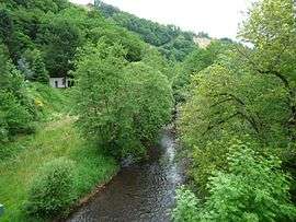
The Chavanon river, in Feyt | ||
| ||
 Feyt | ||
|
Location within Nouvelle-Aquitaine region  Feyt | ||
| Coordinates: 45°41′25″N 2°28′32″E / 45.6903°N 2.4756°ECoordinates: 45°41′25″N 2°28′32″E / 45.6903°N 2.4756°E | ||
| Country | France | |
| Region | Nouvelle-Aquitaine | |
| Department | Corrèze | |
| Arrondissement | Ussel | |
| Canton | Eygurande | |
| Intercommunality | Pays d'Eygurande | |
| Government | ||
| • Mayor (2008–2014) | Bernard Rouge | |
| Area1 | 19.56 km2 (7.55 sq mi) | |
| Population (2008)2 | 99 | |
| • Density | 5.1/km2 (13/sq mi) | |
| Time zone | CET (UTC+1) | |
| • Summer (DST) | CEST (UTC+2) | |
| INSEE/Postal code | 19083 / 19340 | |
| Elevation |
637–804 m (2,090–2,638 ft) (avg. 750 m or 2,460 ft) | |
|
1 French Land Register data, which excludes lakes, ponds, glaciers > 1 km² (0.386 sq mi or 247 acres) and river estuaries. 2 Population without double counting: residents of multiple communes (e.g., students and military personnel) only counted once. | ||
.svg.png)
Feyt is a commune in the Corrèze department of central France.
Geography
The Chavanon forms the commune's southeastern boundary.
Population
| Historical population | ||
|---|---|---|
| Year | Pop. | ±% |
| 1962 | 164 | — |
| 1968 | 178 | +8.5% |
| 1975 | 145 | −18.5% |
| 1982 | 116 | −20.0% |
| 1990 | 119 | +2.6% |
| 1999 | 121 | +1.7% |
| 2008 | 99 | −18.2% |
See also
References
| Wikimedia Commons has media related to Feyt. |
This article is issued from Wikipedia - version of the 2/25/2015. The text is available under the Creative Commons Attribution/Share Alike but additional terms may apply for the media files.