Freeport, Texas
| Freeport, Texas | |
|---|---|
| City | |
| Motto: "Where Fun Happens"[1] | |
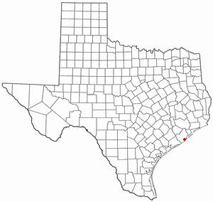 Location in the state of Texas | |
 | |
| Coordinates: 28°57′34″N 95°21′25″W / 28.95944°N 95.35694°WCoordinates: 28°57′34″N 95°21′25″W / 28.95944°N 95.35694°W | |
| Country | United States |
| State | Texas |
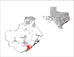
| County | Brazoria |
| Incorporated | February 10, 1917 |
| Government | |
| • Type | Council-Manager |
| • City Council |
Mayor Norma Moreno Garcia Michelle M. Kent Fred Bolton Sandra Loeza Sandra Barbree |
| • City Manager | Jeff Pynes |
| Area | |
| • Total | 17.1 sq mi (44.2 km2) |
| • Land | 14.9 sq mi (38.7 km2) |
| • Water | 2.1 sq mi (5.5 km2) |
| Elevation | 5 ft (2 m) |
| Population (2010) | |
| • Total | 12,049 |
| • Density | 806/sq mi (311.1/km2) |
| Time zone | CST (UTC-6) |
| • Summer (DST) | CDT (UTC-5) |
| ZIP codes | 77541-77542 |
| Area code(s) | 979 |
| FIPS code | 48-27420[2] |
| GNIS feature ID | 1357720[3] |
| Website |
www |
Freeport is a city in Brazoria County, Texas, United States, located on the Gulf of Mexico. As of the 2010 census, the city population was 12,049,[4] down from 12,708 in 2000.
History
Freeport was founded as a European-American settlement in November 1912 by the Freeport Sulphur Company. The population was 300. However, by 1929, that population had grown to 3,500, and to 4,100 by 1939, influencing a steady increase of economic expansion in Freeport.[5]
By 1937, a Freeport School District had been established, consisting of several segregated schools and 27 teachers. There were two white schools, one black school, and a white high school.[5]
Freeport's most substantial economic growth began with the construction of Dow Chemical Company facilities in the city during 1939. This company is the community's largest employer.[5] Freeport has the company's largest single manufacturing site in the 21st century.[6] In 1942 the company acquired 5,000 acres outside of town at the Abner Jackson Plantation, and developed it as a company community, now known as Lake Jackson, Texas. It was planned and designed by Michigan architect Alden B. Dow, son of the founder of Dow Chemical.
In July 1957, Freeport merged with Velasco, Texas. This had been a temporary capital of the Republic of Texas during the 19th century. Soon thereafter, Freeport's population numbered 11,619.[5] In 2003, the city annexed nearby Bryan Beach.
Economy
The Port of Freeport is a seaport on the Gulf of Mexico. The associated chemical plants provide a stable economy. Freeport is the site of the Dow Chemical Company's Texas Operations facility, which is the company's largest integrated site.[6]
Freeport Main Street Program
A visit from former First Lady of Texas and First Lady of the United States Laura Bush in 2000 catalyzed an initiative in Freeport under the Main Street Program, to organize local business owners in a collaborative way to manage their main streets. This is a subprogram of the National Trust for Historic Preservation, which provides advisory services through its affiliate of the Texas Historical Commission. The Main Street Program is supervised by an advisory board.[7] Freeport Main Street merged with the Freeport Historical Commission in 2007. Freeport was recognized as a National Main Street City in 2006, 2007 and 2008 for the progress in street design, downtown marketing, and support of pedestrian and retail businesses.
Geography
Freeport is located in southern Brazoria County at 28°57′34″N 95°21′25″W / 28.95944°N 95.35694°W (28.959527, -95.356941),[8] near the mouth of the Brazos River in the Gulf of Mexico. In 2003, the city annexed 3.5 miles (5.6 km) of beach bounded on the northeast by the village of Quintana and continuing southwest to the mouth of the Brazos River. This beach is known as Bryan Beach. It is just a few miles away from Surfside and Quintana beaches.
Texas State Highway 288, the Nolan Ryan Expressway, leads north from Freeport 17 miles (27 km) to Angleton, the county seat, and 61 miles (98 km) to downtown Houston. Texas State Highway 36 leads northwest 15 miles (24 km) to Brazoria.
According to the United States Census Bureau, Freeport has a total area of 17.1 square miles (44.2 km2), of which 14.9 square miles (38.7 km2) is land and 2.1 square miles (5.5 km2), or 12.36%, is water.[4]
Demographics
| Historical population | |||
|---|---|---|---|
| Census | Pop. | %± | |
| 1920 | 1,798 | — | |
| 1930 | 3,162 | 75.9% | |
| 1940 | 2,579 | −18.4% | |
| 1950 | 6,012 | 133.1% | |
| 1960 | 11,619 | 93.3% | |
| 1970 | 11,997 | 3.3% | |
| 1980 | 13,444 | 12.1% | |
| 1990 | 11,389 | −15.3% | |
| 2000 | 12,708 | 11.6% | |
| 2010 | 12,049 | −5.2% | |
| Est. 2015 | 12,154 | [9] | 0.9% |
As of the census[2] of 2000, there were 12,708 people, 4,163 households, and 3,097 families residing in the city. The population density was 1,069.6 people per square mile (413.0/km²). There were 4,841 housing units at an average density of 407.5 per square mile (157.3/km²). The racial makeup of the city was 33.2% White, 13.9% African American, 0.56% Native American, 0.35% Asian, 0.01% Pacific Islander, 20.91% from other races, and 3.24% from two or more races. Hispanic or Latino of any race were 52.0% of the population.
There were 4,163 households out of which 45.9% had children under the age of 18 living with them, 51.6% were married couples living together, 16.8% had a female householder with no husband present, and 25.6% were non-families. 21.6% of all households were made up of individuals and 7.9% had someone living alone who was 65 years of age or older. The average household size was 3.05 and the average family size was 3.59.
In the city the population was spread out with 35.7% under the age of 18, 10.9% from 18 to 24, 28.4% from 25 to 44, 16.9% from 45 to 64, and 8.1% who were 65 years of age or older. The median age was 27 years. For every 100 females there were 100.0 males. For every 100 females age 18 and over, there were 121.2 males.
The median income for a household in the city was $30,245, and the median income for a family was $32,421. Males had a median income of $30,714 versus $17,028 for females. The per capita income for the city was $12,426. About 22.3% of families and 22.9% of the population were below the poverty line, including 28.1% of those under age 18 and 7.2% of those age 65 or over.
Government
Freeport is in the 14th congressional district,[11] and is represented by Congressman Randy Weber.
Education
Public education
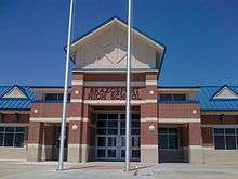
Schools in Freeport include Brazosport High School (Grades 9-12), Freeport Intermediate School (Grades 7-8), Lanier Middle School (Grades 5-6), O.A. Fleming Elementary School, Jane Long Elementary School, and Velasco Elementary School (Grades Pre-K-4). They are all maintained through Brazosport Independent School District.[12] Many athletics events for the district take place in Freeport at Hopper Field.
Since the late 1990s, several schools have been rebuilt or are currently being rebuilt due to old age. Such schools include Freeport Intermediate School, O.A. Fleming Elementary School, Velasco Elementary School, and Brazosport High School.
Libraries
The Freeport Library is a part of the Brazoria County Library System.[13]
Climate
The climate in this area is characterized by hot, humid summers and generally mild to cool winters. According to the Köppen Climate Classification system, Freeport has a humid subtropical climate, abbreviated "Cfa" on climate maps.[14]
References
- ↑ "The City of Freeport Texas". The City of Freeport Texas. Retrieved October 19, 2012.
- 1 2 "American FactFinder". United States Census Bureau. Retrieved 2008-01-31.
- ↑ "US Board on Geographic Names". United States Geological Survey. 2007-10-25. Retrieved 2008-01-31.
- 1 2 "Geographic Identifiers: 2010 Demographic Profile Data (G001): Freeport city, Texas". U.S. Census Bureau, American Factfinder. Retrieved April 16, 2014.
- 1 2 3 4 Freeport, TX, Handbook of Texas, Retrieved 12 August 2007.
- 1 2 "Texas Operation – Freeport, Texas" (PDF). Dow Chemical Company. Retrieved 2011-01-09.
- ↑ Freeport Main Street Program: About Us. Retrieved 05 October 2007.
- ↑ "US Gazetteer files: 2010, 2000, and 1990". United States Census Bureau. 2011-02-12. Retrieved 2011-04-23.
- ↑ "Annual Estimates of the Resident Population for Incorporated Places: April 1, 2010 to July 1, 2015". Retrieved July 2, 2016.
- ↑ "Census of Population and Housing". Census.gov. Retrieved June 4, 2015.
- ↑ http://nationalatlas.gov/printable/images/preview/congdist/tx14_109.gif
- ↑ "Brazosport Independent School District". Brazosport Independent School District. Retrieved October 19, 2012.
- ↑ "Brazoria County Library System.". Brazoria County Library System. Retrieved October 19, 2012.
- ↑ Climate Summary for Freeport, Texas
External links
| Wikimedia Commons has media related to Freeport, Texas. |
- City of Freeport official website
- Brazosport ISD
- Historic materials about Freeport, hosted by the Portal to Texas History
- Handbook of Texas: Freeport
- The Portal of Texas History
- Brazosport College
- City-Data.com
- Podunk: Profile for Freeport, Texas
- Final Report Freeport Harbor, Texas Channel Improvement Project Communication from the Assistant Secretary, Army, Civil Works, the Department of Defense Transmitting the Freeport Harbor Channel Improvement Project, Brazoria County, Texas Feasibility Report and Environmental Impact Statement, Part 1 Part 2
| Counties | 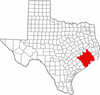 | |
|---|---|---|
| "Principal" cities | ||
| Other cities |
For a complete listing, see list of cities and towns in Houston–The Woodlands–Sugar Land MSA | |
| Unincorporated areas | ||
| Bodies of water | ||
Municipalities and communities of Brazoria County, Texas, United States | ||
|---|---|---|
| Cities | 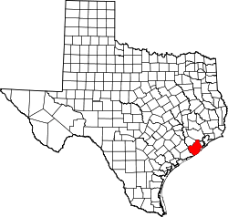 | |
| Towns | ||
| Villages | ||
| CDPs | ||
| Other unincorporated communities | ||
| Footnotes | ‡This populated place also has portions in an adjacent county or counties | |
