Liberty County, Texas
| Liberty County, Texas | |
|---|---|
|
The Liberty County Courthouse in Liberty | |
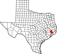 Location in the U.S. state of Texas | |
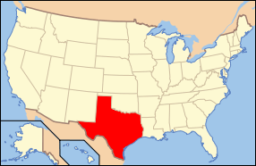 Texas's location in the U.S. | |
| Founded | 1837 |
| Seat | Liberty |
| Largest city | Liberty |
| Area | |
| • Total | 1,176 sq mi (3,046 km2) |
| • Land | 1,158 sq mi (2,999 km2) |
| • Water | 18 sq mi (47 km2), 1.5% |
| Population | |
| • (2010) | 75,643 |
| • Density | 65/sq mi (25/km²) |
| Congressional district | 36th |
| Time zone | Central: UTC-6/-5 |
| Website |
www |

Liberty County is a county in the U.S. state of Texas. As of the 2010 census, the population was 75,643.[1] The county seat is Liberty.[2] The county was created in 1831 as a municipality in Mexico and organized as a county in 1837.[3][4] It is named for the popular American ideal of liberty.[5]
Liberty County is included in the Houston-The Woodlands-Sugar Land, TX Metropolitan Statistical Area.
Geography
According to the U.S. Census Bureau, the county has a total area of 1,176 square miles (3,050 km2), of which 1,158 square miles (3,000 km2) is land and 18 square miles (47 km2) (1.5%) is water.[6]
The Trinity River flows through this county, dividing the county approximately in half. The river begins on the northern border of Liberty County, forming the San Jacinto - Polk County line through the Liberty County line. The east fork of the San Jacinto River flows through far Northeast parts of the county, Flowing through Cleveland. Tarkington Bayou begins in the Sam Houston National Forest in San Jacinto County, working its way south through Northeast and east Liberty County and joining other feeders, before traveling into Harris County and emptying into Galveston Bay. The highest point in Liberty County is "Davis Hill", the roof of a salt dome in the northern part of the county.
Adjacent counties
- Polk County (north)
- Hardin County (east)
- Jefferson County (southeast)
- Chambers County (south)
- Harris County (southwest)
- Montgomery County (west)
- San Jacinto County (northwest)
National protected areas
Demographics
| Historical population | |||
|---|---|---|---|
| Census | Pop. | %± | |
| 1850 | 2,522 | — | |
| 1860 | 3,189 | 26.4% | |
| 1870 | 4,414 | 38.4% | |
| 1880 | 4,999 | 13.3% | |
| 1890 | 4,230 | −15.4% | |
| 1900 | 8,102 | 91.5% | |
| 1910 | 10,686 | 31.9% | |
| 1920 | 14,637 | 37.0% | |
| 1930 | 19,868 | 35.7% | |
| 1940 | 24,541 | 23.5% | |
| 1950 | 26,729 | 8.9% | |
| 1960 | 31,595 | 18.2% | |
| 1970 | 33,014 | 4.5% | |
| 1980 | 47,088 | 42.6% | |
| 1990 | 52,726 | 12.0% | |
| 2000 | 70,154 | 33.1% | |
| 2010 | 75,643 | 7.8% | |
| Est. 2015 | 79,654 | [7] | 5.3% |
| U.S. Decennial Census[8] 1850–2010[9] 2010–2014[1] | |||
As of the census[10] of 2000, there were 70,154 people, 23,242 households, and 17,756 families residing in the county. The population density was 60 people per square mile (23/km²). There were 26,359 housing units at an average density of 23 per square mile (9/km²). The racial makeup of the county was 78.90% White, 12.82% Black or African American, 0.47% Native American, 0.32% Asian, 0.03% Pacific Islander, 6.03% from other races, and 1.43% from two or more races. 10.92% of the population were Hispanic or Latino of any race.
There were 23,242 households out of which 38.10% had children under the age of 18 living with them, 60.50% were married couples living together, 11.40% had a female householder with no husband present, and 23.60% were non-families. 20.40% of all households were made up of individuals and 8.90% had someone living alone who was 65 years of age or older. The average household size was 2.80 and the average family size was 3.23.
In the county, the population was spread out with 27.60% under the age of 18, 9.20% from 18 to 24, 31.60% from 25 to 44, 21.40% from 45 to 64, and 10.30% who were 65 years of age or older. The median age was 34 years. For every 100 females there were 95.70 males. For every 100 females age 18 and over, there were 92.40 males.
The median income for a household in the county was $38,361, and the median income for a family was $43,744. Males had a median income of $37,957 versus $22,703 for females. The per capita income for the county was $15,539. About 11.10% of families and 14.30% of the population were below the poverty line, including 18.30% of those under age 18 and 15.00% of those age 65 or over.
Of Liberty County's residents, 8.8% have a college degree, the lowest percentage of any U.S. county with a population exceeding 50,000.[11]
Government and politics
United States Congress
| Senators | Name | Party | First Elected | Level | |
|---|---|---|---|---|---|
| Senate Class 1 | John Cornyn (opposed by Dwayne Stovall of Cleveland in primary on March 4, 2014) | Republican | 2002 | Senior Senator | |
| Senate Class 2 | Ted Cruz | Republican | 2012 | Junior Senator | |
| Representatives | Name | Party | First Elected | Area(s) of Liberty County Represented | |
| District 36 | Steve Stockman (running against Cornyn and Stovall in 2014 Senate primary) | Republican | 2012 | Countywide | |
Texas Legislature
Texas Senate
- District 3: Robert Nichols (R)- first elected in 2006
Texas House of Representatives
- District 18: John Otto (R)- first elected in 2004; defeated Dwayne Stovall in 2012 Republican primary election
Liberty County elected officials
| Position | Official | Party |
|---|---|---|
| County Judge | Jay Knight | Republican |
| County Commissioner Precinct 1 | Mike McCarty | Republican |
| County Commissioner Precinct 2 | Greg Aurther | Republican |
| County Commissioner Precinct 3 | Eddie Lowery | Republican |
| County Commissioner Precinct 4 | Leon Wilson | Republican |
| County Attorney | Wesley Hinch | Republican |
| County Clerk | Paulette Williams | Republican |
| District Attorney | Logan Pickett | Republican |
| District Clerk | Donna Brown | Republican |
| Sheriff | Bobby Rader | Republican |
| Assessor-Collector | Ricky Brown | Republican |
| County Treasurer | Kim Harris | Republican |
| Constable Precinct 1 | Tim Allison | Democrat |
| Constable Precinct 2 | Leslie Hulsey | Democrat |
| Constable Precinct 3 | Danny Frankum | Democrat |
| Constable Precinct 4 | Robbie Thornton | Republican |
| Constable Precinct 5 | L.W. DeSpain | Democrat |
| Constable Precinct 6 | John Joslin | Republican |
| Justice Of The Peace Precinct 1 | Stephen Hebert | Republican |
| Justice Of The Peace Precinct 2 | Ronnie E. Davis | Democrat |
| Justice Of The Peace Precinct 3 | Cody Parrish | Democrat |
| Justice Of The Peace Precinct 4 | Barry Graves | Republican |
| Justice Of The Peace Precinct 5 | Wade Brown | Republican |
| Justice Of The Peace Precinct 6 | Ralph Fuller | Republican |
Economy
Around 1995 the economy of Liberty County was mainly focused on agriculture and oil. As of that year the economy of Liberty County was struggling. At that time the Texas Department of Criminal Justice had established four correctional facilities (Cleveland, Henley, Hightower, and Plane) in the county within a six-year span. As of 1995 the facilities employed 1,045 employees and contributed $22 million in the county's annual payroll. Since Cleveland is a privately operated facility, the county receives tax revenue from the prison's operation.[12]
Education
Where "ISD" means "Independent School District".
- Dayton ISD (portions of the district extends into another county)
- Liberty ISD
- Cleveland ISD (portions of the district extends into other counties)
- Tarkington ISD
- Hardin ISD
- Hull-Daisetta ISD
- Devers ISD
The Sam Houston Regional Library and Research Center, operated by the Texas State Library and Archives Commission is located 3 miles (4.8 km) north of Liberty in an unincorporated area. Judge and Mrs. Price Daniel donated 114 114 acres (46 ha) of land for the purpose of establishing a library on September 27, 1973. Construction began in the fall of 1975; by then $700,000 had been raised through private donations. The library opened on May 14, 1977.[13]
Infrastructure
Outside of the city limits ambulance services are provided by Liberty County EMS, and Cleveland EMS. Fire protection is provided mostly through Volunteer Fire Departments, four of which in Liberty County are funded by Emergency Services Districts (ESD).[14]
Police services
The headquarters of the Liberty County Sheriff's Office is within the city of Liberty. Most incorporated areas operate their own police departments, including Cleveland, Daisetta, Dayton, Kenefick, and Liberty.
Liberty County operates the Liberty County Sheriff's Office, which serves unincorporated areas and supplements police forces of incorporated areas.
Liberty County also has a constable for each of its six precincts and deputies assigned to each.
Fire services
Incorporated cities of Cleveland and Liberty operate their own fire departments staffed by a combination of paid and volunteers. Both departments cover territory outside their respective city limits. Unincorporated areas have fire service through Volunteer Fire Departments.
Fire departments serving unincorporated areas:
- Ames VFD 1 Station
- Cleveland VFD 2 Stations (Covering areas inside the City of Cleveland and North Cleveland, and unincorporated Liberty County)
- Cypress Lakes VFD 1 Station
- Dayton VFD 2 Stations (Covering areas inside the City of Dayton, and unincorporated Liberty County)
- Devers VFD 1 Station
- Hardin VFD 1 Station (Covering areas inside the City of Hardin, and unincorporated Liberty County)
- Highway 321 VFD 1 Station
- Hull-Daisetta VFD 1 Station (Covering areas inside the City of Daisetta, and unincorporated Liberty County)
- Kenefick VFD 1 Station (Covering areas inside the City of Kenefick, and unincorporated Liberty County)
- Liberty VFD 1 Station (Covering areas inside the City of Liberty, and unincorporated Liberty County)
- Moss Bluff VFD 1 Station
- North Liberty County VFD 1 Station
- Plum Grove VFD 1 Station (Covering areas inside the City of Plum Grove, and unincorporated Liberty County)
- Raywood VFD 1 Station
- Tarkington VFD 2 Stations
- Westlake VFD 1 Station
- Woodpecker VFD 1 Station
Emergency Medical services
EMS services is provided by Liberty County EMS, with the only exception being inside the City of Liberty, which service is provided by the City of Liberty Fire & EMS Department.
Corrections
The Texas Department of Criminal Justice operates one women's prison and two women's state jails, all co-located with one another, in an unincorporated area. The L.V. Hightower Unit prison and the Dempsie Henley Unit and Lucille G. Plane Unit jails are 4 miles (6.4 km) north of Dayton.[15][16][17] The Cleveland Unit, a prison for men privately operated by the GEO Group, Inc. on behalf of the TDCJ, is in Cleveland.[18]
Cleveland opened in September 1989.[18] Hightower opened in March 1990.[15] Henley and Plane opened in May 1995.[16][17] Also, in 1992 Community Education Centers opened a private detention center under federal contract with the United States Marshals Service for 372 beds, co-located at the old decommissioned Liberty County Jail.[19]
As of 1995, of all Texas counties, Liberty County had the fourth largest number of state prisons and jails, after Walker, Brazoria, and Coryell counties.[12]
Transportation
Major highways
 U.S. Highway 59
 The future route of Interstate 69 is planned to follow the current route of U.S. 59 in most places.
 U.S. Highway 90
 State Highway 61
 State Highway 105
 State Highway 146
 State Highway 321
Aviation
Two general aviation airports are located in unincorporated sections of the county.
- Liberty Municipal Airport is located east of Liberty.
- Cleveland Municipal Airport is located east of Cleveland.
The Houston Airport System stated that Liberty County is within the primary service area of George Bush Intercontinental Airport, an international airport in Houston in Harris County.[20]
Communities
Cities
- Ames
- Cleveland
- Daisetta
- Dayton
- Dayton Lakes
- Devers
- Hardin
- Liberty (county seat)
- Mont Belvieu (partly in Chambers County)
- North Cleveland
- Plum Grove
Town
Census-designated place
Unincorporated communities
See also
- List of museums in the Texas Gulf Coast
- National Register of Historic Places listings in Liberty County, Texas
References
- 1 2 "State & County QuickFacts". United States Census Bureau. Retrieved December 19, 2013.
- ↑ "Find a County". National Association of Counties. Archived from the original on May 31, 2011. Retrieved 2011-06-07.
- ↑ "Texas: Individual County Chronologies". Texas Atlas of Historical County Boundaries. The Newberry Library. 2008. Retrieved June 20, 2015.
- ↑ "Liberty County". Texas Almanac. Texas State Historical Association. Retrieved June 20, 2015.
- ↑ Gannett, Henry (1905). The Origin of Certain Place Names in the United States. U.S. Government Printing Office. p. 186.
- ↑ "2010 Census Gazetteer Files". United States Census Bureau. August 22, 2012. Retrieved May 3, 2015.
- ↑ "County Totals Dataset: Population, Population Change and Estimated Components of Population Change: April 1, 2010 to July 1, 2015". Retrieved July 2, 2016.
- ↑ "U.S. Decennial Census". United States Census Bureau. Archived from the original on May 11, 2015. Retrieved May 3, 2015.
- ↑ "Texas Almanac: Population History of Counties from 1850–2010" (PDF). Texas Almanac. Retrieved May 3, 2015.
- ↑ "American FactFinder". United States Census Bureau. Archived from the original on September 11, 2013. Retrieved 2011-05-14.
- ↑ Silver, Nate. "Education, Not Income, Predicted Who Would Vote For Trump". FiveThirtyEight. November 22, 2016.
- 1 2 Horswell, Cindy. "For hard-hit economy of Liberty County, crime officially pays." Houston Chronicle. Thursday June 29, 1995. A30. Retrieved on July 23, 2010.
- ↑ "Sam Houston Center." Texas State Library and Archives Commission. Retrieved on April 5, 2010.
- ↑ What is an Emergency Services District?.
- 1 2 "Hightower Unit." Texas Department of Criminal Justice. Retrieved on May 10, 2010.
- 1 2 "Henley Unit." Texas Department of Criminal Justice. Retrieved on May 10, 2010.
- 1 2 "Plane Unit." Texas Department of Criminal Justice. Retrieved on May 10, 2010.
- 1 2 "Cleveland Unit." Texas Department of Criminal Justice. Retrieved on May 10, 2010.
- ↑ http://www.cecintl.com/facilities_sf_tx_016.html
- ↑ "Master Plan Executive Summary Archived July 11, 2011, at the Wayback Machine.." George Bush Intercontinental Airport Master Plan. [[Houston Airport System]]. December 2006. 2-1 (23/130). Retrieved on December 14, 2010.
External links
- Liberty County government's website
- Liberty County in Handbook of Texas Online from The University of Texas at Austin
- The Liberty Courier -- Conservative Twist, Local news Mainly focuses on politics in Liberty County Texas.
- Cleveland Advocate Cleveland Area Newspaper, covers north east Liberty County.
- Liberty County, TXGenWeb Focuses on genealogical research of Liberty County.
- Liberty County Libertarian Party
 |
San Jacinto County | Polk County | | |
| Montgomery County | |
Hardin County | ||
| ||||
| | ||||
| Harris County | Chambers County | Jefferson County |
Municipalities and communities of Liberty County, Texas, United States | ||
|---|---|---|
| Cities | | |
| Town | ||
| CDPs |
| |
| Other unincorporated communities | ||
| Footnotes | ‡This populated place also has portions in an adjacent county or counties | |
| Counties |  | |
|---|---|---|
| "Principal" cities | ||
| Other cities |
For a complete listing, see list of cities and towns in Houston–The Woodlands–Sugar Land MSA | |
| Unincorporated areas | ||
| Bodies of water | ||
Coordinates: 30°09′N 94°49′W / 30.15°N 94.81°W