Gangadharpur
| Gangadharpur গঙ্গাধরপুর | |
|---|---|
| Census Town | |
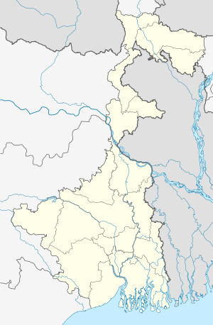 Gangadharpur  Gangadharpur Location in West Bengal, India | |
| Coordinates: 22°45′38″N 88°13′18″E / 22.760419°N 88.221792°ECoordinates: 22°45′38″N 88°13′18″E / 22.760419°N 88.221792°E | |
| Country |
|
| State | West Bengal |
| District | Hooghly |
| Nearest City | Serampore |
| Area | |
| • Total | 2.2 km2 (0.8 sq mi) |
| Elevation | 11 m (36 ft) |
| Population (2011) | |
| • Total | 7,862 |
| • Density | 3,600/km2 (9,300/sq mi) |
| Languages | |
| • Official | Bengali, English |
| Time zone | IST (UTC+5:30) |
| PIN | 712306 |
| Telephone code | +91-3212 |
| Vehicle registration | WB-16 & WB-18 |
| Sex ratio | 979 females/1000 males ♂/♀ |
| Literacy Rate | 83.52 % |
| Lok Sabha constituency | Serampore |
| Vidhan Sabha constituency | Chanditala |
| Website | Gangadharpur |
Gangadharpur (Bengali: গঙ্গাধরপুর)[1] is a census town in Chanditala I CD Block in Hooghly district in the state of West Bengal, India. It is under Chanditala police station. in Srirampore subdivision. It is 26 km from District headquarters Hooghly. 30 km from State capital Kolkata.[2]
Demographics
As of 2011 India census,[3] Gangadharpur had a population of 7862. Males constitute 51% of the population and females 49%. Gangadharpur has an average literacy rate of 83.5%, higher than the state average of 76.26%; with 87.72% of the literates being male and 79.27% being female. 9% of the population is under 6 years of age.
Festivals
Like other parts of West Bengal, Durga Puja is the biggest festival of Gangadharpur . Kali Puja is one of the famous festivals celebrated in Gangadharpur . Also Lakshmi Puja, Viswakarma Puja, Saraswati Puja, Poila Boisakh-Ganesh Puja, kartik Puja, Dol Yatra are widely celebrated at Gangadharpur & Boisakhi mela, Charok Etc..
Geography
Gangadharpur is located at: 22°45′38″N 88°13′18″E / 22.760419°N 88.221792°E[4] It is located in the Chanditala–I community development block under the Srirampore subdivision of the Hooghly district. Chanditala police station serves this town.
Gangadharpur Gram panchayat
Gangadharpur Gram panchayat Area

- Flower us gram panchayat towns & villages : Manirampur, Gangadharpur, Malipukur , Bankrishnapur.
- Market: Ganngadharpur Bazar, Hajaghata, Manirampur .
Gangadharpur Gram panchayat in Chanditala I (community development block).
Roads and transportation

Nearest railway station is Baruipara at Howrah-Bardhaman chord Kolkata Suburban Railway . The main road is 31 Number Road It is the main artery of the town and it is connected NH2 & Grand Trunk Road .

There is 31 Number Bus service Jangipara Bus Stand to Serampore Bus Stand Via Sehakhala, Banmalipur ,Gangadharpur, Baruipara , Bora . Another road renovated under Gangadharpur-Singur Road it is connected SH2. There is Auto & Trecker service Singur to Masat via Gangadharpur. Gangadharpur-Jangalpara Road it is connected SH15. There is Auto & Trecker service Baruipara to Masat Via Ganagadharpur.

Health

There is a government hospital Gangadharpur Primary Health Center & Rural Training Under Chanditala I unit. It has all necessary primary facilities, outdoor facilities for general patients.
References
- ↑ "Mouza Information". Land & Land Reforms Department, Government of West Bengal.
- ↑ "Hugli district census handbook" (PDF). Retrieved 27 February 2016.
- ↑ "Census of India 2011: Data from the 2011 Census, including cities, villages and towns (Provisional)". Census Commission of India.
- ↑ "Google maps location of Gangadharpur". Google maps. Retrieved 2015-12-30.
| Wikimedia Commons has media related to Gangadharpur. |
Cities, towns and locations in Hooghly District | |||||||||||||||
|---|---|---|---|---|---|---|---|---|---|---|---|---|---|---|---|
| Cities, municipal and census towns |
| ||||||||||||||
| Locations other than cities and towns | |||||||||||||||
| Related topics |
| ||||||||||||||
 |
Banmalipur | Jagatnagar | Baruipara | |
| Masat | |
Begampur | ||
| ||||
| | ||||
| Jangalpara | Krishnarampur |