Baidyabati
| Baidyabati বৈদ্যবাটী | |
|---|---|
| Town | |
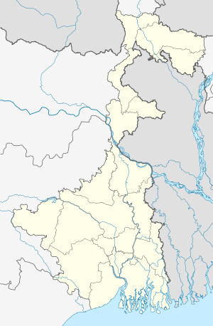 Baidyabati Location in West Bengal, India | |
| Coordinates: 22°47′N 88°19′E / 22.79°N 88.32°ECoordinates: 22°47′N 88°19′E / 22.79°N 88.32°E | |
| Country |
|
| State | West Bengal |
| District | Hooghly |
| Nearest City | Serampore |
| Elevation | 15 m (49 ft) |
| Population (2011) | |
| • Total | 121,081 |
| Languages | |
| • Official | Bengali, English |
| Time zone | IST (UTC+5:30) |
| PIN | 712222 |
| Telephone code | 910332632.... |
| Lok Sabha constituency | Sreerampur |
| Vidhan Sabha constituency | Champdani |
Baidyabati is a city and a municipality in Hooghly district in the state of West Bengal, India. It is under Serampore Town police station and Srirampore subdivision.[1] Now it is a part of the area covered by Kolkata Metropolitan Development Authority.[2]
Demographics
As per 2011 Census of India Baidyabati had a total population of 121,110 of which 62,885 (52%) were males and 58,625 (48%) were females. Population below 6 years was 9,017. The total number of literates in Baidyabati was 98,928 (88.26% of the population over 6 years).[3]
The following Municipalities and Census Towns in Hooghly district were part of Kolkata Urban Agglomeration in 2011 census: Bansberia (M), Hugli-Chinsurah (M), Bara Khejuria (Out Growth), Shankhanagar (CT), Amodghata (CT), Chak Bansberia (CT), Naldanga (CT), Kodalia (CT), Kulihanda (CT), Simla (CT), Dharmapur (CT), Bhadreswar (M), Champdani (M), Chandannagar (M Corp.), Baidyabati (M), Serampore (M), Rishra (M), Rishra (CT), Bamunari (CT), Dakshin Rajyadharpur (CT), Nabagram Colony (CT), Konnagar (M), Uttarpara Kotrung (M), Raghunathpur (PS-Dankuni) (CT), Kanaipur (CT) and Keota (CT).[4]
As of 2001 India census, Baidyabati had a population of 108,231. Males constitute 52% of the population and females 48%. Baidyabati has an average literacy rate of 79%, higher than the national average of 59.5%; with 54% of the males and 46% of females literate. 8% of the population is under 6 years of age.[5]
Transport
The State Highway 6 (West Bengal)/ Grand Trunk Road passes through Baidyabati.[6]
References
- ↑ "District-wise list of stautory towns". Census Commission of India. Archived from the original on 2007-09-30. Retrieved 2009-01-28.
- ↑ "Base Map of Kolkata metropolitan area". Kolkata metropolitan Development Authority. Archived from the original on 28 September 2007. Retrieved 2007-09-03.
- ↑ "2011 Census – Primary Census Abstract Data Tables". West Bengal – District-wise. Registrar General and Census Commissioner, India. Retrieved 15 June 2016.
- ↑ "Provisional Population Totals, Census of India 2011" (PDF). Constituents of Urban Agglomeration Having Population Above 1 Lakh. Census of India 2011. Retrieved 16 June 2016.
- ↑ "Census of India 2001: Data from the 2001 Census, including cities, villages and towns (Provisional)". Census Commission of India. Archived from the original on 2004-06-16. Retrieved 2008-11-01.
- ↑ "List of State Highways in West Bengal". West Bengal Traffic Police. Retrieved 15 October 2016.
Cities, towns and locations in Hooghly District | |||||||||||||||
|---|---|---|---|---|---|---|---|---|---|---|---|---|---|---|---|
| Cities, municipal and census towns |
| ||||||||||||||
| Locations other than cities and towns | |||||||||||||||
| Related topics |
| ||||||||||||||