Villing
| Villing | |
|---|---|
 | |
 Villing | |
|
Location within Grand Est region  Villing | |
| Coordinates: 49°16′55″N 6°37′54″E / 49.2819°N 6.6317°ECoordinates: 49°16′55″N 6°37′54″E / 49.2819°N 6.6317°E | |
| Country | France |
| Region | Grand Est |
| Department | Moselle |
| Arrondissement | Forbach-Boulay-Moselle |
| Canton | Bouzonville |
| Intercommunality | Communauté de communes de la Houve |
| Government | |
| • Mayor (2008–2014) | Gaston Schramm |
| Area1 | 4.93 km2 (1.90 sq mi) |
| Population (1999)2 | 442 |
| • Density | 90/km2 (230/sq mi) |
| Time zone | CET (UTC+1) |
| • Summer (DST) | CEST (UTC+2) |
| INSEE/Postal code | 57720 / 57550 |
| Elevation |
240–366 m (787–1,201 ft) (avg. 274 m or 899 ft) |
|
1 French Land Register data, which excludes lakes, ponds, glaciers > 1 km² (0.386 sq mi or 247 acres) and river estuaries. 2 Population without double counting: residents of multiple communes (e.g., students and military personnel) only counted once. | |
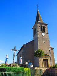
Villing is a commune in the Moselle department in Grand Est in north-eastern France.
Localities of the commune: Trois-Maisons, Gaweistroff, Bedem.
See also
This article is issued from Wikipedia - version of the 11/17/2016. The text is available under the Creative Commons Attribution/Share Alike but additional terms may apply for the media files.