Réchicourt-le-Château
For other uses, see Réchicourt-la-Petite.
| Réchicourt-le-Château | ||
|---|---|---|
|
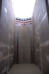
Lock in the Marne–Rhine Canal | ||
| ||
 Réchicourt-le-Château | ||
|
Location within Grand Est region  Réchicourt-le-Château | ||
| Coordinates: 48°39′56″N 6°50′28″E / 48.6656°N 6.8411°ECoordinates: 48°39′56″N 6°50′28″E / 48.6656°N 6.8411°E | ||
| Country | France | |
| Region | Grand Est | |
| Department | Moselle | |
| Arrondissement | Sarrebourg-Château-Salins | |
| Canton | Sarrebourg | |
| Intercommunality | Communauté de communes du Pays des Étangs | |
| Government | ||
| • Mayor (2008–2014) | Gérard Kelle | |
| Area1 | 24.14 km2 (9.32 sq mi) | |
| Population (2006)2 | 559 | |
| • Density | 23/km2 (60/sq mi) | |
| Time zone | CET (UTC+1) | |
| • Summer (DST) | CEST (UTC+2) | |
| INSEE/Postal code | 57564 / 57810 | |
| Elevation | 242–333 m (794–1,093 ft) | |
|
1 French Land Register data, which excludes lakes, ponds, glaciers > 1 km² (0.386 sq mi or 247 acres) and river estuaries. 2 Population without double counting: residents of multiple communes (e.g., students and military personnel) only counted once. | ||

Réchicourt-le-Château (German: Rixingen) is a commune in the Moselle department in Grand Est in north-eastern France. It is part of the arrondissement of Sarrebourg-Château-Salins.[1]
See also
References
This article is issued from Wikipedia - version of the 11/17/2016. The text is available under the Creative Commons Attribution/Share Alike but additional terms may apply for the media files.