Geneva Township, Jennings County, Indiana
| Geneva Township | |
|---|---|
| Township | |
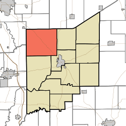 Location in Jennings County | |
| Coordinates: 39°04′51″N 85°43′15″W / 39.08083°N 85.72083°WCoordinates: 39°04′51″N 85°43′15″W / 39.08083°N 85.72083°W | |
| Country | United States |
| State | Indiana |
| County | Jennings |
| Government | |
| • Type | Indiana township |
| Area | |
| • Total | 56.51 sq mi (146.4 km2) |
| • Land | 55.89 sq mi (144.8 km2) |
| • Water | 0.62 sq mi (1.6 km2) 1.10% |
| Elevation | 646 ft (197 m) |
| Population (2010) | |
| • Total | 7,584 |
| • Density | 135.7/sq mi (52.4/km2) |
| GNIS feature ID | 0453323 |
Geneva Township is one of eleven townships in Jennings County, Indiana, United States. As of the 2010 census, its population was 7,584 and it contained 3,365 housing units.[1]
History
Geneva Township was established in about 1824. A majority of the first settlers being natives of Switzerland caused the name Geneva to be selected.[2]
Geography
According to the 2010 census, the township has a total area of 56.51 square miles (146.4 km2), of which 55.89 square miles (144.8 km2) (or 98.90%) is land and 0.62 square miles (1.6 km2) (or 1.10%) is water.[1] The streams of Bear Creek, Bennetts Branch, Nettle Creek, Rattail Creek, Rock Creek and Wyaloosing Creek run through this township.
Unincorporated towns
Adjacent townships
- Rock Creek Township, Bartholomew County (north)
- Jackson Township, Decatur County (northeast)
- Sand Creek Township (east)
- Center Township (southeast)
- Spencer Township (south)
- Redding Township, Jackson County (southwest)
- Sand Creek Township, Bartholomew County (west)
Cemeteries
The township contains three cemeteries: Cave Springs, Henry and Hulse.
Major highways
Airports and landing strips
- Miller and Sons Farm Supply Airport
References
- "Geneva Township, Jennings County, Indiana". Geographic Names Information System. United States Geological Survey. Retrieved 2009-09-24.
- United States Census Bureau cartographic boundary files
- 1 2 "Population, Housing Units, Area, and Density: 2010 - County -- County Subdivision and Place -- 2010 Census Summary File 1". United States Census. Retrieved 2013-05-10.
- ↑ Jennings Co. Historical Society (1999). Jennings Co., Indiana - Pictorial. Turner Publishing Company. p. 65.
External links
Municipalities and communities of Jennings County, Indiana, United States | ||
|---|---|---|
| City | ||
| Town | ||
| Townships | ||
| CDPs | ||
| Other unincorporated communities | ||
| Footnotes | ‡This populated place also has portions in an adjacent county or counties | |
This article is issued from Wikipedia - version of the 11/2/2016. The text is available under the Creative Commons Attribution/Share Alike but additional terms may apply for the media files.