Vernon Township, Jennings County, Indiana
| Vernon Township | |
|---|---|
| Township | |
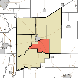 Location in Jennings County | |
| Coordinates: 38°57′17″N 85°35′55″W / 38.95472°N 85.59861°WCoordinates: 38°57′17″N 85°35′55″W / 38.95472°N 85.59861°W | |
| Country | United States |
| State | Indiana |
| County | Jennings |
| Government | |
| • Type | Indiana township |
| Area | |
| • Total | 34.08 sq mi (88.3 km2) |
| • Land | 33.98 sq mi (88.0 km2) |
| • Water | 0.1 sq mi (0.3 km2) 0.29% |
| Elevation | 748 ft (228 m) |
| Population (2010) | |
| • Total | 2,809 |
| • Density | 82.7/sq mi (31.9/km2) |
| GNIS feature ID | 0453957 |
Vernon Township is one of eleven townships in Jennings County, Indiana, United States. As of the 2010 census, its population was 2,809 and it contained 1,118 housing units.[1]
Geography
According to the 2010 census, the township has a total area of 34.08 square miles (88.3 km2), of which 33.98 square miles (88.0 km2) (or 99.71%) is land and 0.1 square miles (0.26 km2) (or 0.29%) is water.[1] The streams of Crooked Creek, Duck Branch, Goose Run and Huckleberry Branch run through this township.
Cities and towns
- North Vernon (southeast edge)
- Vernon (the county seat)
Unincorporated towns
Adjacent townships
- Center Township (north)
- Campbell Township (northeast)
- Bigger Township (east)
- Lovett Township (southwest)
- Spencer Township (west)
Cemeteries
The township contains six cemeteries: Baldwin, Coryell, Ebenezer, Stewart, Sullivan and Vernon.
Major highways
References
- 1 2 "Population, Housing Units, Area, and Density: 2010 - County -- County Subdivision and Place -- 2010 Census Summary File 1". United States Census. Retrieved 2013-05-10.
External links
Municipalities and communities of Jennings County, Indiana, United States | ||
|---|---|---|
| City | ||
| Town | ||
| Townships | ||
| CDPs | ||
| Other unincorporated communities | ||
| Footnotes | ‡This populated place also has portions in an adjacent county or counties | |
This article is issued from Wikipedia - version of the 9/10/2016. The text is available under the Creative Commons Attribution/Share Alike but additional terms may apply for the media files.