Guilford (CDP), New York
| Guilford, New York | |
|---|---|
| Census-designated place | |
 Guilford Location within the state of New York | |
| Coordinates: 42°24′21″N 75°29′35″W / 42.40583°N 75.49306°WCoordinates: 42°24′21″N 75°29′35″W / 42.40583°N 75.49306°W | |
| Country | United States |
| State | New York |
| County | Chenango |
| Town | Guilford |
| Area | |
| • Total | 1.5 sq mi (3.8 km2) |
| • Land | 1.4 sq mi (3.5 km2) |
| • Water | 0.1 sq mi (0.3 km2) |
| Elevation | 1,513 ft (461 m) |
| Population (2010) | |
| • Total | 362 |
| • Density | 271/sq mi (104.6/km2) |
| Time zone | Eastern (EST) (UTC-5) |
| • Summer (DST) | EDT (UTC-4) |
| ZIP code | 13780 |
| Area code(s) | 607 |
| FIPS code | 36-31137 |
| GNIS feature ID | 0951905 |
Guilford is a census-designated place (CDP) in Chenango County, New York, United States. The population was 362 at the 2010 census.[1] It is located in the town of Guilford.
Geography
The Guilford CDP comprises the hamlets of Guilford and Guilford Center in the west-central part of the town of Guilford. It is located on County Road 35, which leads northwest 7 miles (11 km) to Oxford and southeast 10 miles (16 km) to Sidney.
According to the United States Census Bureau, the Guilford CDP has a total area of 1.5 square miles (3.8 km2), of which 1.4 square miles (3.5 km2) is land and 0.1 square miles (0.3 km2), or 8.12%, is water.[1] Guilford Lake occupies the northwestern end of the CDP and drains to the east via Guilford Creek, which passes through both Guilford and Guilford Center on its way southeast to the Unadilla River.
References
- 1 2 "Geographic Identifiers: 2010 Demographic Profile Data (G001): Guilford CDP, New York". U.S. Census Bureau, American Factfinder. Retrieved December 2, 2014.
Municipalities and communities of Chenango County, New York, United States | ||
|---|---|---|
| City | 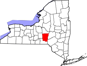 | |
| Towns | ||
| Villages | ||
| CDPs | ||
| Hamlets | ||
| Footnotes | ‡This populated place also has portions in an adjacent county or counties | |