McDonough, New York
| McDonough, New York | |
|---|---|
| Town | |
| Motto: "The hills o' McDonough are calling you home" | |
 McDonough Location within the state of New York | |
| Coordinates: 42°30′6″N 75°43′42″W / 42.50167°N 75.72833°W | |
| Country | United States |
| State | New York |
| County | Chenango |
| Government | |
| • Type | Town Council |
| • Town Supervisor | Arrington J. Canor (R) |
| • Town Council |
Members' List
|
| Area | |
| • Total | 39.6 sq mi (102.6 km2) |
| • Land | 39.0 sq mi (101.1 km2) |
| • Water | 0.6 sq mi (1.5 km2) |
| Elevation | 1,726 ft (526 m) |
| Population (2010) | |
| • Total | 886 |
| • Density | 23/sq mi (8.8/km2) |
| Time zone | Eastern (EST) (UTC-5) |
| • Summer (DST) | EDT (UTC-4) |
| ZIP code | 13801 |
| Area code(s) | 607 |
| FIPS code | 36-44127 |
| GNIS feature ID | 0979178 |
| Website |
mcdonoughny |
McDonough is a town in Chenango County, New York, United States. The population was 886 at the 2010 census.[1] The town is named after Thomas Macdonough,[2] a naval officer who served on Lake Champlain and other locations. McDonough is located in the western part of Chenango County, west of Norwich.
History
The land was settled around 1795 by Sylvanius Moore. The town of McDonough was founded in 1816 from part of the town of Preston.
Calvary Episcopal Church was listed on the National Register of Historic Places in 1998.[3]
Geography
According to the United States Census Bureau, the town has a total area of 39.6 square miles (102.6 km2), of which 39.0 square miles (101.1 km2) is land and 0.58 square miles (1.5 km2), or 1.50%, is water.[1] The water area comes from several small lakes in the town, including Genegantslet Lake, Bowman Lake, and Lake Ludlow.
New York State Route 220 is a highway following a meandering course through the town, leading southeast to Oxford and southwest to Smithville Flats.
Demographics
| Historical population | |||
|---|---|---|---|
| Census | Pop. | %± | |
| 1820 | 789 | — | |
| 1830 | 1,232 | 56.1% | |
| 1840 | 1,369 | 11.1% | |
| 1850 | 1,522 | 11.2% | |
| 1860 | 1,483 | −2.6% | |
| 1870 | 1,280 | −13.7% | |
| 1880 | 1,298 | 1.4% | |
| 1890 | 1,025 | −21.0% | |
| 1900 | 907 | −11.5% | |
| 1910 | 813 | −10.4% | |
| 1920 | 765 | −5.9% | |
| 1930 | 598 | −21.8% | |
| 1940 | 675 | 12.9% | |
| 1950 | 709 | 5.0% | |
| 1960 | 639 | −9.9% | |
| 1970 | 703 | 10.0% | |
| 1980 | 796 | 13.2% | |
| 1990 | 809 | 1.6% | |
| 2000 | 870 | 7.5% | |
| 2010 | 886 | 1.8% | |
| Est. 2014 | 870 | [4] | −1.8% |
As of the census[6] of 2000, there were 870 people, 349 households, and 248 families residing in the town. The population density was 22.2 people per square mile (8.6/km²). There were 590 housing units at an average density of 15.1 per square mile (5.8/km²). The racial makeup of the town was 96.09% White, 1.26% African American, 0.34% Native American, 0.34% Asian, 0.11% from other races, and 1.84% from two or more races. Hispanic or Latino of any race were 2.53% of the population.
There were 349 households out of which 28.4% had children under the age of 18 living with them, 59.9% were married couples living together, 6.6% had a female householder with no husband present, and 28.7% were non-families. 23.2% of all households were made up of individuals and 10.9% had someone living alone who was 65 years of age or older. The average household size was 2.49 and the average family size was 2.93.
In the town the population was spread out with 22.3% under the age of 18, 8.5% from 18 to 24, 27.0% from 25 to 44, 26.3% from 45 to 64, and 15.9% who were 65 years of age or older. The median age was 40 years. For every 100 females there were 101.9 males. For every 100 females age 18 and over, there were 101.8 males.
The median income for a household in the town was $29,402, and the median income for a family was $33,125. Males had a median income of $26,974 versus $19,231 for females. The per capita income for the town was $15,558. About 7.7% of families and 9.8% of the population were below the poverty line, including 10.8% of those under age 18 and 12.1% of those age 65 or over.
Communities and locations in McDonough
- Bowman Lake State Park – A state park north of East McDonough.
- East McDonough – A hamlet on NY-220 in the eastern part of the town.
- Genegantslet Lake – A privately owned and maintained lake in the northwest part of the town.
- Lake Ludlow – A lake in the south part of the town.
- McDonough – The hamlet of McDonough is on NY-220 at the junction of County Roads 5, 7, and 8 in the western part of the town.
Local businesses
- Russo's Tack Shack
- Big Diamond Real Estate
- PBP Management Services
References
- 1 2 "Geographic Identifiers: 2010 Demographic Profile Data (G001): McDonough town, Chenango County, New York". U.S. Census Bureau, American Factfinder. Retrieved November 20, 2014.
- ↑ Gannett, Henry (1905). The Origin of Certain Place Names in the United States. U.S. Government Printing Office. p. 193.
- ↑ National Park Service (2009-03-13). "National Register Information System". National Register of Historic Places. National Park Service.
- ↑ "Annual Estimates of the Resident Population for Incorporated Places: April 1, 2010 to July 1, 2014". Retrieved June 4, 2015.
- ↑ "Census of Population and Housing". Census.gov. Archived from the original on May 11, 2015. Retrieved June 4, 2015.
- ↑ "American FactFinder". United States Census Bureau. Archived from the original on September 11, 2013. Retrieved 2008-01-31.
External links
Coordinates: 42°29′54″N 75°46′05″W / 42.49833°N 75.76806°W
Municipalities and communities of Chenango County, New York, United States | ||
|---|---|---|
| City | 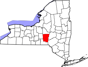 | |
| Towns | ||
| Villages | ||
| CDPs | ||
| Hamlets | ||
| Footnotes | ‡This populated place also has portions in an adjacent county or counties | |