Herkimer (village), New York
| Herkimer, New York | |
|---|---|
| Village | |
|
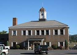
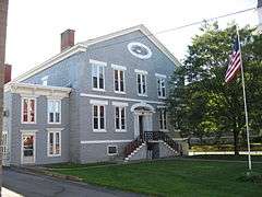
Herkimer Municipal Hall, September 2009 | |
_Herkimer_NY.png) Location within Herkimer County | |
 Herkimer, New York Location within the state of New York | |
| Coordinates: 43°1′34″N 74°59′25″W / 43.02611°N 74.99028°WCoordinates: 43°1′34″N 74°59′25″W / 43.02611°N 74.99028°W | |
| Country | United States |
| State | New York |
| County | Herkimer |
| Government | |
| • Mayor | Anthony Brindisi[1] |
| Area | |
| • Total | 2.5 sq mi (6.6 km2) |
| • Land | 2.4 sq mi (6.3 km2) |
| • Water | 0.1 sq mi (0.3 km2) |
| Elevation | 384 ft (117 m) |
| Population (2010) | |
| • Total | 7,743 |
| Time zone | Eastern (EST) (UTC-5) |
| • Summer (DST) | EDT (UTC-4) |
| ZIP code | 13350 |
| Area code(s) | 315 |
| FIPS code | 36-34121 |
| GNIS feature ID | 0952621 |
| Website |
village |
Herkimer is a village on the north side of the Mohawk River and the county seat of Herkimer County, New York, United States, about 13 miles (21 km) southeast of Utica. As of the 2010 census, it had a population of 7,743.[2] This was part of the Burnetsfield Patent and the first European-American settlement this far west in the Mohawk Valley.
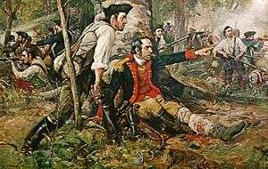
The village takes its name from the Herkimer family, Palatine German immigrants who settled in the area in 1723. The most notable family member was Nicholas Herkimer, a general of the Tryon County militia, who died from wounds received at the Battle of Oriskany in the American Revolutionary War.
The village is located within the Town of Herkimer and Herkimer County; together they are referred to as "The Herkimers". The citizens of the Village are served by three levels of government of the same name: the Village, the Town and the County of Herkimer. (Only the residents of the Village of Madison and New York County, also in New York, share a similar distinction.)
Herkimer County Community College, located in the northwest part of the village, was founded in 1966 by the Herkimer County Board of Supervisors.
History
German Flatts
The region had been part of the territory of the Iroquois Mohawk Native American tribe for centuries. Their villages were linked by winding paths through the wilderness and along the Mohawk River. By the early 18th century, they had two main villages in the Mohawk River valley, Teantontalago to the east, known by the English as the Lower Mohawk Castle, and Canajoharie to the west, known as the Upper Mohawk Castle. The English built Fort Hunter near the Lower Mohawk Castle.
Palatine Germans first arrived in New York State in August 1708, with most arriving in the summer of 1710. Refugees from religious wars in Europe, they had agreed to exchange work for passage to the New York Colony. This was arranged by Queen Anne's government, and in 1710 nearly 2800 Germans arrived in ten ships at present-day Manhattan. They were at first quarantined on Nutten Island (now known as Governors Island) until the ship fevers ran their course. In exchange, they worked for some time in camps along the Hudson River to manufacture British naval supplies. As early as 1712, some went on upriver to settle along Schoharie Creek in the Mohawk Valley.
In 1722, in response to a request by the German Palatine leaders Joseph Petrie and Conrad Rickert, Governor William Burnet granted the Palatines a lease to purchase land from the Mohawk Nation in the vicinity of the confluence of West Canada Creek and the Mohawk River. After a survey of the land was completed in 1723, many more settlers arrived in the area between 1723 and 1725. They settled on both the north and south sides of the Mohawk River. The area was originally known as "Burnetsfield", named in honor of the Governor. The Burnetsfield Patent, granted April 13, 1725, assigned 100-acre (0.40 km2) lots to about ninety heads of family. The area was also referred to at times as "Stone Ridge", "The Flats", "The Falls", and most commonly, due to the mostly German immigrant population and the flat floodplain topography, as German Flatts. This was the first European-American settlement this far west in the Mohawk Valley.
Shortly after 1722, a blockhouse and a church were erected in the village on the north side of the river. This site was later developed as the present Reformed Church. The first known minister was the Reverend George Michael Weiss, who served from 1735 to 1742. A schoolhouse was erected in 1745. Weiss was followed in 1751 by the Elder Rosencrantz, who was succeeded by his son, the Reverend Abraham Rosencrantz, the latter serving until his death in 1796.
During the French and Indian War, the town was twice attacked by the French and their native American allies, in November 1757 (cf. Attack on German Flatts (1757)) and again in April 1758, when the settlement on the south side of the river and Fort Herkimer were attacked, and about 30 settlers were killed. Captain Nicholas Herkimer held the command of the Fort, assembling all of the settlers he could within the fort.
During the Revolutionary War, the town was attacked multiple times by Loyalists and Iroquois allies, as were other German settlements in the valley. One of these raids was by the Butler's Rangers in September 1778. (see Attack on German Flatts (1778)) The village was defended by Fort Dayton.
Fort Herkimer and the settlement on the south side of the river were also attacked. George, Catherine and Nicholas Demuth were among children captured by the Onondaga during a raid in 1779, as they were playing outside the fort. After the war, during prisoner exchange, George and Catherine returned to the Demuth family. Nicholas, the youngest, had been adopted by an Onondaga chief and become assimilated. He chose to stay with the tribe for the rest of his life. Although he maintained contact with his birth family, he accompanied the Onondaga and lived with them on a reservation outside Syracuse. He married into the tribe and worked as an interpreter and negotiator.
The village of Herkimer was attacked for the last time during the war on July 15, 1782, by about five hundred Tories and Iroquois. Two residents were killed, Johann Christian Schell and his son, Denis Augustinius Schell. The rest managed to reach the safety of the Fort. Fifty horses were taken and fifteen killed, 180 cattle were taken and thirteen killed, and thirteen houses and two barns were burned.
"Village of Herkimer"
In 1788, the township of Herkimer was organized, and the town had come to be known generally as the "Village of Herkimer." In 1791, when Herkimer County was organized, the Village of Herkimer was established as the county seat. By 1797, the village had a courthouse, a jail, and a Reformed Dutch Church, with about 40 houses and a population of approximately 250. The village was incorporated in 1807. Its charter was amended in 1832 to enlarge the village. In 1875, the village dispensed with its special charter and organized the village under the state law of the time.[3]
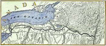
By the mid-to-late 19th century, the Village was served by the New York Central & Hudson River Railroad, a branch of which (the Mohawk and Malone Railway) extended north through the Adirondacks to Malone, New York. An inter-urban electric trolley traveled on railways among villages and Little Falls, Syracuse, Richfield Springs, Cooperstown and Oneonta. The Erie Canal, built from 1817 to 1825, also served villages and towns in the valley, carrying increased traffic and trade between the Great Lakes and the Hudson River and port of New York.[3]
By the late 19th century, the Village also had a public library. The Folts Mission Institute opened in 1893 as a training school for young women under the auspices of the Women's Foreign Missionary Society of the Methodist Episcopal Church.[3] In 1907, a monument was erected in a city park by the Village to honor American Revolutionary War General Nicholas Herkimer (unveiled August 6, 1907).[3]
National Register of Historic Places
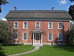
The Herkimer County Courthouse, Herkimer County Jail, Herkimer County Historical Society, The Reformed Church, Palatine German Frame House, and United States Post Office are all listed on the National Register of Historic Places.[4]
National Heritage Site
In 2000, the United States Congress designated the historic route of the Erie Canal, which runs through the Village of Herkimer, as the Erie Canalway National Heritage Corridor.[5] The villages, towns and landscape are all included in this designation as elements contributing to its significance.
Places of interest in modern-day Herkimer
Mudville Softball Complex
The Mudville Softball Complex (which takes its name from the fictional town in the poem Casey at the Bat), on Route 28 just north of Herkimer, hosts Interscholastic and Travel Team Softball Tournaments throughout the spring and summer. The facility is also home of the New York State High School Softball Hall of Fame.
Golf course
Established in 1907 as a private country club, the now public Mohawk Valley Country Club has an 18-hole golf course, driving range, practice green and tennis courts. It is located on State Route 5 just east of Herkimer.[6]
Herkimer diamond mines
Several small commercial mines in the area cater to tourists, where visitors can hunt for Herkimer diamonds.
Plantation Island wildlife management area
The Plantation Island New York State Wildlife Management Areas, consisting of approximately 300 acres of Mohawk River floodplain, lies on the opposite shore of West Canada Creek just southeast of the Village of Herkimer. Another smaller Wildlife Management site, providing access and parking for fishing on the creek, is just northeast of the Village, along Shells Bush Road, across the Donald J. Mitchell Bridge from State Route 28.
Local humor
In the 1940s, a pejorative epithet: "Herkimer-Jerkimer"—used by some in attempts to disparage area residents—developed some currency among a few city slicker denizens of, particularly, New York City—apparently envious of the Upstate area's more laid-back, tranquil pace of life and natural beauty. Local residents took little umbrage, content in their knowledge of the ongoing lucrative boost to the local economy, from the large numbers of these "New York City Pigeons" (as they sometimes referred to them) flocking to the area in droves on week-ends every spring, summer and fall—and even on occasion in the winter months—for tourism and recreation.[7][8][9]
2013 Shooting Incident
On the morning of March 13, 2013, the Herkimer area was the target of two deadly shooting incidents committed by 64-year-old Kurt Myers of nearby Mohawk, New York. The incident left five people dead, including the gunman, with two others injured. Myers fatally shot the first two victims and wounded two others at a barbershop in Mohawk. Shortly afterwards, he fatally shot two additional victims in Herkimer at Gaffey's Fast Lube and Car Wash.[10]
The Herkimer County Police, with assistance from State Police and the FBI initiated a manhunt for Kurt Myers. Myers was discovered in an abandoned hotel building on North Main Street, Herkimer. The ensuing firefight left Myers and an FBI canine deceased.[11]
In popular culture
- Theodore Dreiser's 1925 novel, An American Tragedy is a fictionalized account of the events related to the 1908 trial and conviction of Chester Gillette for the murder of Grace Brown at Big Moose Lake. He was held in the historic Herkimer County Jail. The novel was adapted several times for stage plays, as well as for film and TV versions. These included the 1951 Paramount film A Place in the Sun, starring Elizabeth Taylor, Montgomery Clift and Shelley Winters. (Two non-fiction books recounted the historic murder case and execution of Gillette: Adirondack Tragedy: The Gillette Murder Case of 1906, by Joseph W. Brownell and Patricia A. Wawrzaszek; and Murder in the Adirondacks: An American Tragedy Revisited, by Craig Brandon.)
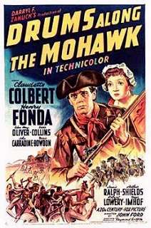
- Walter D. Edmonds' novel, Drums Along the Mohawk (1936), recounts the story of Adam Helmer's run to save the village during the American Revolutionary War, together with an overview of the Germans' colonial settlement along the river. It was adapted as a film by the same name, released in 1939, directed by John Ford and starring Henry Fonda and Claudette Colbert.
Geography
The Village of Herkimer is located at coordinates 43°1′34″N 74°59′25″W / 43.02611°N 74.99028°W (43.026207, -74.990304),[12] in Central New York State, approximately halfway between Syracuse and Albany and 13 miles (21 km) southeast of Utica. It is at Exit 30 on the New York State Thruway (Interstate 90). New York State Route 5 and New York State Route 28 intersect and combine for a short distance within the village. The village has a total area of 2.54 square miles (6.6 km2), of which 0.12 square miles (0.31 km2) is water.[13]
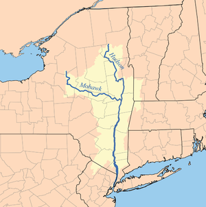
Herkimer is at the confluence of the Mohawk River and its tributary, West Canada Creek. The Plantation Island Wildlife Management Area administered by the NY State Department of Environmental Conservation, has been designated on the opposite shore of West Canada Creek just southeast of the Village of Herkimer, consisting of approximately 300 acres of Mohawk River floodplain. Another smaller Wildlife Management site, providing access and parking for fishing, has been designated on West Canada Creek, northeast of the Village, across the creek on Shells Bush Road.
Geological information
The Herkimer/Middleville area is a favorite collecting area for rockhounds due to its vast deposits of large, low-inclusion quartz crystals known as "Herkimer diamonds," similar to "Cape May diamonds." Although the minerals are not true diamonds, they are sometimes used as gemstones and incorporated into jewelry. The minerals formed in Cambrian age limestone and dolostone, probably from ground water action after the original formation of the rock in an ancient sea. According to locals, it is considered lucky to recover a crystal still partly embedded in a chunk of its host rock.
Several commercial mines cater to tourists. They can break up rock or screen soil weathered from it to find the quartz. The quartz itself is resistant to weathering.
Demographics
| Historical population | |||
|---|---|---|---|
| Census | Pop. | %± | |
| 1870 | 1,220 | — | |
| 1880 | 2,359 | 93.4% | |
| 1900 | 5,555 | — | |
| 1910 | 7,420 | 33.6% | |
| 1920 | 10,453 | 40.9% | |
| 1930 | 10,446 | −0.1% | |
| 1940 | 9,617 | −7.9% | |
| 1950 | 9,400 | −2.3% | |
| 1960 | 9,396 | 0.0% | |
| 1970 | 8,960 | −4.6% | |
| 1980 | 8,383 | −6.4% | |
| 1990 | 7,945 | −5.2% | |
| 2000 | 7,498 | −5.6% | |
| 2010 | 7,743 | 3.3% | |
| Est. 2015 | 7,519 | [14] | −2.9% |
As of the 2000 census, there were 7,498 people, 3,184 households, and 1,687 families residing in the village. The population density was 3,107.1 inhabitants per square mile (1,199.7/km2). There were 3,528 housing units at an average density of 1,462.0 per square mile (564.5/km2).[13] The racial makeup of the village was 96.1% White, 1.2% Black or African American, 0.2% Native American, 1.2% Asian, 0.5% from other races, and 0.6% from two or more races. Hispanic or Latino of any race were 1.4% of the population.[2]
Of the households, 23.6% had children under the age of 18 living in them, 36.6% were married couples living together, 11.8% had a female householder with no husband present, and 47.0% were non-family households. 35.4% of all households were made up of individuals and 17.8% had someone living alone who was 65 years of age or older. The average household size was 2.21 and the average family size was 2.87.[16]
19.2% of the residents were under the age of 18, 15.3% from 18 to 24, 22.5% from 25 to 44, 20.5% from 45 to 64, and 22.6% who were 65 years of age or older. The median age was 39.4 years. For every 100 females there were 88.2 males. For every 100 females age 18 and over, there were 84.9 males.[17]
The median income for a household in the village was $24,762, and the median income for a family was $38,892. Males had a median income of $30,266 versus $19,438 for females. The per capita income for the village was $16,498. About 8.1% of families and 14.8% of the population were below the poverty line, including 8.5% of children under age 18 and 10.0% of those age 65 or over.[17]
Major highways
Notable people
- Jonas Folts (1808 – 1876; native of Herkimer), Wisconsin State Assemblyman and farmer.
- Nicholas Herkimer (c. 1728 - 1777), American Revolutionary War General.
- Charles S. Millington (1855 – 1913), US Congressman 1909 – 1911.
- Donald J. Mitchell (1923 - 2003), US Congressman 1973 - 1983.
- H.M. Quackenbush (1847 - 1933), American inventor and industrialist, founder of the H.M. Quackkenbush Co. in Herkimer.
- Horace H. Witherstine (1852-1924), Physician, Mayor of Rochester, Minnesota, and Minnesota State Senator
References
- ↑ Elizabeth Cooper - "Herkimer Mayor Ainsworth loses election to village Trustee Tony Brindisi," Utica Observer-Dispatch, Jun. 17, 2014. Retrieved 2015-11-20
- 1 2 "Herkimer village, New York - Fact Sheet". American FactFinder. U.S. Census Bureau. Retrieved 2008-08-14.
- 1 2 3 4 Encyclopædia Britannica, "Herkimer", 1911.
- ↑ National Park Service (2009-03-13). "National Register Information System". National Register of Historic Places. National Park Service.
- ↑ "Erie Canalway National Heritage Corridor". Retrieved September 25, 2012.
- ↑ Mohawk Valley Country Club, Mohawk Valley Country Club Homepage, Retrieved 2015-06-16
- ↑ Allen, Irving Lewis (December 1993) [1994]. The City in Slang: New York Life and Popular Speech. Oxford University Press. pp. 3, 245. ISBN 978-0-19-509265-3.
- ↑ Burkardt, John (2008-06-27). "Itty Bitty: Rhyming Nonsense". Retrieved 2008-08-12.
a humorous name, a rustic, a stupid man
- ↑ McKinley, Jesse (1995-11-19). "F.Y.I.". New York Times. ISSN 0362-4331. Retrieved 2008-08-12.
A 'Herkimer Jerkimer?' Why, that's a local yokel, you rube.
- ↑ Carpenter, Jake (March 14, 2013). "Four killed in upstate New York shootings, police say". CNN. Retrieved 2013-06-10.
- ↑ Carroll, Sean (March 14, 2013). "Suspect Killed In Shootout In Herkimer". WHAM-TV. Retrieved 2013-06-10.
- ↑ "US Gazetteer files: 2010, 2000, and 1990". United States Census Bureau. 2011-02-12. Retrieved 2011-04-23.
- 1 2 "New York by County - GCT-PH1. Population, Housing Units, Area, and Density: 2000". American FactFinder. U.S. Census Bureau. Retrieved 2008-08-14.
- ↑ "Annual Estimates of the Resident Population for Incorporated Places: April 1, 2010 to July 1, 2015". Retrieved July 2, 2016.
- ↑ "Census of Population and Housing". Census.gov. Retrieved June 4, 2015.
- ↑ "New York by Place and County Subdivision - GCT-P7. Households and Families: 2000". American FactFinder. U.S. Census Bureau. Retrieved 2008-08-14.
- 1 2 "Table DP-1. Profile of General Demographic Characteristics: 2000, Geographic area: Herkimer village, New York" (PDF). Census 2000 Profiles. U.S. Census Bureau. Retrieved 2008-08-14.
External links
| Wikisource has the text of the 1911 Encyclopædia Britannica article Herkimer. |
- Village of Herkimer Homepage Retrieved 2015-06-28
- Herkimer County Homepage Retrieved 2015-06-28
- Herkimer High School Yearbook Online
- US GenWeb Project - Town of Herkimer
- The Evening Telegram - village newspaper
- Herkimer Home State Historic Park, NYS Parks
- Plantation Island Wildlife Mgt. Area, NYS Parks
- Herkimer Humane Society Retrieved 2015-06-28
Municipalities and communities of Herkimer County, New York, United States | ||
|---|---|---|
| City | 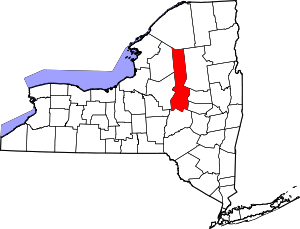 | |
| Towns | ||
| Villages | ||
| CDP | ||
| Hamlets | ||
| Footnotes | ‡This populated place also has portions in an adjacent county or counties | |