West Winfield, New York
| West Winfield | |
|---|---|
| Village | |
 West Winfield Location within the state of New York | |
| Coordinates: 42°53′4″N 75°11′31″W / 42.88444°N 75.19194°WCoordinates: 42°53′4″N 75°11′31″W / 42.88444°N 75.19194°W | |
| Country | United States |
| State | New York |
| County | Herkimer |
| Government | |
| • Mayor | Andrew Bryce |
| Area | |
| • Total | 0.9 sq mi (2.3 km2) |
| • Land | 0.9 sq mi (2.3 km2) |
| • Water | 0.0 sq mi (0.0 km2) |
| Elevation | 1,191 ft (363 m) |
| Population (2010) | |
| • Total | 826 |
| • Density | 920/sq mi (360/km2) |
| Time zone | Eastern (EST) (UTC-5) |
| • Summer (DST) | EDT (UTC-4) |
| ZIP code | 13491 |
| Area code(s) | 315 |
| FIPS code | 36-81292[1] |
| GNIS feature ID | 0970891[2] |
West Winfield is a village in the town of Winfield in Herkimer County, New York, United States. The population was 826 at the 2010 census.[1] The village is indirectly named after General Winfield Scott. The village is south of Utica.
History
An early school in the town, the West Winfield Academy (Mt. Markham), was established in 1850.
The Bonfoy–Barstow House was listed on the National Register of Historic Places in 2011.[3]
Geography
According to the United States Census Bureau, the village has a total area of 0.9 square miles (2.3 km2), all of it land.
A branch of the Unadilla River flows through the village.
The village is on US Route 20 at the junction of New York State Route 51.
Demographics
| Historical population | |||
|---|---|---|---|
| Census | Pop. | %± | |
| 1880 | 594 | — | |
| 1890 | 741 | 24.7% | |
| 1900 | 771 | 4.0% | |
| 1910 | 726 | −5.8% | |
| 1920 | 725 | −0.1% | |
| 1930 | 779 | 7.4% | |
| 1940 | 754 | −3.2% | |
| 1950 | 832 | 10.3% | |
| 1960 | 960 | 15.4% | |
| 1970 | 1,018 | 6.0% | |
| 1980 | 979 | −3.8% | |
| 1990 | 871 | −11.0% | |
| 2000 | 862 | −1.0% | |
| 2010 | 826 | −4.2% | |
| Est. 2015 | 873 | [4] | 5.7% |
As of the census[1] of 2000, there were 862 people, 352 households, and 241 families residing in the village. The population density was 959.3 people per square mile (369.8/km²). There were 372 housing units at an average density of 414.0 per square mile (159.6/km²). The racial makeup of the village was 99.65% White, 0.23% Asian and 0.12% Pacific Islander. Hispanic or Latino of any race were 0.12% of the population.
There were 352 households out of which 27.6% had children under the age of 18 living with them, 53.1% were married couples living together, 11.4% had a female householder with no husband present, and 31.5% were non-families. 29.0% of all households were made up of individuals and 19.9% had someone living alone who was 65 years of age or older. The average household size was 2.45 and the average family size was 3.00.
In the village the population was spread out with 26.0% under the age of 18, 7.0% from 18 to 24, 20.9% from 25 to 44, 25.5% from 45 to 64, and 20.6% who were 65 years of age or older. The median age was 41 years. For every 100 females there were 88.2 males. For every 100 females age 18 and over, there were 84.9 males.
The median income for a household in the village was $33,947, and the median income for a family was $42,031. Males had a median income of $26,793 versus $23,500 for females. The per capita income for the village was $16,465. About 7.6% of families and 9.1% of the population were below the poverty line, including 11.9% of those under age 18 and 8.4% of those age 65 or over.
Schools
The village is within the Mt. Markham Central School District. The Mt. Markham Middle School is located within the village, however the high school and elementary school are located just outside the village but still within the town of Winfield.
References
- 1 2 3 "American FactFinder". United States Census Bureau. Retrieved 2008-01-31.
- ↑ "US Board on Geographic Names". United States Geological Survey. 2007-10-25. Retrieved 2008-01-31.
- ↑ "National Register of Historic Places". WEEKLY LIST OF ACTIONS TAKEN ON PROPERTIES: 8/22/11 THROUGH 8/26/11. National Park Service. 2011-09-02.
- ↑ "Annual Estimates of the Resident Population for Incorporated Places: April 1, 2010 to July 1, 2015". Retrieved July 2, 2016.
- ↑ "Census of Population and Housing". Census.gov. Retrieved June 4, 2015.
External links
Municipalities and communities of Herkimer County, New York, United States | ||
|---|---|---|
| City | 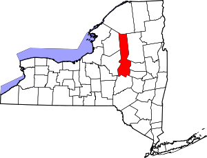 | |
| Towns | ||
| Villages | ||
| CDP | ||
| Hamlets | ||
| Footnotes | ‡This populated place also has portions in an adjacent county or counties | |