Humboldt, Portland, Oregon
| Humboldt | |
|---|---|
| Neighborhood | |
 Humboldt | |
|
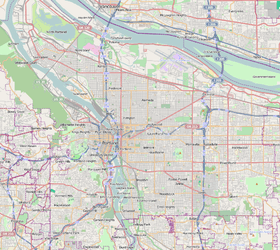
Coordinates: 45°33′35″N 122°40′23″W / 45.55973°N 122.67297°WCoordinates: 45°33′35″N 122°40′23″W / 45.55973°N 122.67297°W PDF map | |
| Country | United States |
| State | Oregon |
| City | Portland |
| Government | |
| • Association | Humboldt Neighborhood Association |
| • Coalition | Northeast Coalition of Neighborhoods |
| Area | |
| • Total | 0.55 sq mi (1.42 km2) |
| Population (2000)[1] | |
| • Total | 5,061 |
| • Density | 9,230/sq mi (3,564/km2) |
| Housing[1] | |
| • No. of households | 1921 |
| • Occupancy rate | 92% occupied |
| • % households renting | 57% renting |
| • Avg. household size | 2.63 persons |
Humboldt is a neighborhood in the North and Northeast sections of Portland, Oregon.
References
External links
-
 Media related to Humboldt, Portland, Oregon at Wikimedia Commons
This article is issued from Wikipedia - version of the 12/26/2014. The text is available under the Creative Commons Attribution/Share Alike but additional terms may apply for the media files.