Kōnan Airport
| Kōnan Airport 岡南飛行場 Kōnan Hikōjō | |||||||||||
|---|---|---|---|---|---|---|---|---|---|---|---|
 | |||||||||||
| IATA: N/A – ICAO: RJBK | |||||||||||
| Summary | |||||||||||
| Airport type | Public | ||||||||||
| Operator | Okayama Prefecture | ||||||||||
| Location | Okayama, Japan | ||||||||||
| Elevation AMSL | 0 ft / 0 m | ||||||||||
| Coordinates | 34°35′29″N 133°56′00″E / 34.59139°N 133.93333°ECoordinates: 34°35′29″N 133°56′00″E / 34.59139°N 133.93333°E | ||||||||||
| Map | |||||||||||
 RJBK Location in Japan | |||||||||||
| Runways | |||||||||||
| |||||||||||
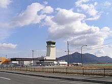
Kōnan Airport (岡南飛行場 Kōnan Hikōjō) (ICAO: RJBK) is a public aerodrome located about eight kilometers south of Okayama Station in Minami-ku, Okayama, Okayama Prefecture, Japan.
History
The airport opened on October 13, 1962 as Okayama Airport. It had scheduled service by All Nippon Airways (Tokyo Haneda) and Toa Domestic Airlines (Matsuyama and Miyazaki); however, the runway was too short to accommodate jet service, and the largest aircraft that could reliably use the airport was the NAMC YS-11.
On March 11, 1988, concurrently with the opening of new Okayama Airport, Konan became an airport exclusively for small planes under the present name.[2]
A ten-seat Cessna jet overshot the runway at the airport on June 10, 2015, landing in a nearby lake.[3]
References
1 Joint civil-military use | |||||||||||
| Major hubs | |||||||||||
| International |
| ||||||||||
| Domestic |
| ||||||||||
| General aviation |
| ||||||||||
| Military | |||||||||||
| Heliports |
| ||||||||||
| Defunct | |||||||||||