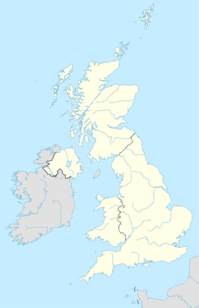
KY postcode area
Postcode district boundaries: Bing / Google
| Kirkcaldy postcode area | |
|---|---|
 KY | |
| Postcode area | KY |
| Postcode area name | Kirkcaldy |
| Post towns | 13 |
| Postcode districts | 17 |
| Postcode sectors | 75 |
| Postcodes (live) | 9,938 |
| Postcodes (total) | 12,695 |
| Statistics as at February 2012[1] | |
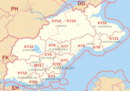
The KY postcode area, also known as the Kirkcaldy postcode area,[2] is a group of postcode districts covering most of Fife, as well as Kinross, around Anstruther, Burntisland, Cowdenbeath, Cupar, Dunfermline, Glenrothes, Inverkeithing, Kelty, Kinross, Kirkcaldy, Leven, Lochgelly and St Andrews in Scotland.
Coverage
The approximate coverage of the postcode districts:
| Postcode district | Post town | Coverage | Local authority area |
|---|---|---|---|
| KY1 | KIRKCALDY | Dysart | Fife |
| KY2 | KIRKCALDY | Auchtertool and Cardenden | Fife |
| KY3 | BURNTISLAND | Aberdour | Fife |
| KY4 | COWDENBEATH, KELTY | Crossgates | Fife |
| KY5 | LOCHGELLY | Ballingry and Kinglassie | Fife |
| KY6 | GLENROTHES | Leslie, Scotlandwell and Kinnesswood | Fife |
| KY7 | GLENROTHES | Markinch and Star | Fife |
| KY8 | LEVEN | Buckhaven, Methil, Methilhill, Largo, Windygates and Kennoway | Fife |
| KY9 | LEVEN | Earlsferry, Elie and Kilconquhar | Fife |
| KY10 | ANSTRUTHER | St. Monans, Pittenweem and Crail | Fife |
| KY11 | DUNFERMLINE, INVERKEITHING | Rosyth | Fife |
| KY12 | DUNFERMLINE | Rumbling Bridge, Powmill, Kincardine and Culross | Fife |
| KY13 | KINROSS | Milnathort and Balado | Perth and Kinross |
| KY14 | CUPAR | Newburgh, Glenfarg and Gateside | Fife |
| KY15 | CUPAR | Ceres, Kilmany, Strathmiglo, Falkland, Ladybank and Freuchie | Fife |
| KY16 | ST. ANDREWS | Kingsbarns, Dunino, Guardbridge, St. Michaels and Balmullo | Fife |
| KY99 | DUNFERMLINE (VISA Special Postcode) |
Map
See also
References
- ↑ "ONS Postcode Directory Version Notes" (ZIP). National Statistics Postcode Products. Office for National Statistics. February 2012. Table 2. Retrieved 21 April 2012. Coordinates from mean of unit postcode points, "Code-Point Open". OS OpenData. Ordnance Survey. February 2012. Retrieved 21 April 2012.
- ↑ Royal Mail, Address Management Guide, (2004)
External links
This article is issued from Wikipedia - version of the 11/26/2016. The text is available under the Creative Commons Attribution/Share Alike but additional terms may apply for the media files.