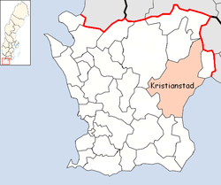
Kristianstad Municipality
| Kristianstad Municipality Kristianstads kommun | ||
|---|---|---|
| Municipality | ||
| ||
 | ||
| Country | Sweden | |
| County | Skåne County | |
| Seat | Kristianstad | |
| Area[1] | ||
| • Total | 1,818.24 km2 (702.03 sq mi) | |
| • Land | 1,246.25 km2 (481.18 sq mi) | |
| • Water | 571.99 km2 (220.85 sq mi) | |
| Area as of January 1, 2014. | ||
| Population (June 30, 2016)[2] | ||
| • Total | 82,783 | |
| • Density | 46/km2 (120/sq mi) | |
| Time zone | CET (UTC+1) | |
| • Summer (DST) | CEST (UTC+2) | |
| ISO 3166 code | SE | |
| Province | Scania | |
| Municipal code | 1290 | |
| Website | www.kristianstad.se | |
Kristianstad Municipality (Kristianstads kommun) is a municipality in Skåne County in southernmost Sweden. Its seat is located in the city Kristianstad.
The present municipality was created in three steps during the last nationwide local government reform, and it has the largest area of the municipalities of Skåne County. In 1967 a number of rural municipalities were merged into the City of Kristianstad. In 1971 more former units were added and the city became a unitary municipality. Finally in 1974, the last amalgamations took place, and the municipality reached its present size. The number of original entities (as of 1863) is 35.
Its size of 1,818.24 square kilometres (702.03 sq mi) makes it the largest municipality in Skåne County by area.
Localities
There are 26 urban areas (also called tätort or locality) in Kristianstad Municipality.[3]
In the table the urban areas are listed according to the size of the population as of December 31, 2010. The municipal seat is in bold characters.
|
|
International relations
Twin towns — Sister cities
The municipality is twinned with:
-
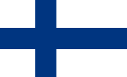 Espoo, Finland
 -
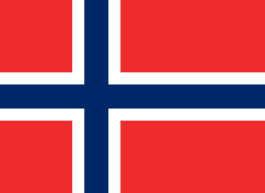 Kongsberg, Norway
 -
 Koszalin, Poland
 -
 Køge Municipality, Denmark
 -
 Rendsburg, Germany
 -
 Šiauliai, Lithuania
 -
 Skagafjörður, Iceland
See also
- University College of Kristianstad
- Kristianstad County (abolished 1998)
References
- ↑ "Statistiska centralbyrån, Kommunarealer den 1 januari 2014" (Microsoft Excel) (in Swedish). Statistics Sweden. Retrieved 2014-04-18.
- ↑ "Folkmängd i riket, län och kommuner 30 juni 2016" (in Swedish). Statistics Sweden. August 17, 2016. Retrieved August 17, 2016.
- ↑ Statistics Sweden
External links
- Kristianstad - Official site
- Coat of arms
Municipalities and seats of Skåne County | ||
|---|---|---|
| Municipalities | ||
| Municipal seats | ||
Coordinates: 56°02′N 14°09′E / 56.033°N 14.150°E