Kävlinge Municipality
| Kävlinge Municipality Kävlinge kommun | ||
|---|---|---|
| Municipality | ||
| ||
 | ||
| Country | Sweden | |
| County | Skåne County | |
| Seat | Kävlinge | |
| Area[1] | ||
| • Total | 292.45 km2 (112.92 sq mi) | |
| • Land | 152.56 km2 (58.90 sq mi) | |
| • Water | 139.89 km2 (54.01 sq mi) | |
| Area as of January 1, 2014. | ||
| Population (June 30, 2016)[2] | ||
| • Total | 30,340 | |
| • Density | 100/km2 (270/sq mi) | |
| Time zone | CET (UTC+1) | |
| • Summer (DST) | CEST (UTC+2) | |
| ISO 3166 code | SE | |
| Province | Scania | |
| Municipal code | 1261 | |
| Website | www.kavlinge.se | |

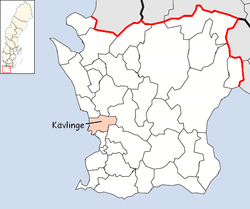
Kävlinge Municipality (Kävlinge kommun) is a municipality in Skåne County in southern Sweden. Its seat is located in the town of Kävlinge.
Localities
There are nine urban areas (also called a Tätort or locality) in Kävlinge Municipality. In the table they are listed according to the size of the population as of December 31, 2005. The municipal seat is in bold characters.
| # | Locality | Population |
|---|---|---|
| 1 | Kävlinge | 10,500 |
| 2 | Löddeköpinge | 5,582 |
| 3 | Furulund | 3,888 |
| 4 | Hofterup | 3,243 |
| 5 | Dösjebro | 752 |
| 6 | Sandskogen | 533 |
| 7 | Barsebäck | 509 |
| 8 | Barsebäckshamn | 401 |
| 9 | Lilla Harrie | 321 |
Barsebäck was the location of a nuclear power plant, opened in the 1970s, but after decades of Danish protests - Copenhagen being located just across the Oresund Sound - it closed in 2005.
Twinnings
 Alatskivi Parish, Estonia[3]
References
- ↑ "Statistiska centralbyrån, Kommunarealer den 1 januari 2014" (Microsoft Excel) (in Swedish). Statistics Sweden. Retrieved 2014-04-18.
- ↑ "Folkmängd i riket, län och kommuner 30 juni 2016" (in Swedish). Statistics Sweden. August 17, 2016. Retrieved August 17, 2016.
- ↑ "Välissuhted" (in Estonian). Alatskivi vald. Retrieved 2 May 2012.
External links
- Kävlinge - Official site
Municipalities and seats of Skåne County | ||
|---|---|---|
| Municipalities | ||
| Municipal seats | ||
Coordinates: 55°48′N 13°07′E / 55.800°N 13.117°E
This article is issued from Wikipedia - version of the 2/22/2013. The text is available under the Creative Commons Attribution/Share Alike but additional terms may apply for the media files.