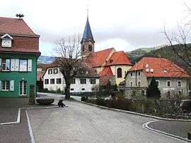
Lautenbachzell
| Lautenbachzell | ||
|---|---|---|
 | ||
| ||
 Lautenbachzell | ||
|
Location within Grand Est region  Lautenbachzell | ||
| Coordinates: 47°56′28″N 7°09′00″E / 47.9411°N 7.15°ECoordinates: 47°56′28″N 7°09′00″E / 47.9411°N 7.15°E | ||
| Country | France | |
| Region | Grand Est | |
| Department | Haut-Rhin | |
| Arrondissement | Thann-Guebwiller | |
| Canton | Guebwiller | |
| Intercommunality | Région de Guebwiller | |
| Government | ||
| • Mayor (2008–2014) | Richard Gall | |
| Area1 | 23.14 km2 (8.93 sq mi) | |
| Population (2006)2 | 1,060 | |
| • Density | 46/km2 (120/sq mi) | |
| Time zone | CET (UTC+1) | |
| • Summer (DST) | CEST (UTC+2) | |
| INSEE/Postal code | 68178 / 68610 | |
| Elevation |
368–1,420 m (1,207–4,659 ft) (avg. 425 m or 1,394 ft) | |
|
1 French Land Register data, which excludes lakes, ponds, glaciers > 1 km² (0.386 sq mi or 247 acres) and river estuaries. 2 Population without double counting: residents of multiple communes (e.g., students and military personnel) only counted once. | ||

Lautenbachzell is a commune in the Haut-Rhin department in Grand Est in north-eastern France.
See also
References
| Wikimedia Commons has media related to Lautenbachzell. |
This article is issued from Wikipedia - version of the 11/13/2016. The text is available under the Creative Commons Attribution/Share Alike but additional terms may apply for the media files.