Linwood Township, Anoka County, Minnesota
| Linwood Township, Minnesota | |
|---|---|
| Township | |
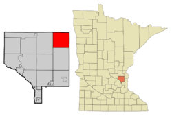 Location of Linwood Township (unincorporated) within Anoka County, Minnesota | |
| Coordinates: 45°22′50″N 93°5′7″W / 45.38056°N 93.08528°WCoordinates: 45°22′50″N 93°5′7″W / 45.38056°N 93.08528°W | |
| Country | United States |
| State | Minnesota |
| County | Anoka |
| Area | |
| • Total | 35.9 sq mi (93.0 km2) |
| • Land | 33.2 sq mi (86.1 km2) |
| • Water | 2.7 sq mi (6.9 km2) |
| Elevation | 892 ft (272 m) |
| Population (2010) | |
| • Total | 5,123 |
| • Density | 154/sq mi (59.5/km2) |
| Time zone | Central (CST) (UTC-6) |
| • Summer (DST) | CDT (UTC-5) |
| ZIP code | 55005 |
| Area code(s) | 651 and 763 |
| FIPS code | 27-37376[1] |
| GNIS feature ID | 0664793[2] |
| Website |
linwoodtownship |
Linwood Township is a township in Anoka County, Minnesota, United States. The population was 5,123 at the 2010 census.[3] Linwood Township remains the only unincorporated area in Anoka County.
History
Linwood Township was organized in 1871. It took its name from Linwood Lake.[4]
Geography
According to the United States Census Bureau, the township has a total area of 35.9 square miles (93.0 km2), of which 33.2 square miles (86.1 km2) is land and 2.7 square miles (6.9 km2), or 7.42%, is water. County Road 22 serves as one of the main routes in the community.
Demographics
As of the census[1] of 2000, there were 4,668 people, 1,578 households, and 1,292 families residing in the township. The population density was 139.9 people per square mile (54.0/km²). There were 1,662 housing units at an average density of 49.8/sq mi (19.2/km²). The racial makeup of the township was 97.45% White, 0.30% African American, 0.39% Native American, 0.30% Asian, 0.11% Pacific Islander, 0.13% from other races, and 1.33% from two or more races. Hispanic or Latino of any race were 1.20% of the population.
There were 1,578 households out of which 44.5% had children under the age of 18 living with them, 70.8% were married couples living together, 6.5% had a female householder with no husband present, and 18.1% were non-families. 13.3% of all households were made up of individuals and 2.2% had someone living alone who was 65 years of age or older. The average household size was 2.95 and the average family size was 3.22.
In the township the population was spread out with 30.0% under the age of 18, 6.8% from 18 to 24, 35.3% from 25 to 44, 23.4% from 45 to 64, and 4.5% who were 65 years of age or older. The median age was 35 years. For every 100 females there were 109.7 males. For every 100 females age 18 and over, there were 108.1 males.
The median income for a household in the township was $58,596, and the median income for a family was $60,000. Males had a median income of $43,373 versus $30,568 for females. The per capita income for the township was $23,690. About 2.5% of families and 3.5% of the population were below the poverty line, including 4.5% of those under age 18 and none of those age 65 or over. The original homesteading families were the Broadbents, Carlisles, Clarks, and Browns.
Historic places
- Crescent Grange Hall No. 512 in Linwood Township is listed in the National Register of Historic Places.
References
- 1 2 "American FactFinder". United States Census Bureau. Retrieved 2008-01-31.
- ↑ "US Board on Geographic Names". United States Geological Survey. 2007-10-25. Retrieved 2008-01-31.
- ↑ "Geographic Identifiers: 2010 Demographic Profile Data (G001): Linwood Township, Anoka County, Minnesota". U.S. Census Bureau, American Factfinder. Retrieved June 17, 2013.
- ↑ Upham, Warren (1920). Minnesota Geographic Names: Their Origin and Historic Significance. Minnesota Historical Society. p. 24.
External links
Municipalities and communities of Anoka County, Minnesota, United States | ||
|---|---|---|
| Cities | 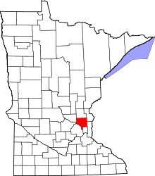 | |
| Township | ||
| CDP | ||
| Unincorporated community | ||
| Ghost town | ||
| Footnotes | ‡This populated place also has portions in an adjacent county or counties | |