List of Missouri conservation areas – Kansas City region
Main article: List of Missouri conservation areas
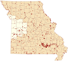
Map of Missouri conservation areas with the Kansas City region highlighted
The Kansas City administrative region of the Missouri Department of Conservation encompasses Bates, Benton, Cass, Clay, Henry, Jackson, Johnson, Lafayette, Pettis, Platte, St. Clair, and Vernon counties. The regional office is located in Lee's Summit.
| Conservation Area | Description | Size | County | Location | |
|---|---|---|---|---|---|
| Amarugia Highlands Conservation Area | This area contains grassland, wetlands (95 acres), forest/woodlands, cropland and old fields. Facilities/features: boat ramp, fishing jetty, Amarugia Lake (55 acres), and permanent streams (South Grand River and South Fork creek). | 1,039 acres | 420 ha | Cass | 38°32′26.18″N 94°26′3.02″W / 38.5406056°N 94.4341722°W |
| Balltown Access | This forest and cropland area offers access to the Little Osage River. | 180 acres | 73 ha | Vernon | 37°59′6.07″N 94°23′57.03″W / 37.9850194°N 94.3991750°W |
| Baltimore Bend Conservation Area | This area contains river-hills forest. | 1,156 acres | 468 ha | Lafayette | 39°13′10.02″N 93°35′45.65″W / 39.2194500°N 93.5960139°W |
| Big Buffalo Creek Conservation Area | The area is mostly forest. Facilities/features: primitive camping, three interconnected hiking trails, Big Buffalo Lake (5 acres), three springs and two permanent streams (Big Buffalo Creek and Pole Hollow Creek). There is one Natural Area: Big Buffalo Fe | 1,565 acres | 633 ha | Morgan, Benton | 38°20′35.29″N 93°4′45.28″W / 38.3431361°N 93.0792444°W |
| Big Drywood Creek Conservation Area | This is a mostly wetlands area. | 15 acres | 6.1 ha | Vernon | 37°50′24.93″N 94°29′25.14″W / 37.8402583°N 94.4903167°W |
| Birdsong Conservation Area | This area is mostly forest with old fields and cropland. Facilities/features: permanent stream (Brush Creek), Brush Creek Natural Area. | 422 acres | 171 ha | St. Clair | 37°52′1.73″N 93°42′23.57″W / 37.8671472°N 93.7065472°W |
| Bittern Bottoms Conservation Area | This area contains wetlands and forest, including a 20-acre (81,000 m2) marsh and a 13-acre (53,000 m2) sedge-and-grass wet meadow. | 63 acres | 25 ha | Cass | 38°33′44.19″N 94°24′17.90″W / 38.5622750°N 94.4049722°W |
| Blackjack Access | This forest and grassland area offers access to Brush Creek and the Sac River. There is a boat ramp. | 209 acres | 85 ha | St. Clair | 37°52′55.75″N 93°44′48.12″W / 37.8821528°N 93.7467000°W |
| Brickley Hollow Conservation Area | This area contains old fields, forest, woodlands, savannas, and Cole Camp Creek (a small arm of the Lake of the Ozarks). | 211 acres | 85 ha | Benton | 38°16′53.47″N 93°13′31.78″W / 38.2815194°N 93.2254944°W |
| Bridger (Jim) Urban Conservation Area | This is a grassland and forest area. | 320 acres | 130 ha | Jackson | 38°57′55.19″N 94°17′26.46″W / 38.9653306°N 94.2906833°W |
| Bristow Conservation Area | This area contains cropland, grassland, prairie, and some forest and wetlands. There are 3 small, fishable ponds (1 acre total). | 158 acres | 64 ha | Vernon | 37°47′33.18″N 94°15′32.55″W / 37.7925500°N 94.2590417°W |
| Bruns Tract | Owned by the Missouri Prairie Foundation and managed by the Conservation Department. The primary management objective is to provide optimum brood-rearing and nesting cover for prairie chickens. | 158 acres | 64 ha | Pettis | 38°37′2.55″N 93°28′3.45″W / 38.6173750°N 93.4676250°W |
| Bryson's Hope Conservation Area | 288-acre (1.17 km2) area is being intensively managed for the recovery of the Greater Prairie Chicken, which is an endangered species in Missouri. | 200 acres | 81 ha | Pettis | 38°34′59.57″N 93°28′44.47″W / 38.5832139°N 93.4790194°W |
| Burr Oak Woods Conservation Area | This area is mostly forested, but it also features established prairies, restored glades and savannas, numerous ponds and creeks. Facilities/features: A large nature center offering exhibits and interpretive programs, picnic areas, pavilions, 5 hiking tra | 1,067 acres | 432 ha | Jackson | 39°2′56.68″N 94°17′31.81″W / 39.0490778°N 94.2921694°W |
| Bushwhacker Lake Conservation Area | This area contains prairie, forest, old fields, cropland, grassland and savanna. Facilities/features: boat ramp, primitive camping, 3 fishing jetties, fishing dock, archery range, Bushwhacker, and Willow lakes (196 acres total), and a permanent stream (Dr | 4,774 acres | 1,932 ha | Vernon, Barton | 37°40′14.62″N 94°24′42.26″W / 37.6707278°N 94.4117389°W |
| Cephas Ford Access | This is an old field and forest area offering access to the Marmaton River. There is a seasonal boat ramp and primitive camping is allowed. | 101 acres | 41 ha | Vernon | 37°57′3.69″N 94°21′11.51″W / 37.9510250°N 94.3531972°W |
| Chapel View Prairie Conservation Area | This area is predominantly prairie with some forest and is noted for its wildflowers. There are 2 fishable ponds (2 acres total). This area has some sandstone outcrops. | 384 acres | 155 ha | Henry | 38°13′5.60″N 93°51′22.46″W / 38.2182222°N 93.8562389°W |
| Clear Creek Conservation Area | This area is mostly prairie with more than 200 acres (0.81 km2) of woodlands. Facilities/features: 5 fishable ponds (5.2 acres total) and an intermittent stream (Clear Creek). This area has excellent deer and turkey hunting opportunities. | 979 acres | 396 ha | Vernon, Barton | 37°38′42.88″N 94°14′5.62″W / 37.6452444°N 94.2348944°W |
| Cooley Lake Conservation Area | This 1,348-acre (5.46 km2) area includes an ancient oxbow lake (Cooley Lake), which was once the main channel of the Missouri River, and also wetlands, croplands, and a forested bluff. The area also has access to the Missouri River. Facilities/features: Disabled acce | 1,337 acres | 541 ha | Clay | 39°14′51.88″N 94°14′18.65″W / 39.2477444°N 94.2385139°W |
| Dave Rock Conservation Area | This tract features a 44-acre (180,000 m2) Designated Natural Area containing a sandstone glade, savanna, and forest. Click here | 130 acres | 53 ha | St. Clair | 38°7′5.99″N 93°43′45.30″W / 38.1183306°N 93.7292500°W |
| Dorsett Hill Prairie Conservation Area | This area contains forest along with 15 acres (61,000 m2) of native prairie and 18 acres (73,000 m2) of old fields. | 76 acres | 31 ha | Cass | 38°30′47.24″N 94°24′51.34″W / 38.5131222°N 94.4142611°W |
| Douglas Branch Conservation Area | This area contains prairie, cropland, forest, pasture, and some wetlands. There are 2 fishable ponds (3 acres total). | 521 acres | 211 ha | Vernon | 37°55′47.66″N 94°22′30.25″W / 37.9299056°N 94.3750694°W |
| Drovers Prairie Conservation Area | This is a native prairie. | 78 acres | 32 ha | Pettis | 38°31′53.43″N 93°17′42.98″W / 38.5315083°N 93.2952722°W |
| Edmonson Access | This area contains forest, old fields, and Cole Camp Creek (a small arm of the Lake of the Ozarks). | 104 acres | 42 ha | Benton | 38°19′16.90″N 93°13′56.38″W / 38.3213611°N 93.2323278°W |
| Ferguson-Herold Conservation Area | This area contains old fields, forest, cropland, and grassland. | 176 acres | 71 ha | Lafayette | 38°58′20.14″N 94°4′42.27″W / 38.9722611°N 94.0784083°W |
| Fewel (Connor O) Conservation Area | This area contains old fields, forest, grassland, and cropland. There are three fishable lakes (14 acres total). | 324 acres | 131 ha | Henry | 38°28′42.95″N 93°42′9.22″W / 38.4785972°N 93.7025611°W |
| Flight Lake Conservation Area | This area contains 54 acres (220,000 m2) of native prairie along with wetlands, forest, and old fields. Flight Lake provides 42 acres (170,000 m2) of fishable water. | 154 acres | 62 ha | Vernon | 37°52′44.63″N 94°25′26.71″W / 37.8790639°N 94.4240861°W |
| Friendly Prairie Conservation Area | This is an unplowed native prairie. More than 260 species of plants have been identified in the area. | 39 acres | 16 ha | Pettis | 38°33′5.47″N 93°17′45.84″W / 38.5515194°N 93.2960667°W |
| Gama Grass Prairie Conservation Area | This area contains about 60 acres (240,000 m2) of native prairie. The rest is forest. | 78 acres | 32 ha | Vernon | 38°1′25.99″N 94°23′41.95″W / 38.0238861°N 94.3949861°W |
| Gay Feather Prairie Conservation Area | This area is mostly prairie with a small stand of hardwoods. | 111 acres | 45 ha | Vernon | 37°43′43.23″N 94°10′25.58″W / 37.7286750°N 94.1737722°W |
| Gorman (The Anita B) Conservation Discovery Center | Just a 10-minute walk from the Plaza shopping area, the Discovery Center is a unique, hands-on, urban conservation education center located on 8 acres (32,000 m2) in the heart of Kansas City. Open from 8 a.m. to 5 p.m. Monday through Saturday. | 10 acres | 4.0 ha | Jackson | 39°2′24.80″N 94°34′30.37″W / 39.0402222°N 94.5751028°W |
| Grandfather Prairie Conservation Area | Unplowed native prairie. | 81 acres | 33 ha | Pettis | 38°34′4.02″N 93°18′20.00″W / 38.5677833°N 93.3055556°W |
| Grove (Cecil G) Memorial Conservation Area | This is a forest area. | 39 acres | 16 ha | Lafayette | 39°1′59.06″N 93°39′3.53″W / 39.0330722°N 93.6509806°W |
| Harmony Mission Lake Conservation Area | This area is mostly cropland, grassland, and old fields with 93-acre (380,000 m2) woods. Facilities/features: boat ramp, Harmony Mission Lake (96 acres), and several small ponds (4 acres total). | 1,066 acres | 431 ha | Bates | 38°4′56.69″N 94°25′54.72″W / 38.0824139°N 94.4318667°W |
| Harter (James R) Conservation Area | The area is largely cropland with grassland, old fields, and forest. | 453 acres | 183 ha | Cass | 38°35′46.25″N 94°16′12.46″W / 38.5961806°N 94.2701278°W |
| Hartwell Conservation Area | Four miles west of Green Ridge at the intersection of Highways B and AA. | 163 acres | 66 ha | Pettis | 38°37′32.83″N 93°29′4.43″W / 38.6257861°N 93.4845639°W |
| Hazel Hill Lake | Old fields, grassland, cropland and forest. Facilities/features: boat ramp, fishing jetty, Hazel Hill Lake (72 acres). | 504 acres | 204 ha | Johnson | 38°50′46.73″N 93°46′56.31″W / 38.8463139°N 93.7823083°W |
| Hi Lonesome Prairie Conservation Area | Nearly all unplowed native prairie. There are 3 fishable ponds (2 acres total). | 621 acres | 251 ha | Benton | 38°28′44.86″N 93°13′22.50″W / 38.4791278°N 93.2229167°W |
| Humphrey Access | This area offers access to the Platte River. | 16 acres | 6.5 ha | Platte | 39°20′17.31″N 94°48′45.25″W / 39.3381417°N 94.8125694°W |
| Kahrs-Boger Park | This area contains cropland, forest, grassland, and old fields. Facilities/features: fishable pond (1 acre), permanent stream (Lake Creek). | 106 acres | 43 ha | Pettis | 38°34′38.30″N 93°6′52.42″W / 38.5773056°N 93.1145611°W |
| Kearn (J N Turkey) Memorial WA | Old fields, forest and cropland. | 1,698 acres | 687 ha | Johnson, Pettis | 38°38′37.30″N 93°30′23.75″W / 38.6436944°N 93.5065972°W |
| Kearn (W R) Memorial Conservation Area | This area is being intensely managed for prairie chickens. Cropfields have been converted to native warm-season and cool-season grasses to provide both nesting and brood-rearing cover for prairie chickens. Many species of grassland wildlife, incliuding No | 120 acres | 49 ha | Pettis | 38°36′4.21″N 93°28′33.60″W / 38.6011694°N 93.4760000°W |
| Kendzora (Anthony and Beatrice) Conservation Area | This area provides a variety of habitats for many fish and wildlife species. The area includes 100 acres (0.40 km2) of cropland that is seasonally flooded, providing both upland game and waterfowl habitats. A 35-acre (140,000 m2) fishing lake and approximately 1-mile (1.6 km) of the Plat | 789 acres | 319 ha | Platte, Buchanan | 39°31′38.10″N 94°38′54.12″W / 39.5272500°N 94.6483667°W |
| Kings Prairie Access | This area contains forest and cropland. Facilities/features: permanent stream (Weaubleau Creek). | 285 acres | 115 ha | St. Clair | 37°59′33.43″N 93°36′2.63″W / 37.9926194°N 93.6007306°W |
| Ladue Bottoms Conservation Area | This area contains cropland, old fields, forest, and grassland. There is an intermittent stream. | 347 acres | 140 ha | Henry | 38°17′57.94″N 93°51′53.14″W / 38.2994278°N 93.8647611°W |
| Lake City Range | In addition to the firearms range, this area contains 30 acres (120,000 m2) of forest. | 88 acres | 36 ha | Jackson | 39°4′26.94″N 94°14′37.25″W / 39.0741500°N 94.2436806°W |
| Liberty Bend Conservation Area | This is a forest area fronting the Missouri River. | 134 acres | 54 ha | Clay | 39°9′55.13″N 94°22′9.51″W / 39.1653139°N 94.3693083°W |
| Lichen Glade Conservation Area | Lichen Glade Natural Area is an example of xeric habitat, which is populated by stunted trees and grasses adapted to living in dry, rocky soil. | 26 acres | 11 ha | St. Clair | 38°3′17.37″N 93°47′33.32″W / 38.0548250°N 93.7925889°W |
| Linscomb WA | This area contains grassland, forest, cropland and wetlands. There is a permanent stream (Simms Creek). | 1,915 acres | 775 ha | St. Clair | 37°59′32.32″N 93°54′31.51″W / 37.9923111°N 93.9087528°W |
| Lipton Conservation Area | Lipton Conservation Area adjoins Santa Fe Park (City of Independence). | 33 acres | 13 ha | Jackson | 39°3′47.83″N 94°25′15.07″W / 39.0632861°N 94.4208528°W |
| Little Bean Marsh Conservation Area | This area contains forest and wetlands. Facilities/features: viewing blind, viewing deck, Bean Lake (a 400-acre (1.6 km2) oxbow), Little Bean Marsh Natural Area. The area is visited by migrating white pelicans. | 440 acres | 180 ha | Platte | 39°29′55.07″N 95°1′10.97″W / 39.4986306°N 95.0197139°W |
| Little Osage Prairie | This is an 80-acre (320,000 m2) Designated Natural Area with a diversity of native plants. | 80 acres | 32 ha | Vernon | 37°45′59.16″N 94°20′31.61″W / 37.7664333°N 94.3421139°W |
| Lone Jack Lake Conservation Area | Facilities/features: boat ramp, two fishing jetties, and Lone Jack Lake (35 acres). | 292 acres | 118 ha | Jackson | 38°53′40.53″N 94°11′54.88″W / 38.8945917°N 94.1985778°W |
| Lost Valley Fish Hatchery | The area is mostly old fields with some forest. Facilities/features: hatchery, nature center, numerous fishless ponds, and permanent stream (Sterret Creek). | 938 acres | 380 ha | Benton | 38°16′27.86″N 93°21′11.13″W / 38.2744056°N 93.3530917°W |
| Maple Leaf Lake Conservation Area | This area contains a boat ramp, fishing jetties, and small ponds. | 825 acres | 334 ha | Lafayette | 38°59′32.12″N 93°47′7.79″W / 38.9922556°N 93.7854972°W |
| Maple Woods Natural Area | This is a forest area. Facilities/features: mature stand of sugar maples and oaks. It is a designated Natural Area. | 39 acres | 16 ha | Clay | 39°13′48.37″N 94°32′52.66″W / 39.2301028°N 94.5479611°W |
| Marshall (Dr Frederick) Conservation Area | This area is mixed forest, prairie, and savanna. Facilities/features: pond and permanent stream (Platte River). | 177 acres | 72 ha | Platte | 39°19′8.64″N 94°49′8.29″W / 39.3190667°N 94.8189694°W |
| Marshall Junction Conservation Area | This is a mostly forest area with old fields and cropland. Facilities/features: firearms range, fishable pond (.25 acre), and a permanent stream (Blackwater River). | 778 acres | 315 ha | Saline, Pettis | 38°56′44.46″N 93°15′35.71″W / 38.9456833°N 93.2599194°W |
| Montrose Conservation Area | This is a predominantly wetlands area with forest, some old fields and a small prairie. Facilities/features: boat ramp, primitive camping, 15 waterfowl blinds, Montrose Lake (1,600 acres). | 2,443 acres | 989 ha | Henry | 38°18′19.58″N 93°57′40.77″W / 38.3054389°N 93.9613250°W |
| Mora Conservation Area | This area is mostly grassland, cropland, and old fields with a small amount of forest. This area falls within the Cole Camp/Hi Lonesome focus area, which has been identified as an important landscape in the Greater Prairie Chicken Recovery Plan | 589 acres | 238 ha | Benton | 38°31′1.32″N 93°12′31.07″W / 38.5170333°N 93.2086306°W |
| Mount Hulda Towersite | This is a 40-acre (160,000 m2) forested area. | 37 acres | 15 ha | Benton | 38°22′15.58″N 93°6′23.07″W / 38.3709944°N 93.1064083°W |
| Old Town Access | Mostly bottomland forest and cropland, and provides access to the Bates County Drainage Ditch. Facilities/features: boat ramp, primitive camping, 2 streams (Marais Des Cygnes River and Bates County Drainage Ditch), and an oxbow lake and fishing pond (10 a | 296 acres | 120 ha | Bates | 38°8′36.72″N 94°21′46.82″W / 38.1435333°N 94.3630056°W |
| Osage Prairie Conservation Area | This tract, which contains a 615-acre (2.49 km2) Designated Natural Area, is mostly native prairie along with forest, cropland, and some old fields. There are 3 small, fishable ponds (2 acres total). | 1,561 acres | 632 ha | Vernon | 37°44′26.09″N 94°19′47.96″W / 37.7405806°N 94.3299889°W |
| Paint Brush Prairie Conservation Area | This area is native prairie and contains Paint Brush Prairie Natural Area (74 acres). | 315 acres | 127 ha | Pettis | 38°32′50.02″N 93°15′39.41″W / 38.5472278°N 93.2609472°W |
| Park (Guy B) Conservation Area | This area contains forest, grassland and cropland. Facilities/features: boat ramp, fishing dock, Tobacco Hills Lake (17 acres), and permanent stream (Bee Creek). | 374 acres | 151 ha | Platte | 39°25′26.13″N 94°48′8.19″W / 39.4239250°N 94.8022750°W |
| Parma Woods Range and Training Center | The facility is located on 188 acres (0.76 km2) of scenic bluff land above the Missouri River. | 200 acres | 81 ha | Platte | 39°12′15.72″N 94°45′50.22″W / 39.2043667°N 94.7639500°W |
| Peabody Conservation Area | This area is dominated by strip pits and spoil banks. Facilities/features: 2 boat ramps, 23 acres (93,000 m2) of lakes and ponds. | 289 acres | 117 ha | Bates | 38°5′49.86″N 94°27′6.12″W / 38.0971833°N 94.4517000°W |
| Perry (Ralph and Martha) Memorial Conservation Area | This area contains forest, old fields, wetlands, cropland, and grassland. Facilities/features: primitive camping, firearms range, fishable ponds (16 acres total) and a permanen | 4,179 acres | 1,691 ha | Saline, Johnson, Pettis | 38°55′4.85″N 93°30′53.23″W / 38.9180139°N 93.5147861°W |
| Pinhook Access | This forested area offers access to Muddy Creek. | 4 acres | 1.6 ha | Pettis | 38°48′31.48″N 93°10′24.10″W / 38.8087444°N 93.1733611°W |
| Platte Falls Conservation Area | This area contains forest, cropland, old fields, and pasture. Facilities/features: boat ramps, pavilions, firearms and archery ranges, fishable ponds (2 acres total), and permanent stream (Platte River). | 2,535 acres | 1,026 ha | Platte | 39°23′14.49″N 94°44′40.90″W / 39.3873583°N 94.7446944°W |
| Poague (Haysler A) Conservation Area | This area is mostly forest with wetlands and old fields. Facilities/features: primitive camping and numerous ponds. | 889 acres | 360 ha | Henry | 38°25′4.68″N 93°50′10.64″W / 38.4179667°N 93.8362889°W |
| Reed (James A) Memorial WA | Woodlands, old fields, grassland, and wetlands. Facilities/features: boat rental, picnic areas and 3 pavilions, numerous fishing jetties, 2 fishing docks, an archery range, and 11 fishable lakes and ponds (252 acres tot | 2,598 acres | 1,051 ha | Jackson | 38°52′7.86″N 94°19′31.82″W / 38.8688500°N 94.3255056°W |
| Ripgut Prairie Natural Area | This area contains 140 acres (0.57 km2) of native wet prairie and the Bates County Drainage Ditch. | 279 acres | 113 ha | Bates | 38°7′0.13″N 94°20′5.08″W / 38.1167028°N 94.3347444°W |
| Rush Creek Conservation Area | This area contains forest and old fields. Facilities/features: picnic areas, pavilion, viewing deck, and a nature center. | 40 acres | 16 ha | Clay | 39°14′57.86″N 94°23′29.39″W / 39.2494056°N 94.3914972°W |
| Saeger Woods Conservation Area | This is a forest area with a small prairie. | 20 acres | 8.1 ha | Jackson | 38°52′57.73″N 94°34′27.45″W / 38.8827028°N 94.5742917°W |
| Schell-Osage Conservation Area | In addition to Truman Reservoir, this diverse area contains fishable lakes and ponds totaling about 900 acres (3.6 km2). The tract also has 42 acres (170,000 m2) of native prairie (Schell-Osage Prairie Natural Area), 2 boat ramps, waterfowl blinds, a staffed office, and bald ea | 8,616 acres | 3,487 ha | Vernon, St. Clair | 38°1′11.45″N 94°3′58.39″W / 38.0198472°N 94.0662194°W |
| Schimmel City Access | This forest area offers access to the Platte River. There is a boat ramp. | 14 acres | 5.7 ha | Platte | 39°17′29.06″N 94°49′11.19″W / 39.2914056°N 94.8197750°W |
| Settle's Ford Conservation Area | This area contains 2,500 acres (10 km2) of opportunistic wetlands (no pumping capability) as well as old fields, cropland, and forest. Facilities/features:&nb | 6,708 acres | 2,715 ha | Bates, Cass | 38°27′1.39″N 94°8′49.57″W / 38.4503861°N 94.1471028°W |
| Sharps Station Access | This forest area offers access to the Platte River with a concrete boatramp. | 9 acres | 3.6 ha | Platte | 39°24′3.26″N 94°43′30.43″W / 39.4009056°N 94.7251194°W |
| Sni-A-Bar Conservation Area | This is a forest area with a permanent stream (Sni-A-Bar Creek). | 76 acres | 31 ha | Lafayette | 39°2′56.82″N 94°5′37.80″W / 39.0491167°N 94.0938333°W |
| Taberville Access | This area offers access to the Osage arm of Truman Reservoir. There is a boat ramp. | 6 acres | 2.4 ha | St. Clair | 38°0′5.60″N 93°59′44.54″W / 38.0015556°N 93.9957056°W |
| Taberville Prairie Conservation Area | This tract contains the 1,360-acre (5.5 km2) Taberville Prairie Natural Area, which as the largest such resource in the state, is registered as a National Natural Landmark. | 1,692 acres | 685 ha | St. Clair | 38°3′1.61″N 93°58′50.84″W / 38.0504472°N 93.9807889°W |
| Truman Reservoir Management Lands (Bethlehem) | (In Clinton) Take Highway 7 east 3 miles (4.8 km) to Highway AA, then turn south to Bethlehem WMA. | 3,311 acres | 1,340 ha | Henry | 38°19′37.61″N 93°44′1.79″W / 38.3271139°N 93.7338306°W |
| Truman Reservoir Management Lands (Brownington) | (In Clinton) Take Highway 13 south to Highway Z, then east to Highway BB, and north to County Road SE171 to Brownington WMA. | 1,464 acres | 592 ha | Henry | 38°14′31.64″N 93°44′38.72″W / 38.2421222°N 93.7440889°W |
| Truman Reservoir Management Lands (Brush Creek) | (From Clinton) Go east on Highway 7 to Highway C, then take Highway C to Highway T south to Highway TT. | 3,393 acres | 1,373 ha | Henry, Benton | 38°20′45.73″N 93°30′1.94″W / 38.3460361°N 93.5005389°W |
| Truman Reservoir Management Lands (Cedar Creek) | Landlocked; access by boat only. No access by land. | 666 acres | 270 ha | Henry | 38°16′54.15″N 93°35′49.66″W / 38.2817083°N 93.5971278°W |
| Truman Reservoir Management Lands (Deepwater Creek) | (In Clinton) Take Highway 13 south to Highway 52, then west to SW 401. Deepwater Creek WMA is east and north of SW 401. | 5,571 acres | 2,255 ha | Henry | 38°16′52.37″N 93°47′31.34″W / 38.2812139°N 93.7920389°W |
| Truman Reservoir Management Lands (Gallinipper Creek) | Truman Reservoir ML (Gallinipper Creek) is 4 miles (6.4 km) north of Osceola on Hwy 13, then 3 miles (4.8 km) southwest on CR NE 301. | 2,082 acres | 843 ha | St. Clair | 38°4′22.32″N 93°43′22.61″W / 38.0728667°N 93.7229472°W |
| Truman Reservoir Management Lands (Gouge Eye) | Truman Reservoir ML (Gouge Eye) is Highway 7 east from Clinton to Highway W, then south on Highway W to County Road SE550, then east approximately a half-mile to the cable gate. | 581 acres | 235 ha | Henry | 38°16′25.06″N 93°38′29.44″W / 38.2736278°N 93.6415111°W |
| Truman Reservoir Management Lands (Grand River Bottoms) | South of Clinton on Highway 13, turn west on SW 450 to Highway T, go west on T to SW 351 and turn north. Past SW 300, Grand River Bottoms is on both sides of SW 351. | 6,710 acres | 2,720 ha | Henry | 38°19′59.64″N 93°47′46.88″W / 38.3332333°N 93.7963556°W |
| Truman Reservoir Management Lands (Leesville) | Other than by boat, SE80 road is the only public access to the Leesville WMA. | 1,933 acres | 782 ha | Henry, Benton | 38°19′25.09″N 93°30′30.66″W / 38.3236361°N 93.5085167°W |
| Truman Reservoir Management Lands (Little Pomme de Terre) | Direct access to Truman Reservoir is very limited. | 2,338 acres | 946 ha | Benton | 38°6′58.01″N 93°25′14.94″W / 38.1161139°N 93.4208167°W |
| Truman Reservoir Management Lands (Little Tebo Creek) | Little Tebo Creek WMA has limited public access by vehicle other than near the bridge. | 1,746 acres | 707 ha | Benton | 38°19′7.43″N 93°24′48.45″W / 38.3187306°N 93.4134583°W |
| Truman Reservoir Management Lands (Sac Osage) | Shorebird viewing marsh is closed from October 15 until end of waterfowl season as a refuge. | 6,281 acres | 2,542 ha | St. Clair | 38°0′1.91″N 93°44′15.43″W / 38.0005306°N 93.7376194°W |
| Truman Reservoir Management Lands (Salt Creek) | Take Highway E north from Roscoe 2 miles (3.2 km). The area will be on both sides of the blacktop. | 3,947 acres | 1,597 ha | St. Clair | 38°0′23.77″N 93°47′42.04″W / 38.0066028°N 93.7950111°W |
| Truman Reservoir Management Lands (Tebo Islands) | Tebo Islands are accessible only by boat. | 211 acres | 85 ha | Benton | 38°19′55.03″N 93°30′19.54″W / 38.3319528°N 93.5054278°W |
| Truman Reservoir Management Lands (Upper Tebo Creek) | (From Clinton) Go east on Highway 7 to NE 681, then north on NE 681 to end of road. | 6,960 acres | 2,820 ha | Henry | 38°22′25.71″N 93°34′53.53″W / 38.3738083°N 93.5815361°W |
| Truman Reservoir Management Lands (Valhalla) | (From Lowry City) Take Highway C east 6 miles (9.7 km), then turn north on Highway HH and go until County Road NE 900 east. | 1,821 acres | 737 ha | St. Clair | 38°9′37.19″N 93°33′52.29″W / 38.1603306°N 93.5645250°W |
| Truman Reservoir Management Lands (Weaubleau Creek) | Take Highway 82 east from Osceola 5 miles (8.0 km), then go north on County Road NE 1025. | 3,493 acres | 1,414 ha | St. Clair | 38°3′50.68″N 93°36′23.84″W / 38.0640778°N 93.6066222°W |
| Union Mill Access | This area offers access to the Platte River. | 0.7 acres | 0.28 ha | Platte | 39°30′51.01″N 94°39′24.85″W / 39.5141694°N 94.6569028°W |
| Urich Access | This area offers access to the Grand River. There is a boat ramp. | 1.9 acres | 0.77 ha | Henry | 38°27′10.77″N 94°0′12.65″W / 38.4529917°N 94.0035139°W |
| Urich Conservation Area | This area consists of forest, old fields, cropland, and grassland. It has one permanent stream (Big Creek). | 470 acres | 190 ha | Henry | 38°29′8.66″N 93°56′43.17″W / 38.4857389°N 93.9453250°W |
| Wah-Kon-Tah Prairie | This is a prairie area with 2 small, fishable ponds. | 3,067 acres | 1,241 ha | Cedar, St. Clair | 37°54′9.89″N 94°0′9.51″W / 37.9027472°N 94.0026417°W |
| Walnut Woods Conservation Area | The area contains forest. The adjoining Stockdale Park (City of Liberty) includes these facilities/features: picnic area, playground and permanent stream (Rush Creek). | 63 acres | 25 ha | Clay | 39°14′6.96″N 94°22′54.70″W / 39.2352667°N 94.3818611°W |
| White Alloe Creek Conservation Area | This is a mostly forest area adjoining the Parkville Nature Sanctuary which includes the following facilities/features: picnic area, pavilion, viewing deck, and a permanent stream (White Alloe Creek). | 70 acres | 28 ha | Platte | 39°11′43.44″N 94°40′40.29″W / 39.1954000°N 94.6778583°W |
Notes
- Acreage and counties from MDCLand GIS file
- Names, descriptions, and locations from Conservation Atlas Online GIS file
References
- "MDCland" (shapefile). Missouri Department of Conservation. 2007-01-01.
- "Google Earth File". Conservation Atlas Online. Missouri Department of Conservation. 2007-06-18.
This article is issued from Wikipedia - version of the 9/17/2013. The text is available under the Creative Commons Attribution/Share Alike but additional terms may apply for the media files.