Lopata, Žužemberk
| Lopata | |
|---|---|
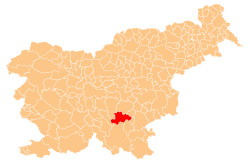
 Lopata Location in Slovenia | |
| Coordinates: 45°46′57.56″N 14°53′58.83″E / 45.7826556°N 14.8996750°ECoordinates: 45°46′57.56″N 14°53′58.83″E / 45.7826556°N 14.8996750°E | |
| Country |
|
| Traditional region | Lower Carniola |
| Statistical region | Southeast Slovenia |
| Municipality | Žužemberk |
| Area | |
| • Total | 4.8 km2 (1.9 sq mi) |
| Elevation | 368.2 m (1,208.0 ft) |
| Population (2002) | |
| • Total | 86 |
| [1] | |
Lopata (pronounced [lɔˈpaːta]) is a village in the hills south of Žužemberk in southeastern Slovenia. The area is part of the historical region of Lower Carniola. The Municipality of Žužemberk is now included in the Southeast Slovenia Statistical Region.[2]
The local church is dedicated to Saint Agnes (Slovene: sveta Neža) and belongs to the Parish of Hinje. It has a medieval nave with 16th-, 17th-, and 18th-century additions.[3]
References
- ↑ Statistical Office of the Republic of Slovenia
- ↑ Žužemberk municipal site
- ↑ "EŠD 1571". Registry of Immovable Cultural Heritage (in Slovenian). Ministry of Culture of the Republic of Slovenia. Retrieved 8 April 2011.
External links
This article is issued from Wikipedia - version of the 12/4/2014. The text is available under the Creative Commons Attribution/Share Alike but additional terms may apply for the media files.