Podlipa, Žužemberk
| Podlipa | |
|---|---|
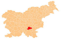
 Podlipa Location in Slovenia | |
| Coordinates: 45°50′28.91″N 14°59′58.11″E / 45.8413639°N 14.9994750°ECoordinates: 45°50′28.91″N 14°59′58.11″E / 45.8413639°N 14.9994750°E | |
| Country |
|
| Traditional region | Lower Carniola |
| Statistical region | Southeast Slovenia |
| Municipality | Žužemberk |
| Area | |
| • Total | 3.1 km2 (1.2 sq mi) |
| Elevation | 242 m (794 ft) |
| Population (2002) | |
| • Total | 44 |
| [1] | |
Podlipa (pronounced [pɔˈdliːpa]) is a small village in the hills north of Dvor in the Municipality of Žužemberk in southeastern Slovenia. The municipality is included in the Southeast Slovenia Statistical Region and the wider area is part of the historical region of Lower Carniola.[2]
References
External links
This article is issued from Wikipedia - version of the 3/5/2014. The text is available under the Creative Commons Attribution/Share Alike but additional terms may apply for the media files.